
#Philadelphia #weather #PAwx
NO RAIN for Philadelphia Area
Posted Thursday 10/17/24 @ 11:26 AM — The latest extended range models are in good agreement and currently show little to no rain (and certainly no meaningful rainfall ) through Oct 29th.
The ECMWF-AIFS, which was impressive with its predictions of Helene and Milton, shows no tropical development to affect the mainland US within the next week or so.
Yet Another Pattern Change But NO Rain
Posted Tuesday 10/15/24 @ 5:09 PM — The cold upper air trough will dissipate by the end of the week. Troughs often spawn low pressure, and the current trough will spawn a low that will form off the coast, not giving us any rain.
The upper ridge in the central US will move over us by the weekend and the upper ridge will be with us through most if not all of next week. NO rain expected through at least the end of next week.
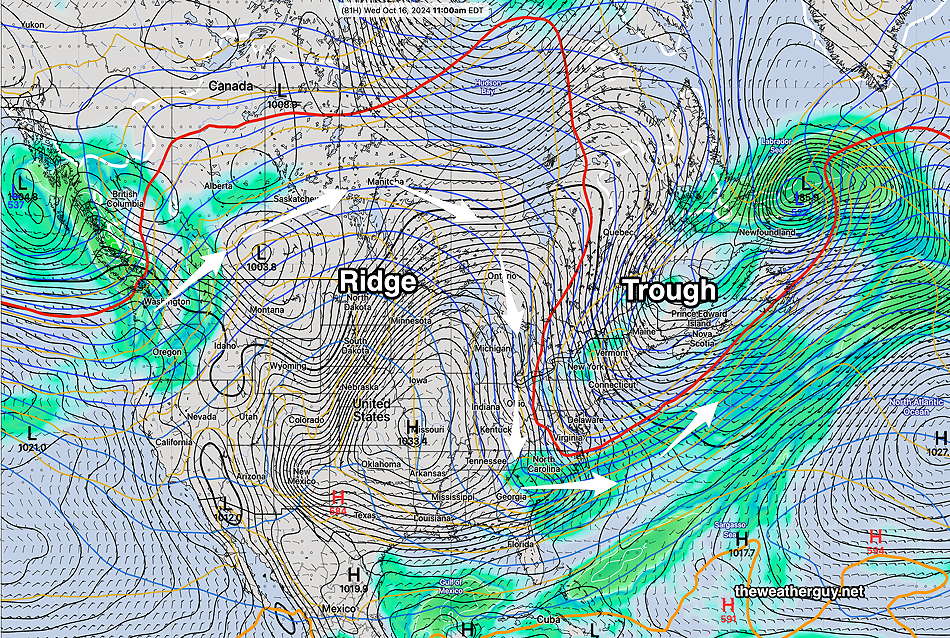
Here’s what we’re evolving into by next Monday. A broad ridge across the continental US and dry high pressure over us—
A Pattern Change
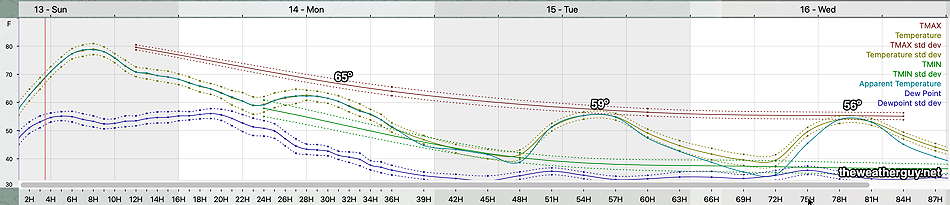
Originally Posted Sun @ 4:21 PM — —The models are showing signs of an evolving pattern change beginning this week. Most obvious will be a developing trough in the the northeastern US giving us much cooler temperatures following a cold front passage tonight.
Here’s the NBM temperatures through Wednesday—
A cold front moves through tonight. Showers associated with this front will likely stay to our north. A few models vacillate on whether the Philadelphia area will see any showers or sprinkles with an upper air disturbance that moves through Monday morning. If we get anything, it will be scattered and very light.
The upper trough for the first part of this week may cause some instability cloudiness, perhaps more than the models are showing.
With the upper blocking ridge in the central US breaking down by the end of this week, we may finally see some systems by next week bring us some rain. although I don’t see any specific system yet in the extended range models.