#Philadelphia #weather #PAwx
Weekend Rainfall Summary
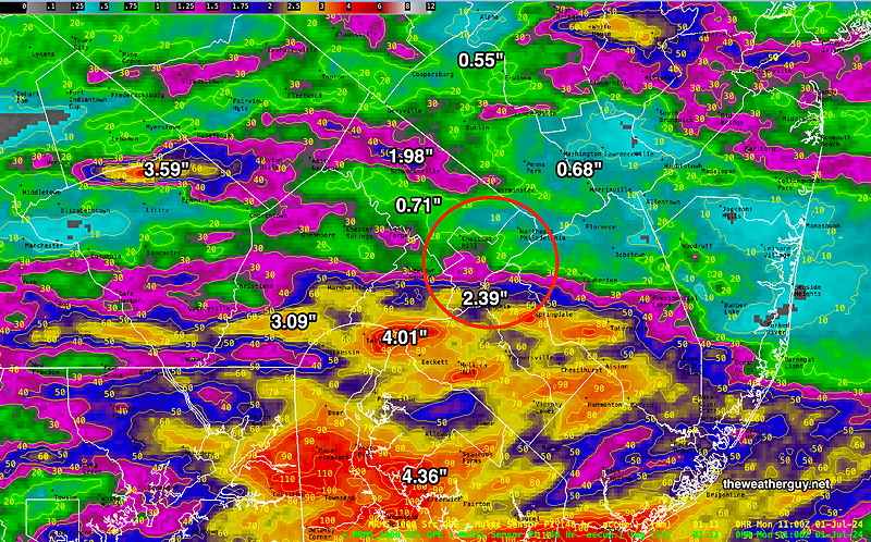
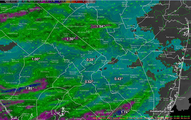
Here’s the 48 hour weekend rainfall summary. Includes Saturday and Sunday. Some areas received plenty of rain; others, not so much.
Sunday Forecast Update
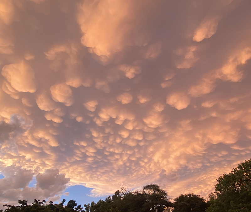
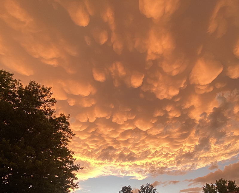
Often associated with severe thunderstorms and even tornadoes, a sky of mammatocumulus clouds (also referred to as mammatus clouds) was visible before sunset tonight—
Posted Sunday 06/30/24 @ 11:12 AM —
This morning’s models continue with the forecast of heavy rain between 5 PM and 8 PM, but there’s the possibility of of showers and thunderstorms throughout the afternoon.
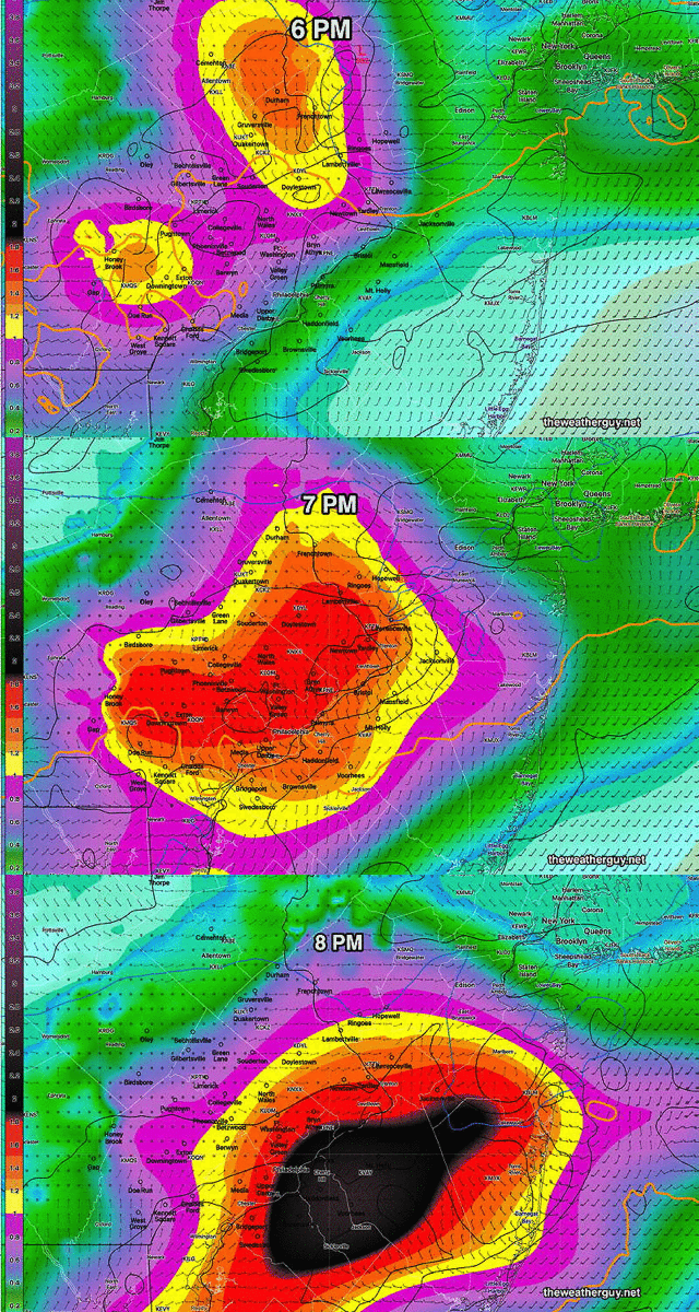
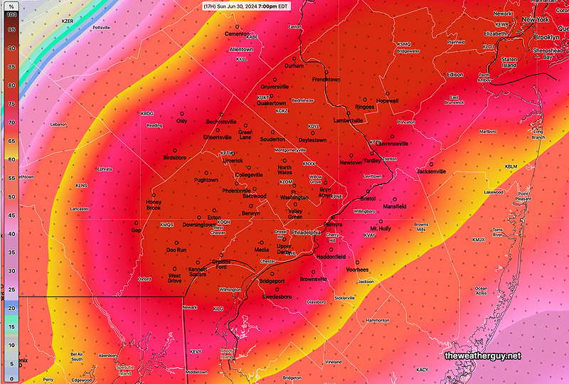
Posted Sunday 06/30/24 @ 8:59 AM — The latest HRDPS shows extremely heavy rain rates develop over Philadelphia between 6 and 8 PM tonight—
The main group arrived after midnight, as forecast, and dropped light to moderate rainfall with a few localized heavier areas. Here’s the MRMS rainfall summary —
For today, Sunday, a very moist and unstable airmass will produce thunderstorms as a cold front approaches from the west. Some widely scattered storms are possible anytime after noon time, mostly north of the city, but the heaviest activity will be from 5 PM to 9 PM in the immediate Philadelphia area. Higher instability values (CAPE, helicity and vertical shear) may result in some storms being severe. Localized heavy rain is possible.
Weekend Forecast Updates
Posted Saturday 06/29/24 @ 5:37 PM —
Another shift in the forecast with tonight’s storms significantly diminishing in intensity as they approach the immediate Philadelphia area.
Posted Saturday 06/29/24 @ 1:28 PM —
This morning’s models are trending towards the showers and thunderstorms approaching the Delaware Valley area earlier than previously forecast— as early as 9-10 PM Saturday evening and the main batch moving in between 10 PM and 1 AM. Scattered storms may persist until 4 AM.
Moisture levels (precipitable water) is approaching 2.4″ which is almost tropical— Heavy rain and gusty winds are possible with any storms and based on elevated shear and helicity values, storms could be severe.
Posted Saturday 06/29/24 @ 10:07 AM —
Some sprinkles have broken out in some areas, but they may not be reaching the ground. These should dissipate and a mix of sun and clouds for most of the late morning and early afternoon.
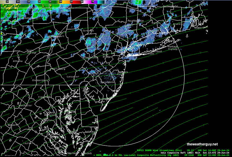
Showers and thunderstorms expected between midnight and 3 AM Sunday morning. Additional showers and thunderstorms expected Sunday mid to late afternoon into the evening. Heaviest activity expected in NJ.
Posted Friday 06/28/24 @ 10:34 PM —
Tonight’s NAM-Nest is suggesting low clouds and possibly some drizzle early Saturday morning. Skies should brighten by afternoon.
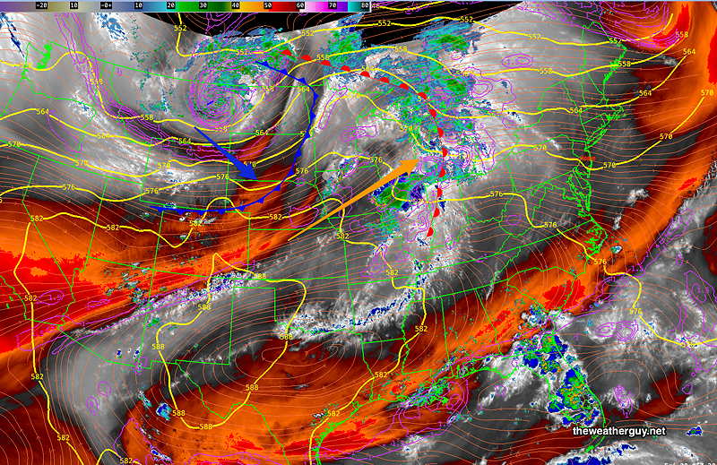
Previously Posted Fri 5:47 PM —A warm front with a strong flow of moisture ahead of it will move through Saturday night and a cold front will move through later Sunday afternoon or evening. Both features are visible on this afternoon’s satellite water vapor imagery—
Saturday
Saturday presents a difficult forecast challenge. When it comes to warm fronts, the degree of cloud cover ahead of the front can be tricky to predict. A best guess is that it will be cloudy in the morning Saturday, giving way to some bright spots through high clouds late morning into very early afternoon. Then increasingly cloudy mid to late afternoon into evening.
Regarding showers, the latest ECMWF the NAM-NEST and the model blend (NBM) show very light, widely scattered showers possible in some places during the mid to late afternoon. Most areas will be dry during the daytime.
Heavy rainfall with thunderstorms are expected late Saturday evening into the predawn hours of Sunday with the actual warm front. Heavy thunderstorms expected 1 AM- 4 AM. Incredibly, the latest HRRR has the heavy activity skipping past the immediate Philadelphia area. So there’s uncertainty with the rainfall as well.
Highs 85º (Blue Bell) 87º (Philadelphia). Average uncertainty. Very humid with dew points into the low 70s.
Sunday
Following the warm front passage, clouds in the morning break for hazy sunshine by the afternoon. Heavy thunderstorms late afternoon or evening.
Highs 90º (Blue Bell) 93º (Philadelphia). Higher than average uncertainty ± 2-3º Very humid and uncomfortable with dew points into the mid 70s.
