
#Philadelphia #weather #PAwx #PhillyWx
Weekend Outlook and Beyond
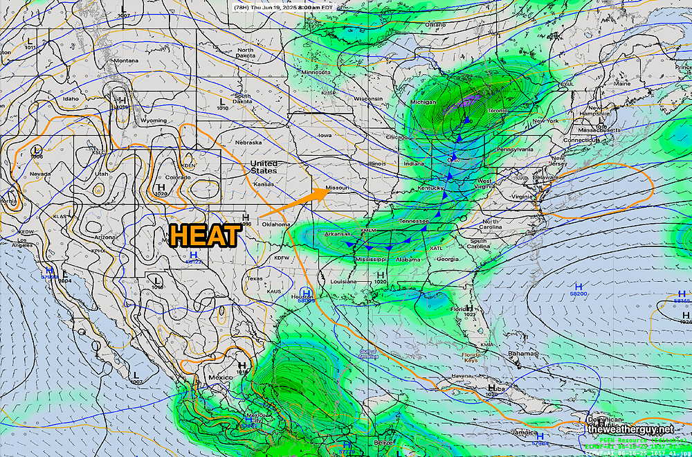
Posted Friday 06/20/25 @ 8:29 AM — Increasing temperatures and high humidity will be the big story for the next six days. The European AI model has been very good with high temperature forecasts and here’s a sample for Sunday, Monday and Tuesday—
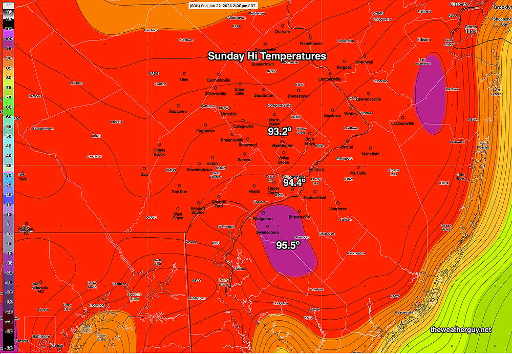
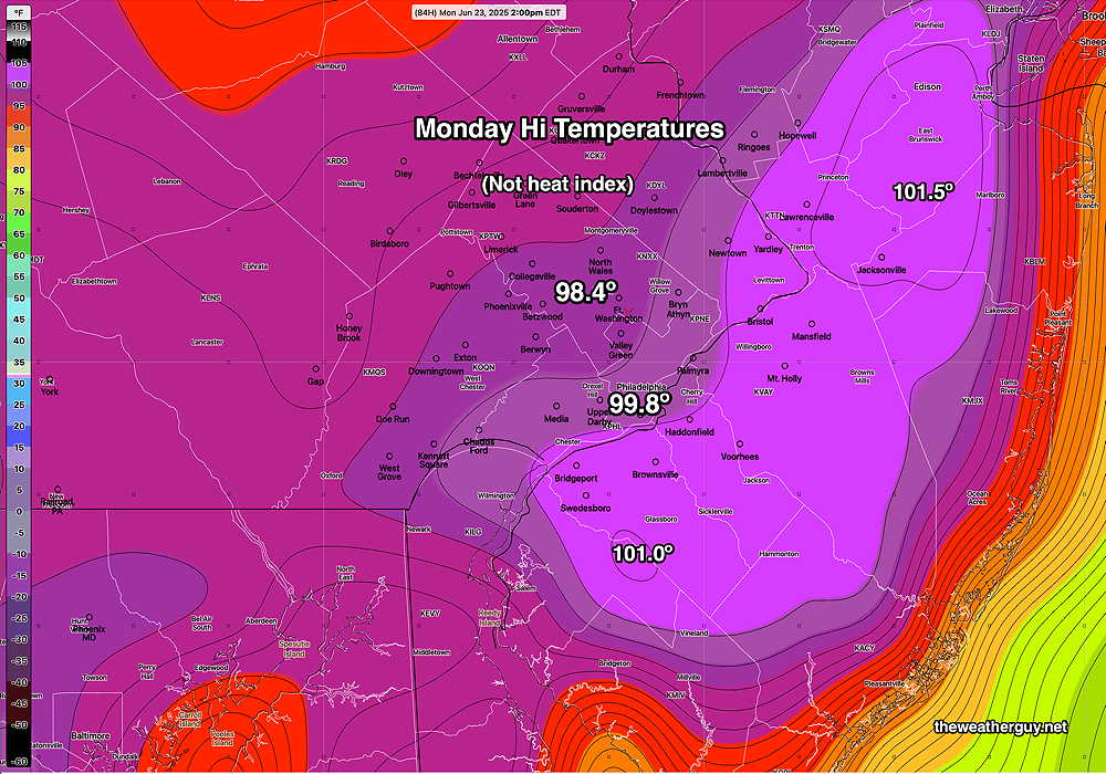
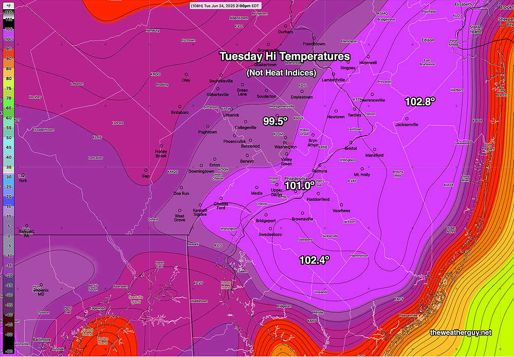
These are actual forecast highs at 2 PM. Since the ECMWF-AI data that I access doesn’t include temperatures at 3-4 PM, the actual likely daily high may be even higher. Since the TV people like to sensationalize with the heat indices, add about 5-10º to get the “apparent temperature” or heat index. Frankly, I don’t know the difference between 100º and 110º; neither is too comfortable.
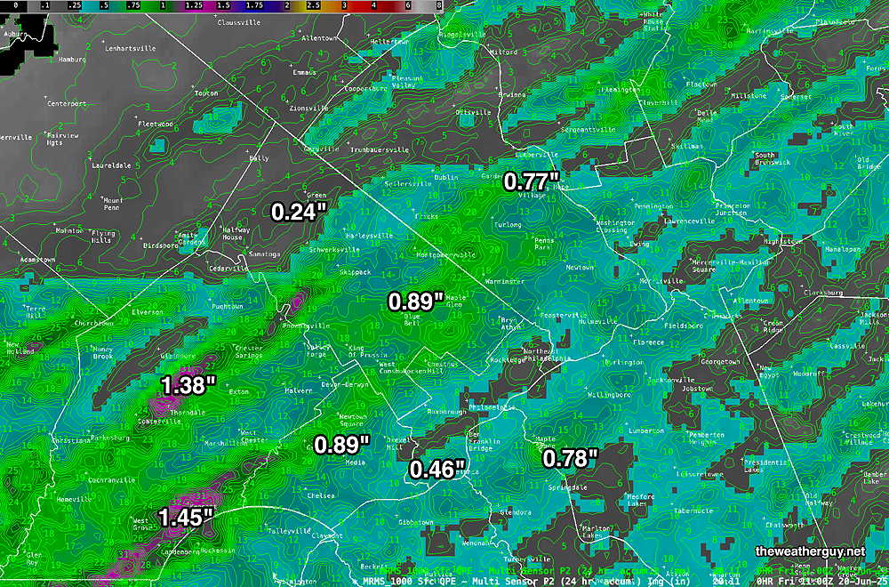
Here’s the MRMS precipitation estimate—
Thursday’s Storms
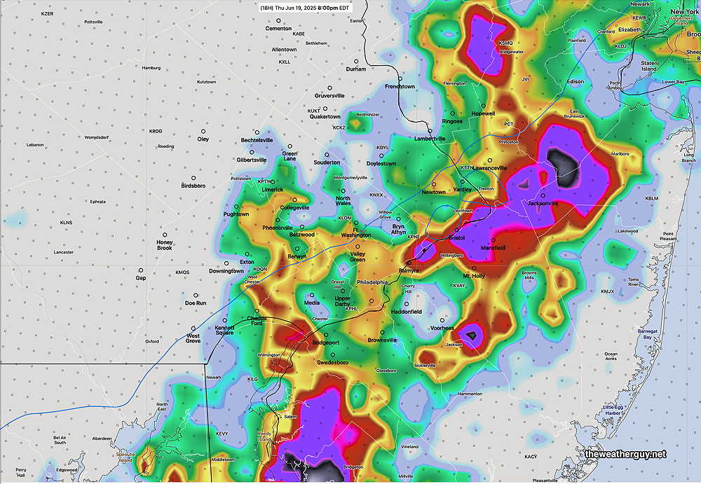
Posted Thursday 06/19/25 @ 5:04 PM — The storms are moving in on schedule. There was a radar signal for hail in Lancaster county with these storms, but not present at the current moment.
They are fast moving and there may be additional showers later this evening.
Posted Thursday 06/19/25 @ 1:33 PM — A quick update. Additional models show likely severe weather that includes the immediate Philadelphia area, but still more likely just south, in Chester and Delaware counties into South Jersey. Timing still 5:30 PM ± 1.5 hours.
Posted Thursday 06/19/25 @ 10:07 AM — I wanted to wait for a few of this morning’s models to become available before posting today.
A cold front approaches with showers and thunderstorms likely. For Philadelphia, the peak time time is 5:30 PM ± 1.5 hours. Several models are suggesting that the heaviest activity will occur just south of Philadelphia and into South Jersey.
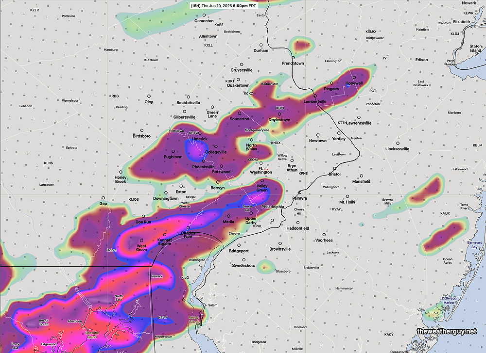
There are several signs that suggest a pattern reminiscent of last summer where the heaviest rain misses the city and its immediate suburbs.
We’ll have to see if that occurs.
The strong wave in the upper atmosphere was balanced out by strong downward motion in the lower third of the atmosphere.
Wednesday Storms
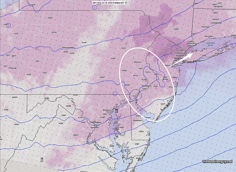
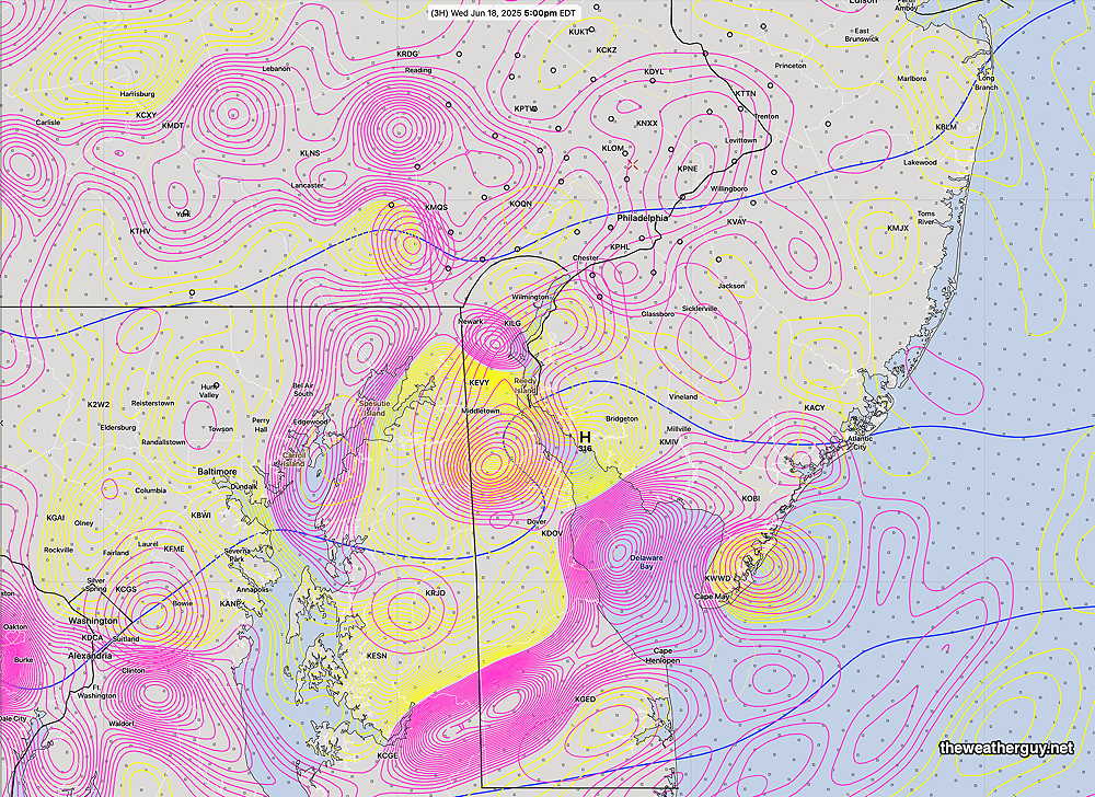
Posted Wednesday 06/18/25 @ 8:56 AM — Trying to determine where and when storms will develop today is like trying to decide where the first bubble will form at the bottom of a saucepan bring brought to a boil.
We have some general cues. The storms will be widespread, but a few areas may not see anything. There’s plenty of “juice” (energy) available with some models showing CAPE values as high as 3000 joules/kg. (very high). The “precipitable water” values are tropical with amounts as high as 2.7″ (extreme).
Most likely time is anytime from 1:30 PM to 6 PM with highest probability in the 4 PM to 6 PM time slot.
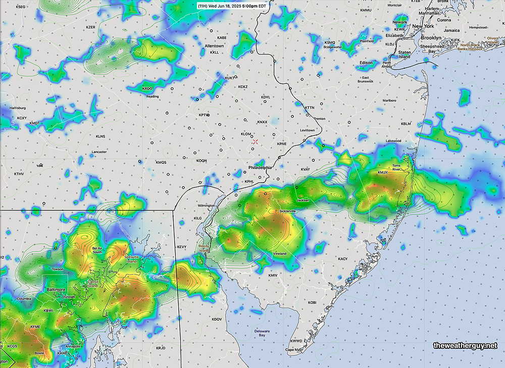
The latest hourly HRRR shows storms in the over the immediate Philadelphia area, while the latest hourly experimental RRFS shows the heaviest storms just over the river in NJ about 4-7 PM. Any storms will have extremely heavy rainfall. There will be some sunshine by late morning and early afternoon in many (but not all) areas. Any sunshine will fuel the already unstable atmosphere.
Wednesday into Thursday
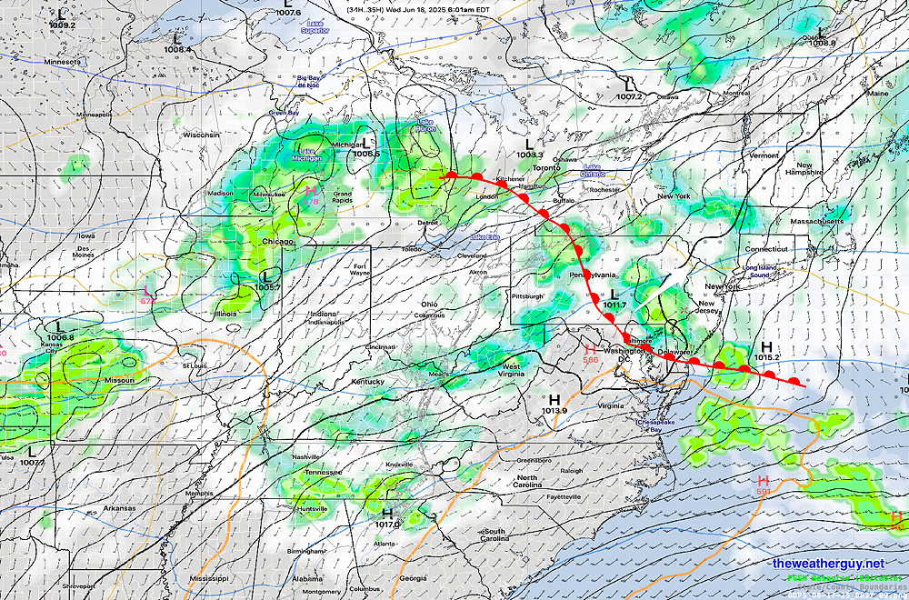
Posted Tuesday 06/17/25 @ 7:41 PM — A warm front with showers and some thunderstorms is expected to move through our area later this evening into early Wednesday morning. The current radar shows the showers more eastward at this time than any of the model forecast—
Current models have the showers and thunderstorms ending early morning Wednesday, but with a range between 8 AM and 11 AM. Clouds remain for the most part, but some sunny breaks are possible in during the afternoon. Very warm and very humid conditions by the late morning.
Most models have instability showers/thunderstorms develop Wednesday afternoon between 3 PM and 6 PMs as an upper air disturbance moves through. Any sunshine will fuel their formation.
A cold front moves through Thursday late afternoon with more thunderstorms.
Tuesday into Wednesday
Posted Tuesday 06/17/25 @ 8:41 AM — Another cloudy day today. Some showers may break out this afternoon in Berks county but little in the way of showers for most of the daytime hours closer to the city.
A warm front approaches and moves through our area tonight into Wednesday morning. Around or before daybreak Wednesday, we may get some heavy thunderstorm activity that wakes everyone up a bit earlier than they’d like.
A very humid day expected on Wednesday with dew points in the low to mid 70s!
Heat and Humidity by Wednesday
Posted Monday 06/16/25 @ 8:28 PM — The latest models reinforce the expected dramatic change in temperature and humidity in store for us. The latest model blend has temperatures approaching 90° 85° with dew points in the uncomfortable low to mid 70s as early as Wednesday. There’s a fairly high probability of heavy thunderstorms late afternoon Wednesday.
Temperatures 98°-100° still expected by next Tuesday.
Forecast Review
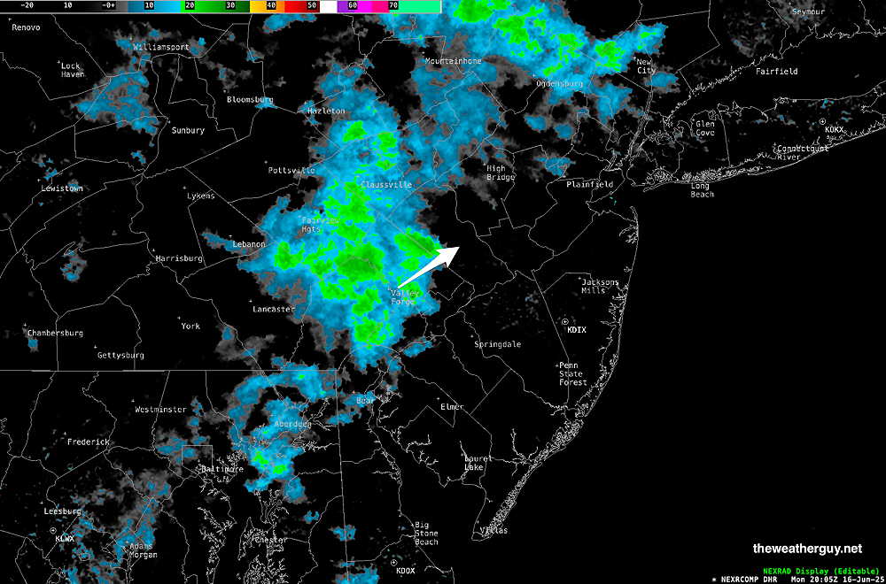
Posted Monday 06/16/25 @ 5:05 PM — The showers forecast to stay well west of Philadelphia this afternoon developed and moved closer to the city than forecast by most models.
Here’s the radar at 3 PM—
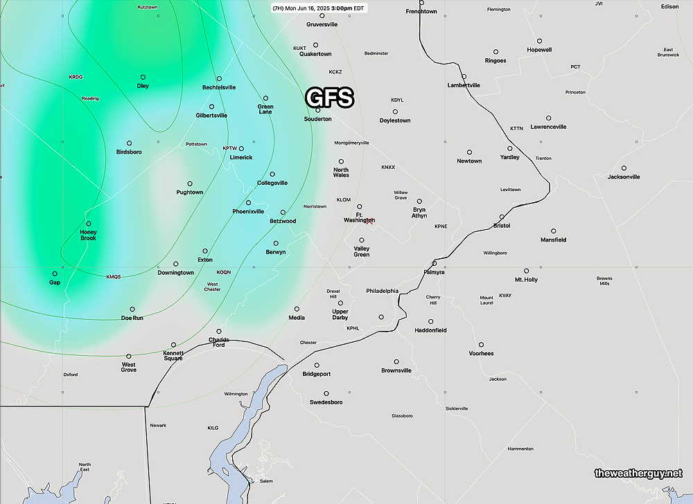
Here’s the GFS forecast rain placement—
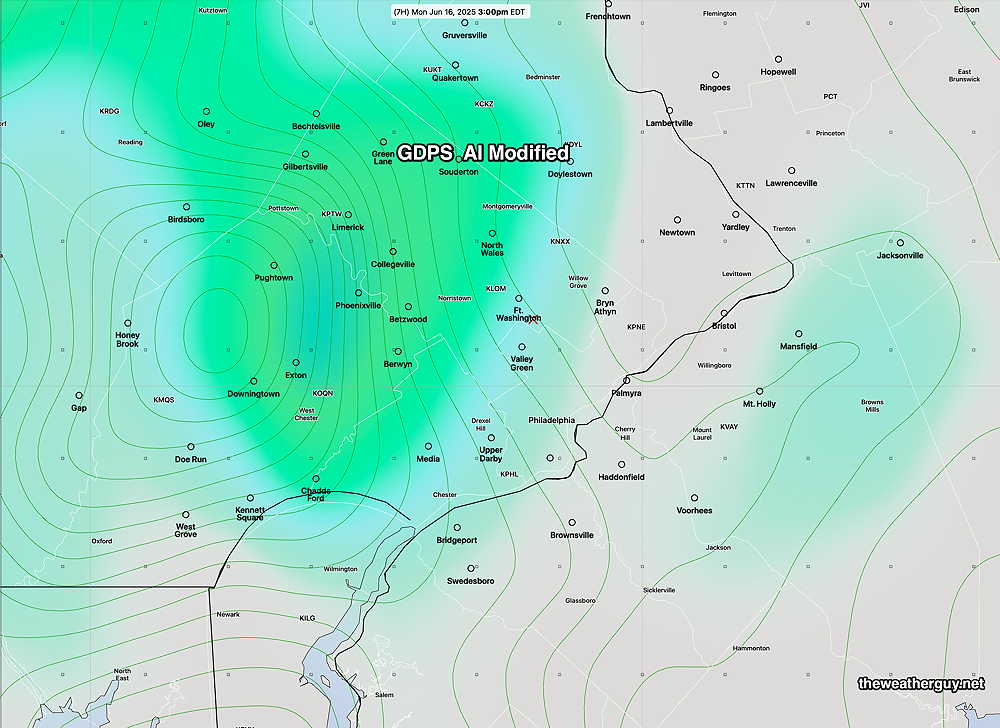
Earlier today, I spoke of the new Canadian experimental AI modified model just released. Here’s its forecast for 3 PM today—
At the other end of the spectrum are the experimental RRFS and REFS models. I’ve held great hope in their release as operational. Unfortunately, they forecast today’s weather very poorly, with virtually no rain forecast in this time period near the city—
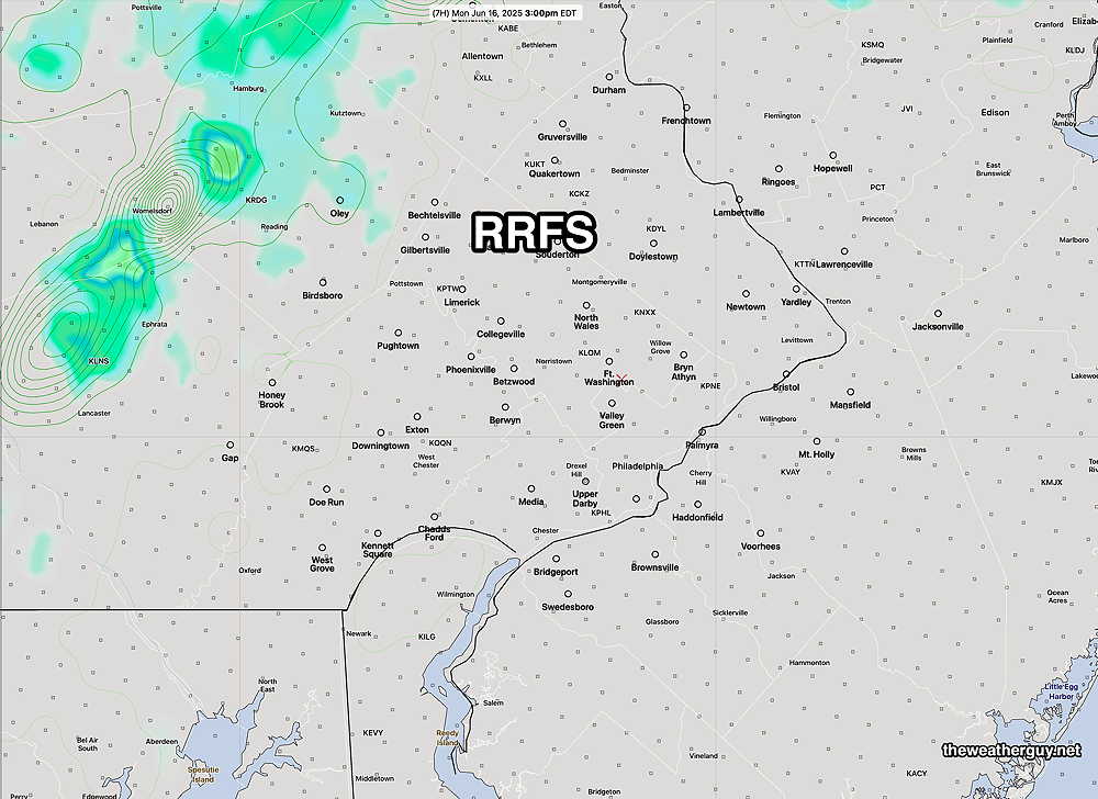
They will have to become much better in order to be released. The expectation with the RRFS and REFS is for them to replace and eventually eliminate the NAM, NAM-NEST and HRRR models. I don’t see that being possible with their recent forecast errors. It would be a step backwards.
Transition to Summer Heat
Originally Posted Mon 11:15 AM — The stagnant cold, damp pattern we’ve been in over this past weekend will finally transition to summer and some significant summer heat is expected by early next week.
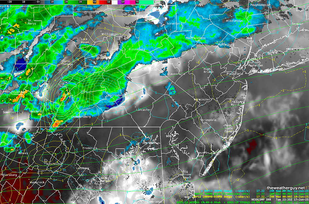
Current water vapor image—
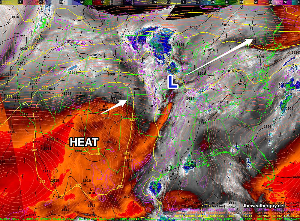
We have a few more days of unsettled weather. Today (Monday) will be cloudy and warmer than recent days. A few showers are possible this afternoon, mostly in far western suburbs.
Tuesday will also be cloudy. A warm front approaches late Tuesday evening with showers and thunderstorms after midnight into early Wednesday morning.
Warmer and more humid on Wednesday with highs in the mid 80s.
A cold front moves through Thursday, also with some showers.
Despite the “cold” front, temperatures will quickly warm over the weekend and into next week. Current AI models are predicting 95º-98º by next Tuesday.
I’ve started working on programming the download and post-processing of this model and I hope to share it here in the coming days.