
#Philadelphia #weather #PAwx #PhillyWx
A Low Confidence Forecast for Friday
Posted Thursday 06/05/25 @ 5:37 PM — The forecast for Friday and the coming weekend remains “up in the air”. The general trend has been for much of the area from the city and eastward to remain rain-free for Friday with increasing chances of some scattered showers at times during the day Saturday.
I think a few weather maps capture the current trend—
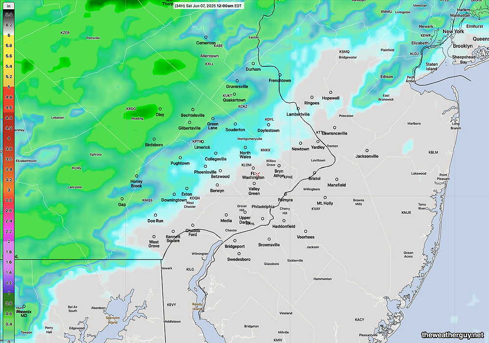
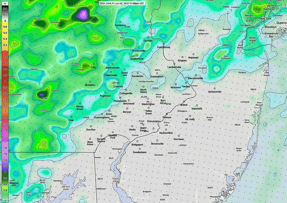
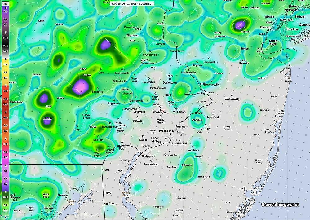
The European AI model, the ECMWF-AI Single, is closer to the REFS forecast, bringing the chance of light showers into NJ—
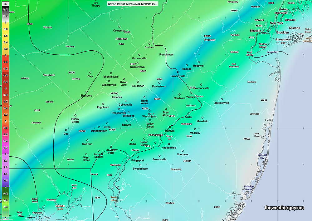
So, we’ll see which model does the best with this system and l’ll lean on it for the weekend forecast tomorrow.
Thursday into the Weekend
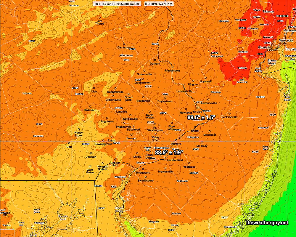
Posted Wednesday 06/04/25 @ 5:41 PM — The smoke at several levels of the atmosphere may reduce the high temperatures on Thursday (originally expected to be near or above 90º according to the AI model) by a few degrees. The models are clustering closer to 88º to 89º for Thursday’s highs with some 90º temps northeast of our immediate area.
The forecast for Friday and this weekend still remains uncertain.
Some models have the rain/thunderstorms staying to our far north and far south on Friday, but the latest HRRR bring some showers into Philadelphia from the south early Friday morning, possibly dissipating afterwards.
As for the weekend, the GFS and ECMWF models have moved in the direction of the European AI model, with rain now possible for Saturday AND Sunday. But there may be a few periods of no rain during the daytime hours.
Looking Ahead
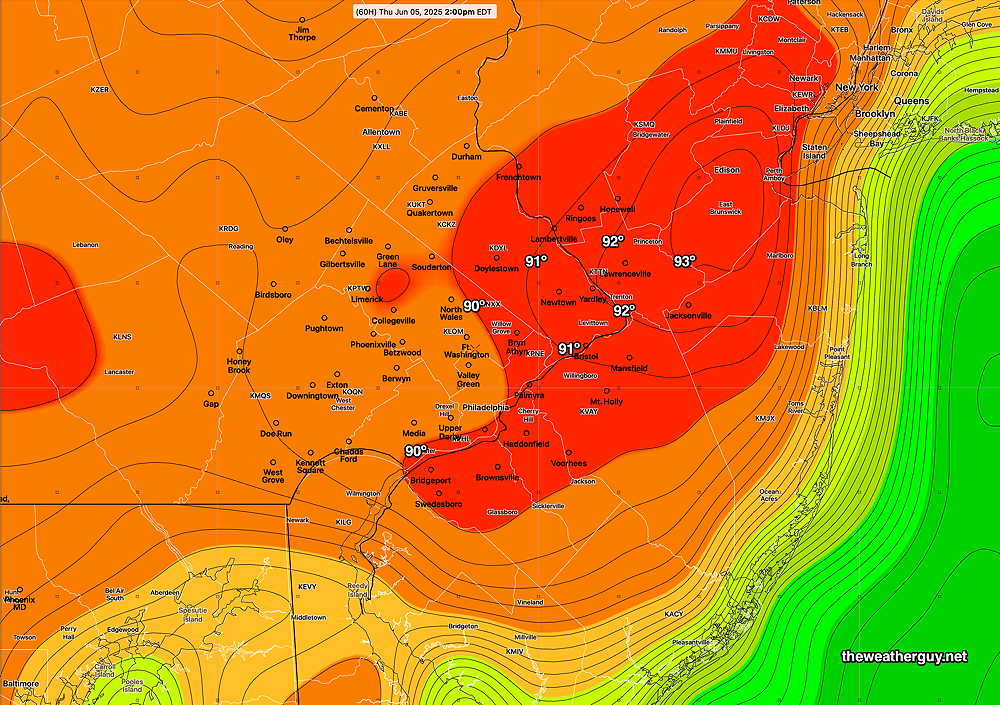
Posted Tuesday 06/03/25 @ 8:25 AM — Looking ahead, there’s some summery weather coming this Thursday, with temperatures likely breaking 90º in some areas.
The latest ECMWF AI model (which gives 6 hour forecasts with 2 PM being the closest to the high temperature time period) shows 90º+ at 2 PM (high temperatures likely about 4-5 PM). Dew points near 63º
ECMWF-AI
The NBM model blend (a statistical ensemble model) is in the same ball park—
The weekend forecast has high uncertainty with showers/rain Saturday and clearing on Sunday. The weekend forecast hinges on the uncertain position of a stalled front and the uncertain formation and track of a coastal low that’s expected to form.
Tuesday Forecast Update
Posted Monday 06/02/25 @ 5:54 PM — A building high pressure ridge will bring increasingly warm and more humid weather to our area through Friday.
A front will move through late Friday or Saturday with some showers and thundershowers, although the heaviest activity will likely remain north of the immediate Philadelphia area.
Of interest will be a smoke plume from wildfires in Canada that will bring considerably hazy skies. At ground level, smoke increases will be only slight, but perhaps noticeable.
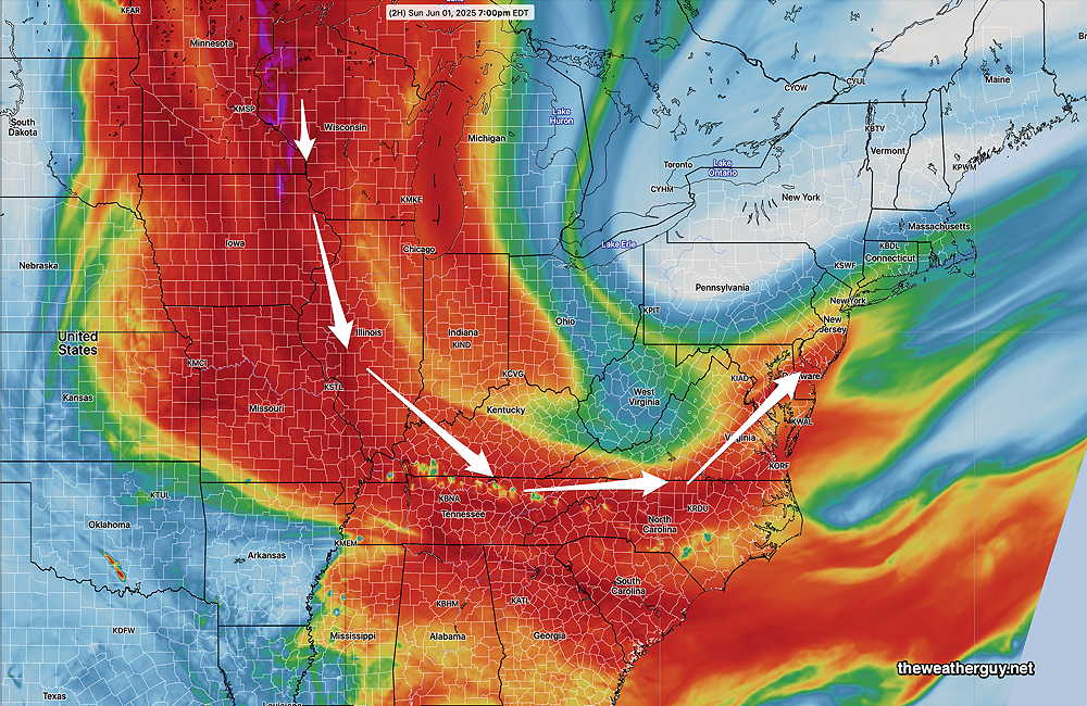
Previously Posted Sun @ 7:40 PM — —An upper air low that is north of our region is expected to move away by Tuesday.
Today it was responsible for more clouds [than had been forecast by many models] and for the cooler than average temperatures. The upper low is visible in the satellite water vapor image—
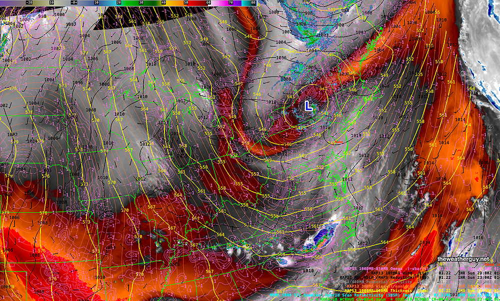
Also dimming the sun today was smoke from forest fires in Canada. The smoke plumes are rotating around the upper low—
By Wednesday, an upper air ridge will be taking shape over the eastern US, bringing much warmer temperatures on a southwesterly wind flow—
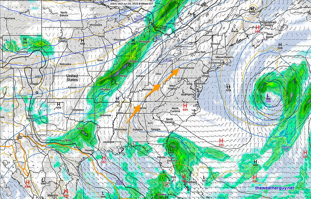
The latest ECMWF-AI model has the cold front (visible on the graphic above) dropping south and likely stalling over our region for late Friday into Saturday. Some showers move in late Friday.
So, a transition period to warmer temperatures and possibly a different pattern looks to be the outlook.
Due to the highly unbalanced political environment on X, I’ve considerably cut back auto-posting there. To receive all of my forecast postings, I recommend following me on mastodon.social or bluesky.social