#Philadelphia #weather #PAwx
Looking for Monday’s Storm forecast Updates? They’re below.
Storm Forecast Updated Saturday 01/04/25 @ 10:05PM—Another Storm update posted below
Previously Posted Fri @ 5:55 PM — —Following the clipper disturbance moving through Friday evening, cold high pressure will build in for the weekend. The frigid temperatures and colder wind chills expected have been well-advertised, although the latest NBM is forecasting highs somewhat less extreme than previous forecasts.
A disturbance in the Northwestern US will move down in the jet flow to arrive here well before daybreak Monday.
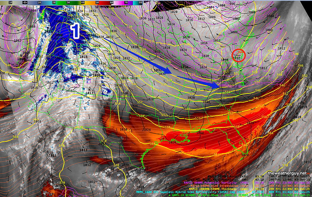
The path of the disturbance and the degree of development will determine how much precipitation we’ll receive in the form of snow Monday.
Saturday Forecast
Sunny early, the partly cloudy/partly sunny in the afternoon as instability cloudiness develops. Gusty winds near 28 mph. Wind chills 17º-21º
NBM high temperatures: Blue Bell, PA 33º Philadelphia, PA 34º
Average uncertainty (based on standard deviation): ± 1.2º
Sunday Forecast
Mostly sunny and continued cold. Wind chills 18-24º, rising in the late afternoon. High clouds move in late in the afternoon or evening.
NBM high temperatures: Blue Bell, PA 33º Philadelphia, PA 34º
Low uncertainty (based on standard deviation): ± 1.0º
Monday’s Potential Winter Storm
Due to the highly unbalanced political environment on X, I’ve considerably cut back auto-posting there. To receive all forecast postings, I recommend following me on mastodon.social or bluesky.social
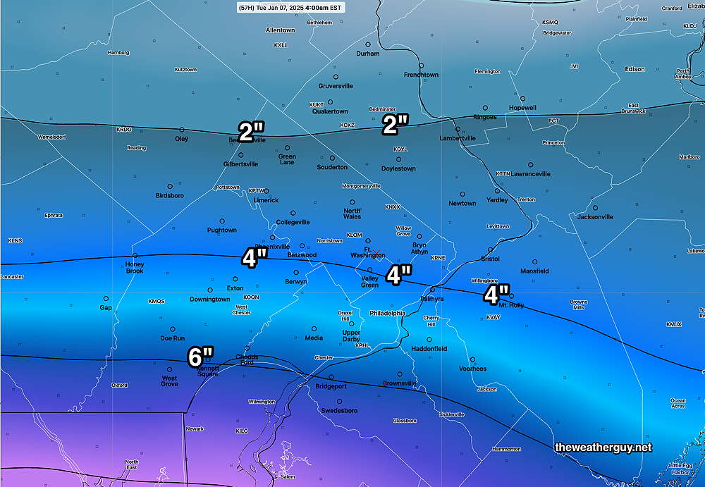
Posted Saturday 01/04/25 @ 10:05 PM — A quick update with tonight’s latest 00z models, the NAM and the HRRR. The NAM continues in the general moderate range as seen earlier—
The HRRR is an eye-opener and possibly a single model run error—
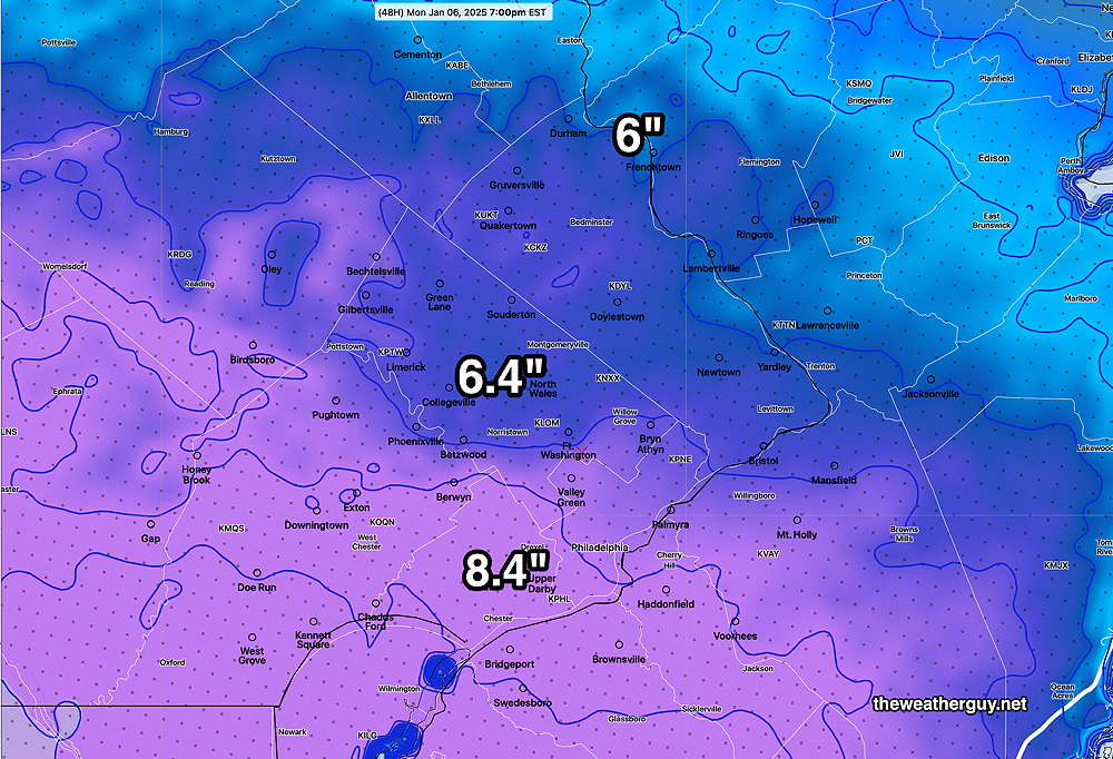
Updates Sunday morning after 9:45 AM with the newer 12z models.
Posted Saturday 01/04/25 @ 5:05 PM — I’m glad I gave this the title of “Potential Winter Storm”, since more and more models are forecasting high pressure to nose down from the northeast, blocking any significant snowfall in our area and to our northeast.
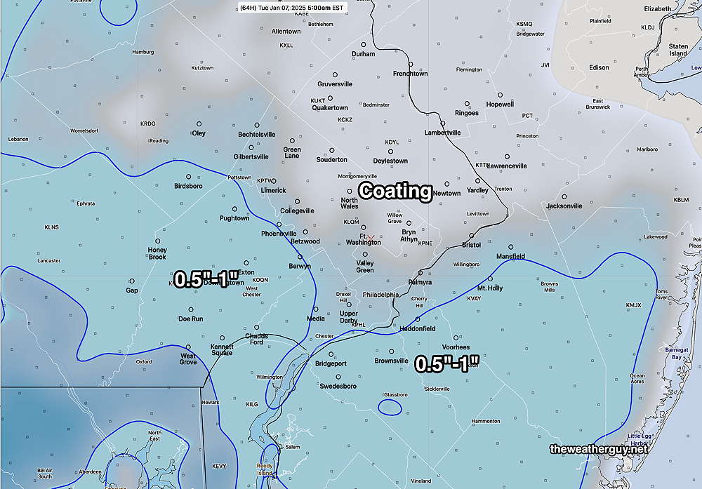
The European (ECMWF), Canadian RGEM and German ICON models are now forecasting a minimal snowfall for Philadelphia on Monday. However our US -NOAA models continue to forecast a moderate snowfall.
Perhaps the most striking in the low range is the RGEM, which just became available and shows little to no snow!—
The latest ECMWF that’s available is from this morning. It also trends towards low snow totals—
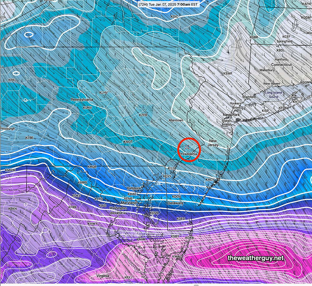
The GFS is still predicting a moderate snowfall—
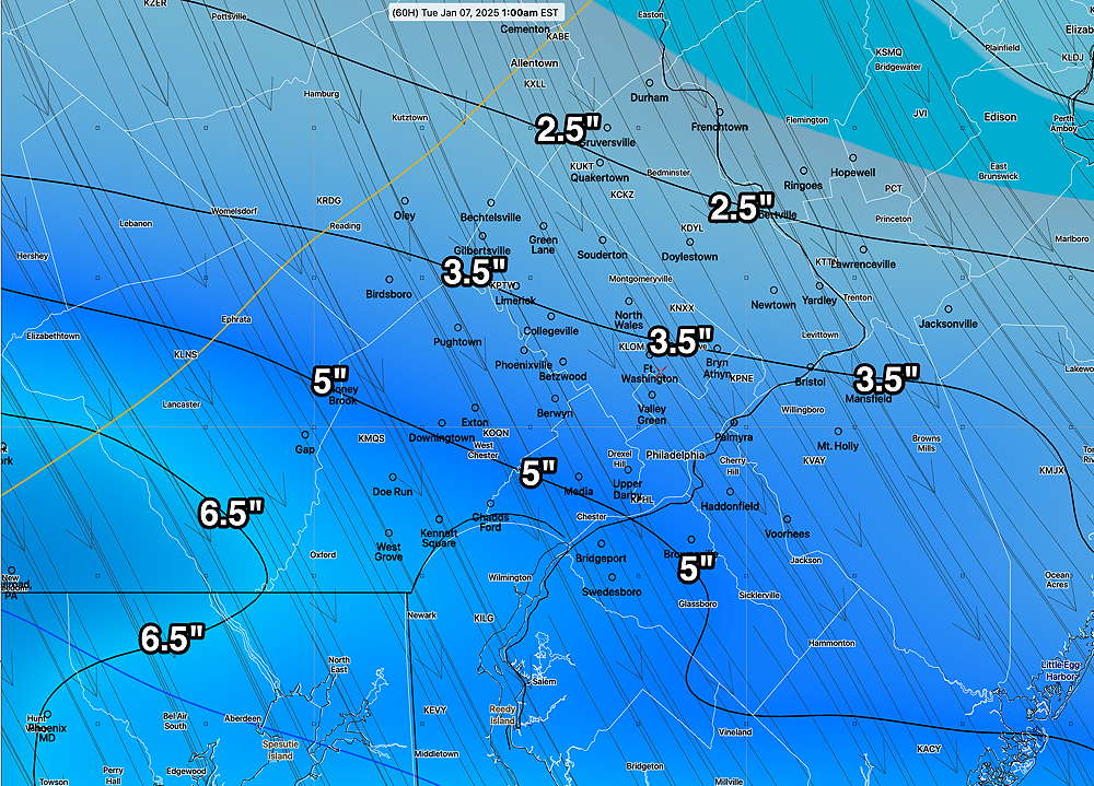
Long time readers of this blog know my mantra, “Never ignore the NAM”.
The NAM is also still predicting a moderate snowfall here—
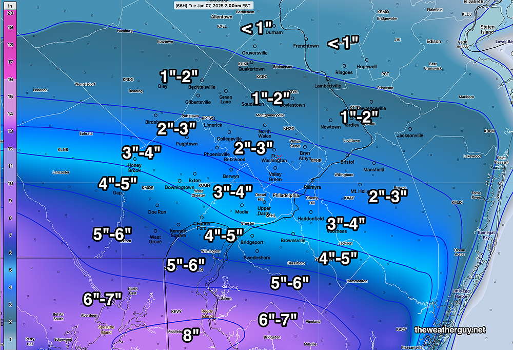
As they say about elections, it’s too soon to call. But there’s a wide range of forecasts.
The NAM does tend to run high about 48 hours out, so I’m inclined to hang my hat on tomorrow’s NAM runs. In its favor, it generally captures any southward suppression of snowfall.
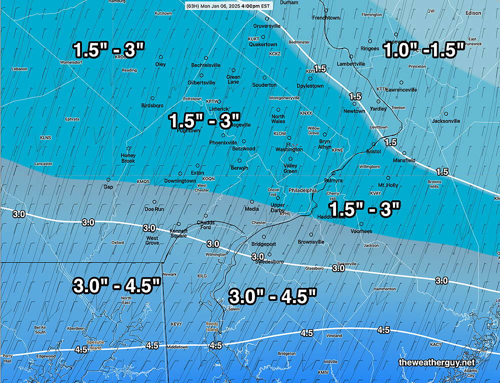
You would think the AI models would be useful. The ECMWF-AI model is leaning towards the low end, with a range of 1.5″- 3″ for most of the Philadelphia area.
So I’m still leaning towards the moderate snowfall of the GFS and NAM, but with knowledge that this might be incorrect.
Posted Saturday 01/04/25 @ 11:51 AM — This morning’s (06z) ECMWF continues to show much less of a snow shield north of this system. Here’s its snow forecast—
Posted Saturday 01/04/25 @ 9:16 AM — There are differences between the European Model (ECMWF) and the NOAA models, with the NOAA models forecasting a more northern shield of precipitation (snow) than the ECMWF. The ECMWF forecast has the low pressure system to our south—
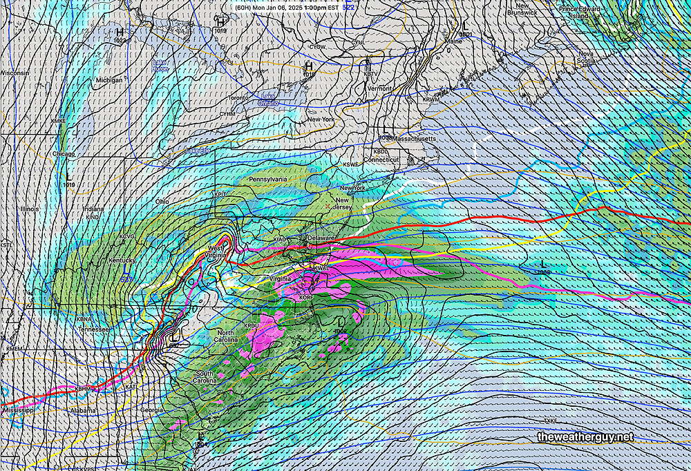
I’m inclined to stay with our NOAA models.
Reviewing the latest NAM and NBM, here’s the latest snow accumulation forecast—
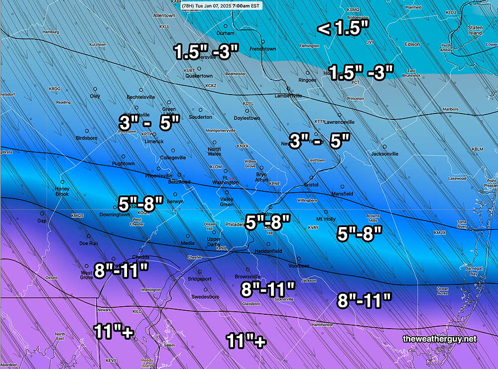
Here’s the latest NBM forecast—
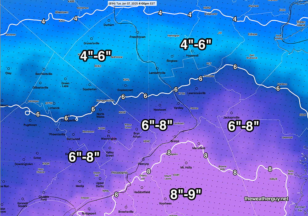
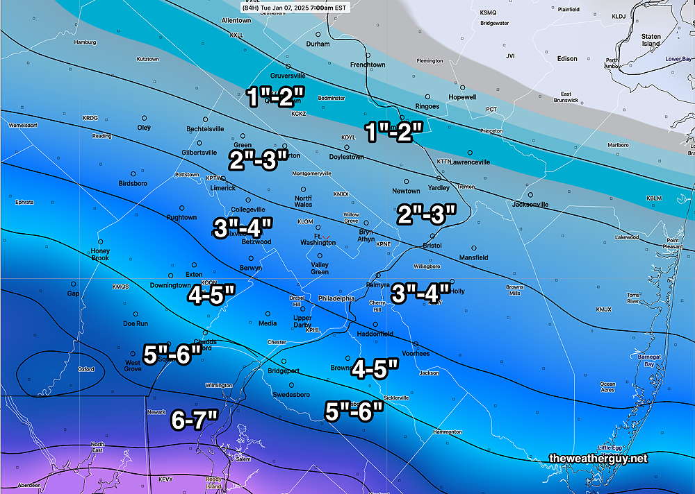
Posted Friday 01/03/25 @ 9:56 PM A quick update. After looking over the afternoon models, and tonight’s NAM, the trend has been for a southern track for the heaviest snow. The global ensemble (statistical) models are remarkably similar with similar areas of uncertainty in position and speed of the system.
I’m posting the latest snow forecast, based on the latest NAM model which just became available—
Posted Friday 01/03/25 @5:51 PM —There remains uncertainty with the final track of the storm and the degree of intensification. The general trend has been for a track that’s further south, giving the Philadelphia region less snowfall than had been predicted yesterday.
Here’s the current GFS forecast, showing several low pressure centers.
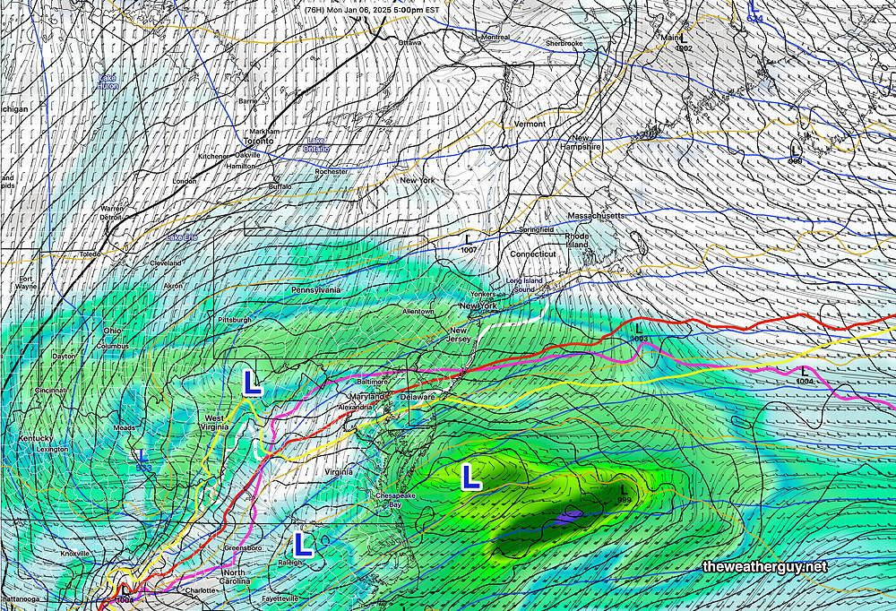
Here’s what I’m calling for, based on the latest NBM precipitation forecast—
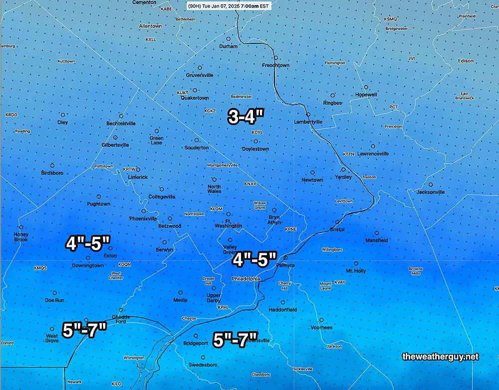
Check back for updates tomorrow morning.
