#Philadelphia #weather #PAwx
Friday and Weekend Preview
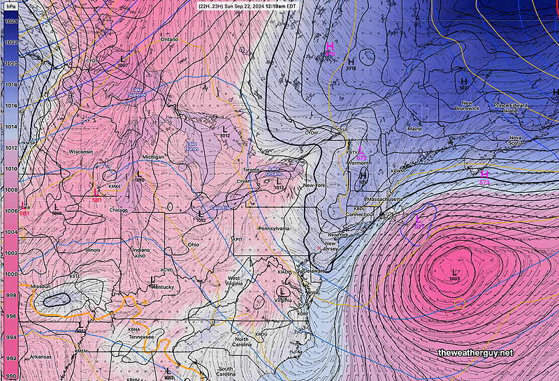
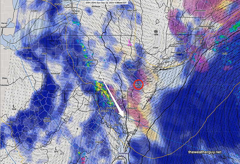
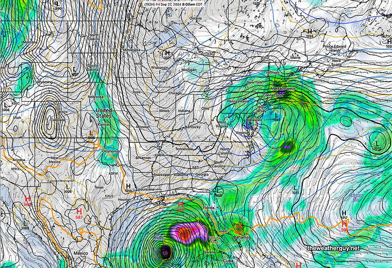
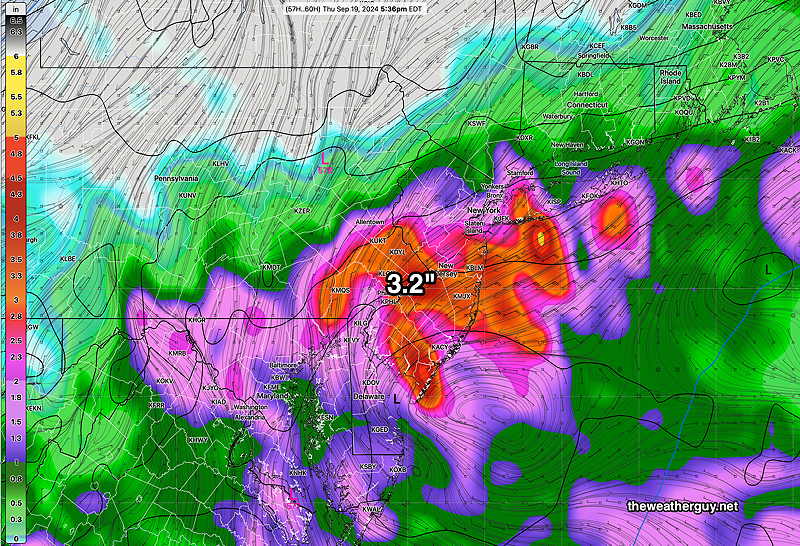
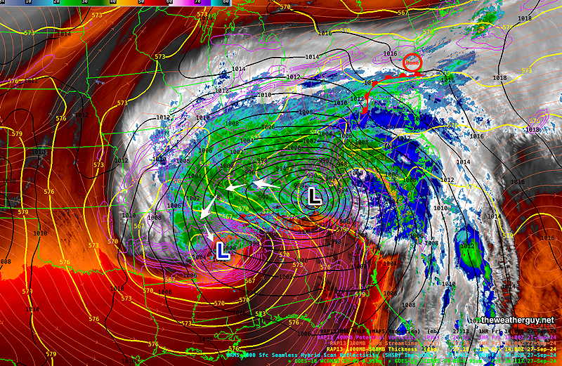
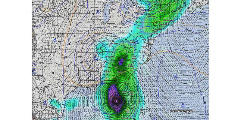
Posted Friday 09/27/24 @ 10:37 AM — Hurricane Helene will become merged with an upper low today, as a moist east-southeasterly flow in overruns an upper ridge in our area, creating a warm-front type scenario. Here’s the current water vapor image depicting the current conditions—
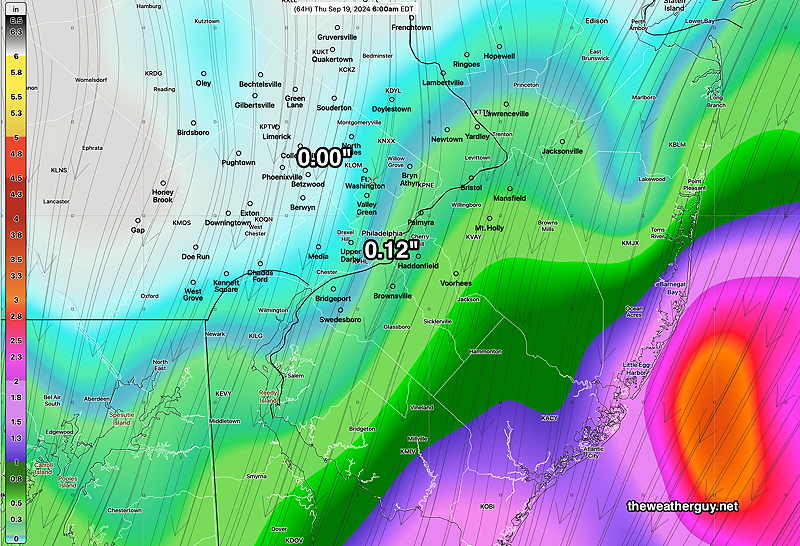
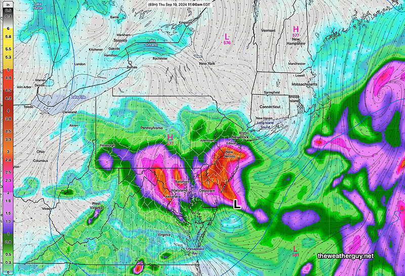
The warm front won’t make much progress moving north of our area Friday. We’ll have some heavier rain Friday evening and night.
Drizzle showers and fog are likely to continue through Saturday morning.
It’s possible that some brightening skies poke through Saturday mid day. but most models keep us cloudy and wet.
More clouds and showers likely for Sunday and possibly Monday.
The combined system may spawn a secondary coastal low for rain on Tuesday.
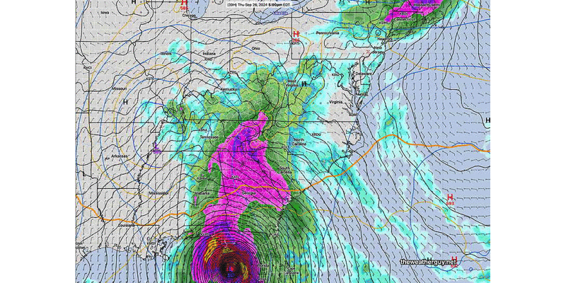
Hurricane Helene Update -Early Weekend Outlook
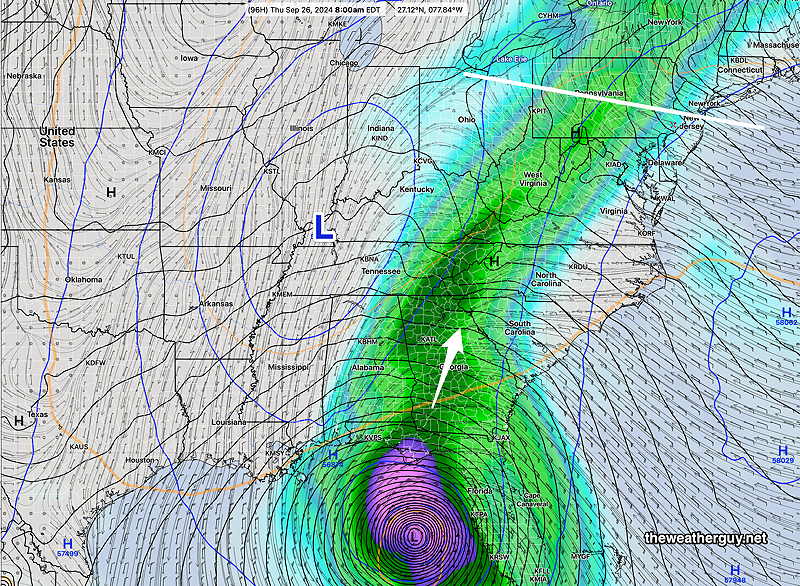
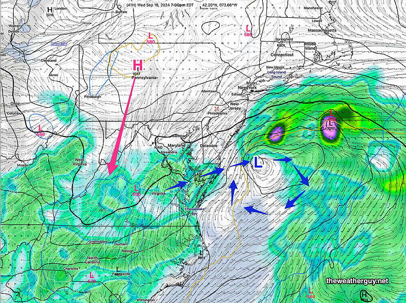
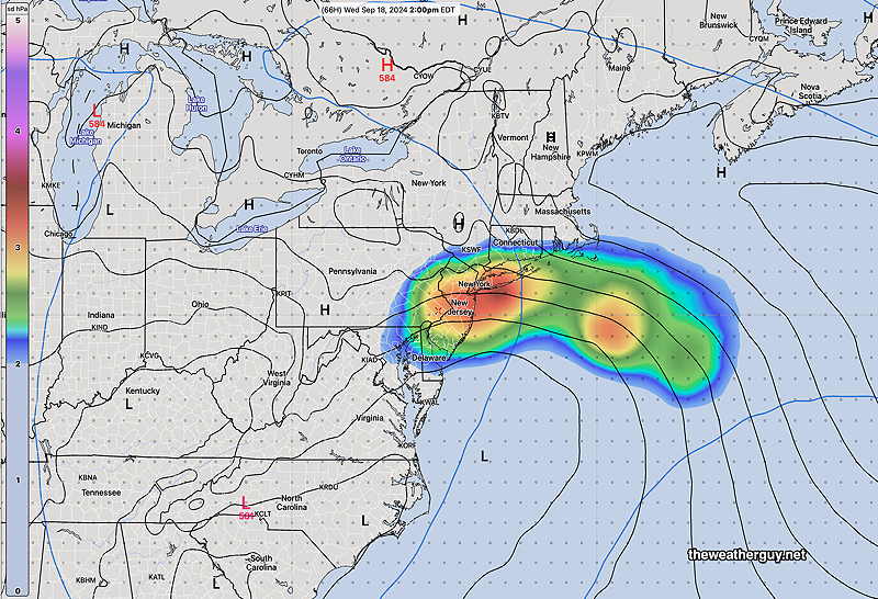
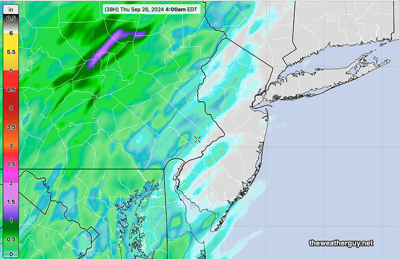
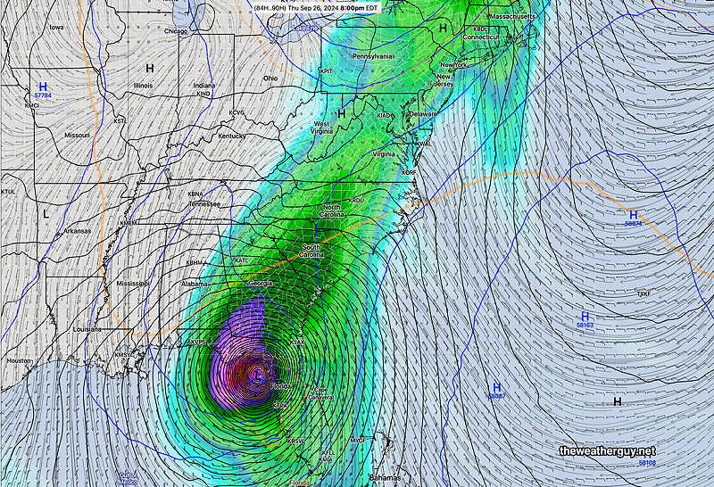
Posted Thursday 09/26/24 @ 4:32 PM — Hurricane Helene is expected to reach landfall about 8-10 PM in the Big Bend area of Florida, perhaps just east of Tallahassee. It’s then expected to move rapidly northward and then northwestward to be incorporated into the upper closed low pressure system, while some of the moisture is flung northeastward towards our area—
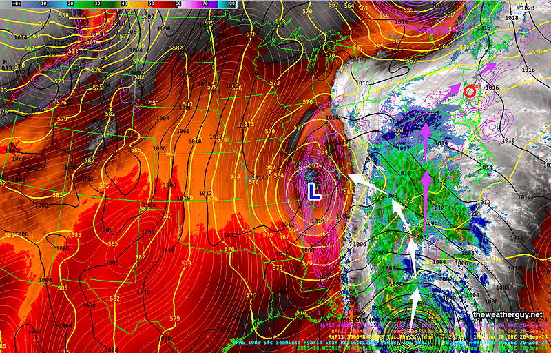
Several days ago, it appeared that an upper ridge over our area would block the moisture and rain from this system from our area. It currently appears that our area will have clouds and showers Friday through Sunday and possibly into Tuesday.
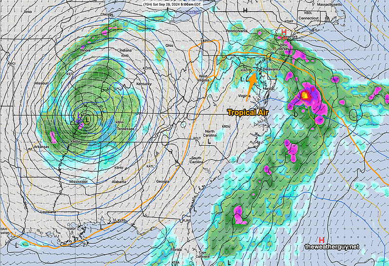
Helene Update- Early Weekend Outlook
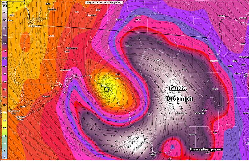
Posted Thursday 09/26/24 @ 10:12 AM — It appears that Hurricane Helene will hit the coastline of Florida, just east and south of the Big Bend between 8PM and 10 PM EDT. Forecast central pressures are in the 958 mb range, suggesting at least a Category 3 storm.
Wind gusts over 100 mph are forecast quite a distance from the storm’s eye—
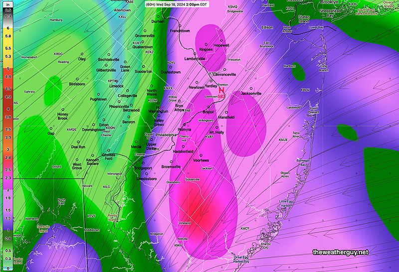
It’s appearing increasingly likely that some moisture and resulting rainfall from from this system and its merger with a closed upper low will overspread the Philadelphia area on Friday and Saturday. This to occur despite the persistent blocking ridge which is forecast to retreat. Details likely to change. I’ll update later today.
Thursday – Saturday & Hurricane Helene Update
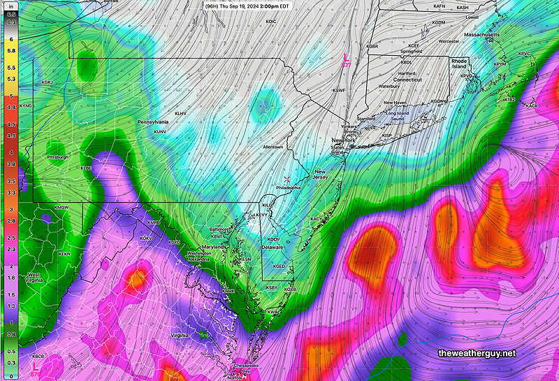
Posted Wednesday 09/25/24 @ 1:38 PM — Hurricane Helene continues on a track to be a major hurricane. It is forecast to merge with a closed upper level low pressure system in the Midwest with some of it’s moisture moving up against (and slightly over) a high pressure ridge that’s over the Philadelphia area by early Saturday morning.
It appears that by Saturday, some moisture over-running the ridge in our area will bring additional rain as moist tropical air moves in and over us. This tropical air is circulating up from the closed upper low in the Midwest.
For our area, we’ll be under the indirect influence of the circulation around this, almost stationary upper closed low in the Midwest Thursday through Sunday. We’ll continue to see much needed periods of rain.
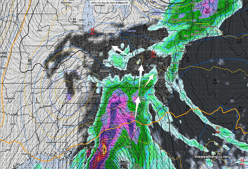
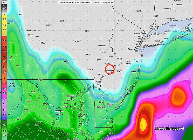
Currently, much of this rain will fall to our west, but the lack of predictability of both the closed low and the hurricane will make for a changeable forecast with below average confidence. Stay tuned.
Wednesday Forecast
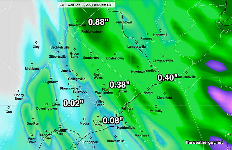
Posted Tuesday, 09/24/24 @ 9:41 PM— A disturbance will approach us from the southwest on Wednesday, unrelated to the moisture associated with developing hurricane Helene. Anyone hoping for a good soaking rainfall will be disappointed; the model blend (NBM) has as much as 0.35″ falling mostly west of Philadelphia on Wednesday.
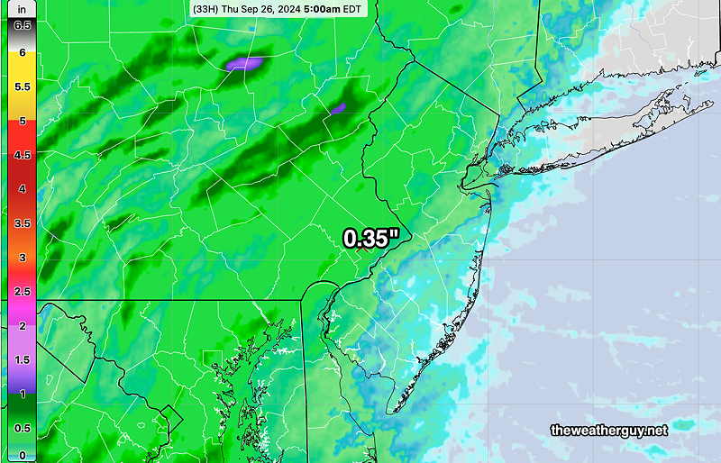
In contrast, the experimental RRFS has much less rain, especially near the city and eastward, on the order of 0.05″
As mentioned earlier today, the forecast for the coming days will be below average confidence and above average uncertainty. The scenario of a closed upper low and and an interacting tropical system combines two systems that weather models have considerable difficulty with.
Hurricane Helene
Posted Tuesday 09/24/24 @ 5:41 PM — Sorry folks. I jumped the gun with the hurricane name and incorrectly used the name, Gordon, already used for a central Atlantic hurricane recently. The new Hurricane is Helene. What’s in a name? (Quite a bit!) We now return you to our regularly scheduled programming.
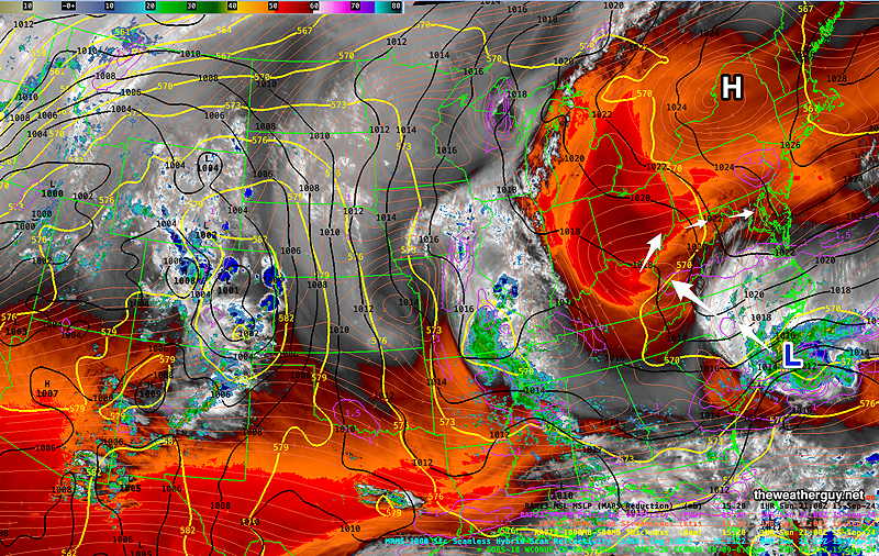
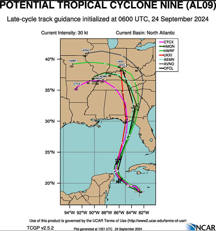
Posted Tuesday 09/24/24 @ 9:35 AM — While not yet officially categorized as a hurricane, Tropical Cyclone 9 (to be called Hurricane Helene} promises to be a major hurricane according to most models. It’s expected to approach the Florida Great Bend area (and near the coast from Tampa northward) early Thursday.
The power of this storm will cause it to remain as a hurricane even when it enters Georgia.
The ECMWF-AIFS has been fairly consistent with its forecast and track for several days. Here’s a graphic I put together to capture its size and track Thursday into Thursday night—
Notice the same high pressure system that has been keeping us with little rainfall will block northeastern movement of the rain associated with Helene.
Here are some official tracks—
Since this scenario involves an upper closed low and a tropical system, it presents a double-whammy for weather models. We’ll see what happens.
As for our area, no change from previous forecast for today, Tuesday. Cloudy, some bright skies and even brief partly sunny intervals mid day and early afternoon. Showers move in later.
Tuesday Outlook
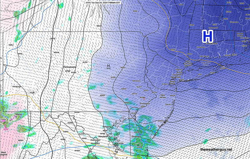
Posted Monday 09/23/24 @ 4:54 PM — Some light showers made it into the Philadelphia area Monday afternoon, and additional intermittent light showers area expected tonight. (There had been uncertainty yesterday regarding the progress of the showers into our area this afternoon.)
Last night’s 00z experimental RRFS accurately forecast these showers.
Unfortunately, the RRFS output has been intermittent, delayed or missing over the past two weeks. The model development group are making improvements. However, recent revisions in the “precipitation physics” seems to have improved its forecasts and has made it worth the wait.
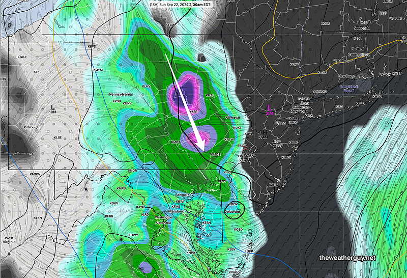
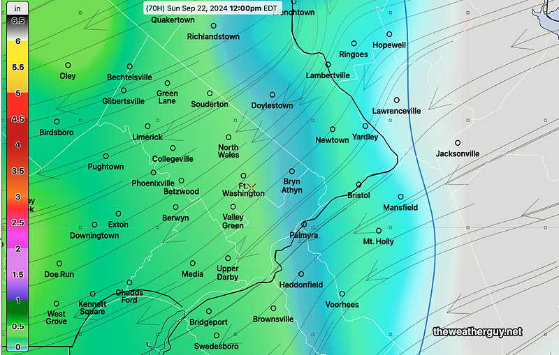
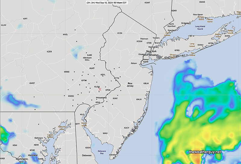
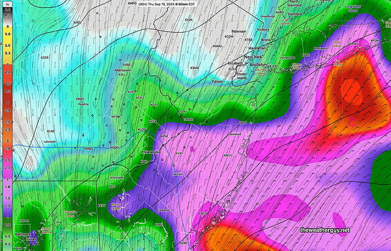
Here’s last night’s RRFS 00z forecast for 3 PM—
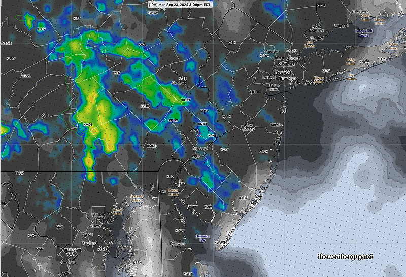
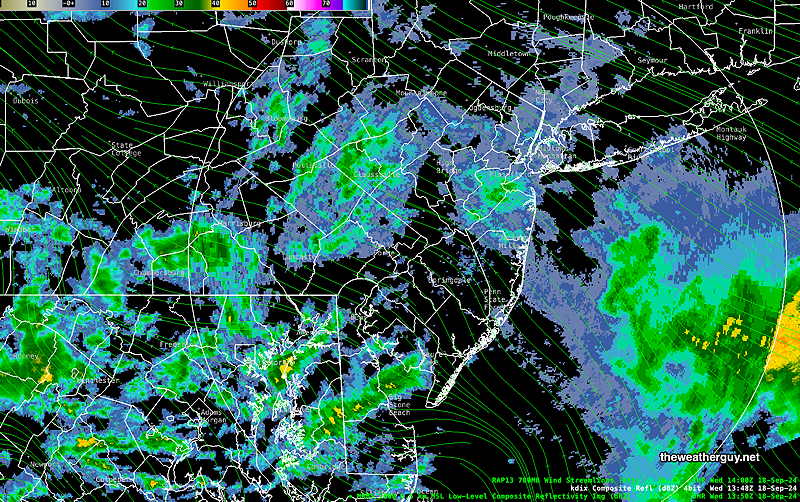
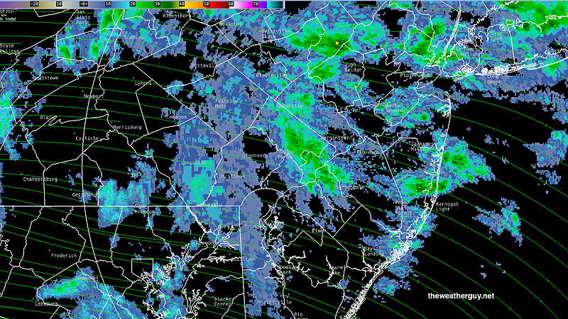
Here’s the radar at 3 PM—
For Tuesday, light showers end around daybreak and much of Tuesday should be cloudy, perhaps with some intervals of sun or bright skies.
Showers return Tuesday night and much of Wednesday. Total rainfall still does NOT look impressive in the immediate Philadelphia area and eastward.
I’m still watching the development of Tropical Storm 9, likely to become Hurricane Helene. The trend has followed the ECMWF-AIFS model fairly well, with a more eastward track affecting the Great Bend of Florida and areas near Tampa and north.
Here’s the latest ECMWF-AIFS forecast for Thursday 8 PM—
An interesting weather week. Stay tuned.
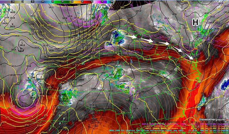
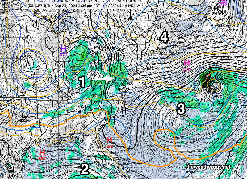
Originally Posted Sun @ 5:34 PM — —This week’s weather will be influenced by low pressure (1) moving in from the west, a developing strong hurricane (2) in the Gulf, blocking persistent high pressure (4) to our north and persistent blocked low (3) in the Atlantic —
Monday
Monday will be cloudy, perhaps with some sunny intervals around noontime.
The HRRR has some showers moving in late afternoon and early evening. How far they will get into the city is an unknown, since the HRRR has blocking high pressure building in at the same time—
The NAM-NEST is predicting most of these showers on Monday are shunted to our south, but some may give parts of our dry area some light showers.
We may finally get a period of rain on Wednesday, as the high pressure system will retreat to the northeast.
Towards the end of the week, the next hurricane (“Helene”) is expected to form and to move inland around the Florida Panhandle or the Florida Great Bend area. according to the ECMWF AIFS. This hurricane could be powerful. Incredibly, our much needed rainfall here may be blocked by high pressure and an upper level ridge again.
There remains uncertainty about this possible hurricane, according to the National Hurricane Center and I may be jumping the gun on the hurricane forecast . Nonetheless, the GFS, ECMWF and CMC Global all predict some strong system.