#Philadelphia #weather #PAwx
Sunny Skies
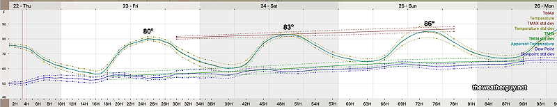
Posted Thursday 08/22/24 @ 5:20 PM — Sunny skies with a gradual increase in temperatures through Sunday. Here’s the latest NBM temp and dew point forecast in the form of a meteogram —
First chance of any precipitation, may be Monday, late afternoon or evening.
Quiet Week Weather-wise
With an upper trough and corresponding surface high pressure system in place, our weather is spectacular, but a bit cool. (Current seasonal average highs are 82º Blue Bell, 83º Philadelphia.) We’re also seeing a bit of instability cloudiness at times.
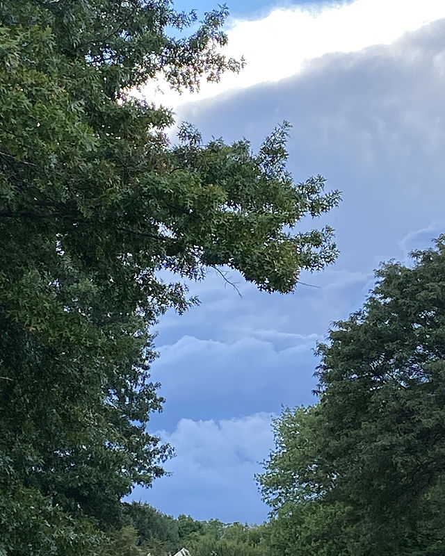
As for that storm that threatened on Monday, here is a photo of what looks almost like a shelf cloud associated with a thunderstorm just northwest of my home at 6:30 PM Monday—
Forecast Update
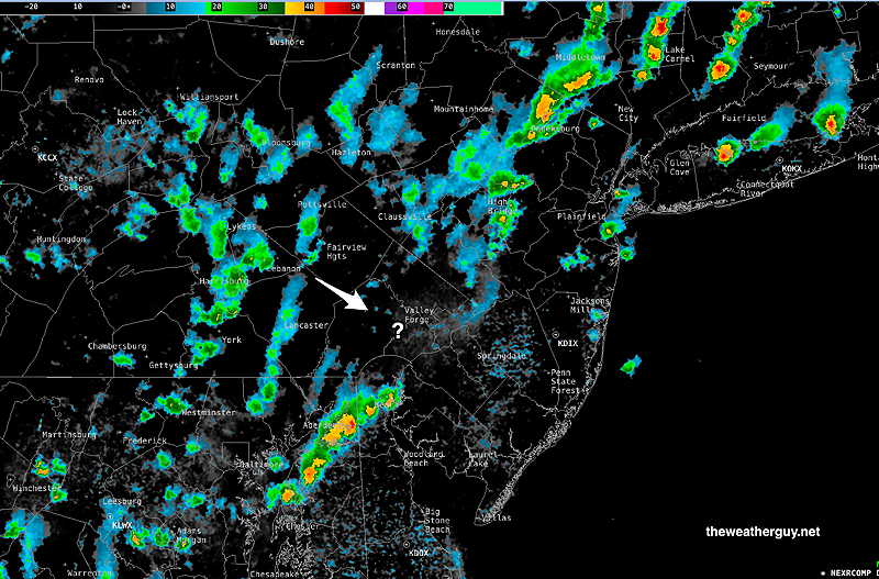
Posted Monday 08/19/24 @ 8:47 PM — Well, a wave has developed on the front and some showers are expanding in coverage just northwest of the city. Apparently predicted by the NAM-NEST and the HRDPS. May move in over the next hour. Very interesting.
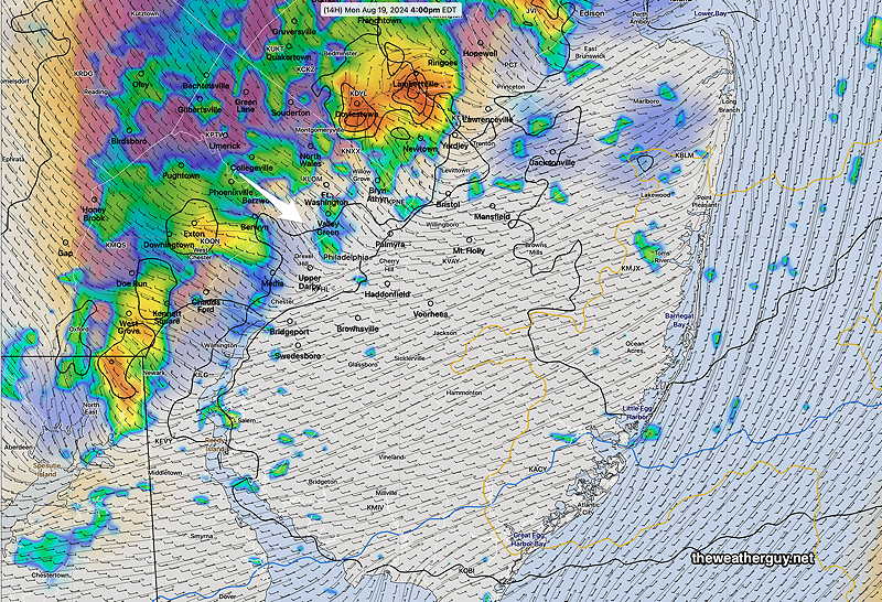
Posted Monday 08/19/24 @ 4:37 PM — Today’s forecast line of showers and thundershowers fell apart and went to our north and to our south. Current radar shows some other activity but winds have shifted and I wouldn’t count on any significant showers in the immediate Philadelphia area. Here’s the current radar at 4:30 PM—
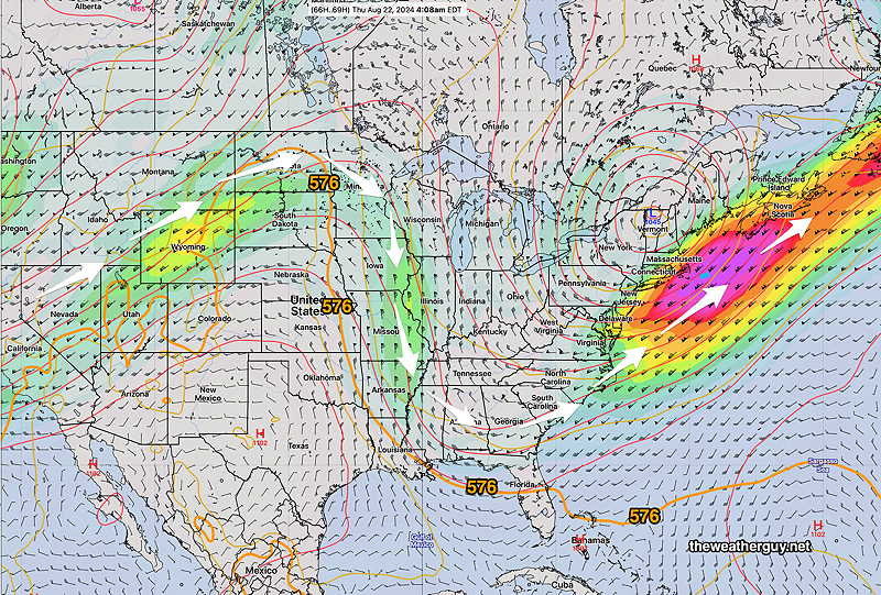
For the balance of the week, an upper trough will allow cool high pressure to build in through the weekend. Sunny skies and unseasonably cool weather is expected for the next several days. The NAEFS shows the forecast jet stream position on Thursday—
Mostly sunny and dry through the week. The upper low can cause some instability cloudiness at times, especially in the afternoons and some difficult to time disturbances may rotate around the upper low. But overall, quite nice for an extended period of time.
Just speculation, but I expect the heat dome to return by the end of August or the beginning of September.
Monday Forecast
Originally Posted Mon 8:41 AM — A strong cold front will move through our area late this afternoon preceded and accompanied by showers and some thunderstorms. Gusty winds expected but severe weather not expected at this time.
Prior to the showers/storms, expect some sunshine.
Current timing is between 4 PM and 8 PM. Here’s the RRFS simulated radar forecast for 4 PM—