#Phillywx #Philadelphia #weather #PAwx
The forecast update posted last night still holds. Sunshine, with instability cloudiness expected this afternoon.
Sunday Forecast Update
Updated Sat 10/14 @ 9:54 PM — Rain will be ending about 3 AM and skies clear around sunrise. Mostly sunny in the morning, sun and periods of cloudiness in the afternoon due to instability.. Windy. Highs 59º Blue Bell, 61º Philadelphia.
Saturday Forecast Update
Updated Sat 10/14 @ 9:51 AM — Showers have moved through Philadelphia and a steadier rain is on the way by late morning.
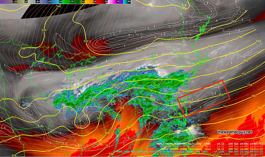
The latest water vapor image shows the likely placement of the secondary low pressure expected to form off the coast—
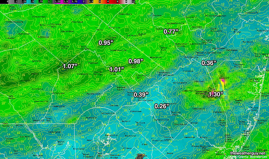
The latest NBM (12z) just available shows its latest estimate of total rainfall with this system —
Update Fri 10/13 9:49 PM — The earlier start of the rain Saturday, between 7 AM to 9 AM, is now forecast by additional models.
Previously Posted Fri 6:01 PM —
As forecast this past week in “This Week’s Weather”, a low pressure system will approach from the west early Saturday and a secondary coastal low will quickly develop along the coast later Saturday through Saturday night.
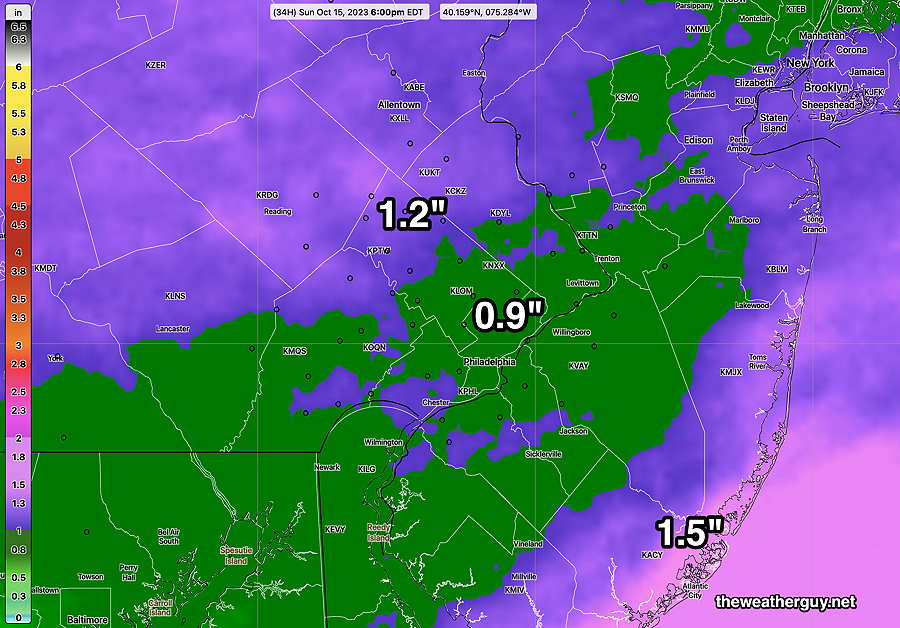
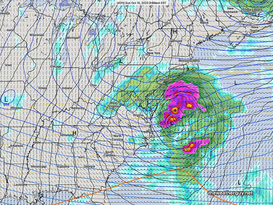
Here’s the ECMWF forecast for 2AM Sunday morning, showing the secondary coastal low—
A generalized 1″-1.3″ rainfall is forecast for most of the area through early Sunday morning.
Saturday
Cloudy with rain moving in from the west anytime between 8 AM and noon.
(There’s been a wide spread of times for the rain to start here, depending upon the model. This afternoon’s high resolution models have closer to a noon start time. With this sort of thing, I tend to lean towards the GFS which has an 8-9 AM start. ) Increasingly windy.
High temperature 55º ( NBM model— location Blue Bell, PA)
High temperature 57º ( NBM model— location Philadelphia, PA)
uncertainty ± 2.3º
Sunday
Any remaining showers ends early morning. Clouds break for some sunshine 2-5 PM in many (but not all) areas. Windy.
High temperature 58º ( NBM model— location Blue Bell, PA)
High temperature 59º ( NBM model— location Philadelphia, PA)
uncertainty ± 1.8º
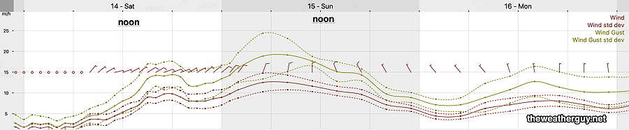
Winds