
#Phillywx #Philadelphia #weather
Friday Weather Update
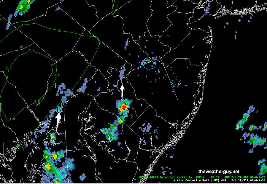
Updated Fri 10/06 @ 3:48 PM — The model forecasts for today have been unusually poor with this system. Last night’s models have turned out to be convincingly wrong, especially the high resolution models. Little to no rain has fallen in our area. As I write this. radar is beginning to show some scattered shower activity, forecast to move into the immediate PHL area. We may see some showers over the next few hours around the city and its immediate suburbs.
I’m just beginning to prepare the Weekend Weather Forecast. I’ll post it later.
Friday & the Weekend Outlook
Updated Thu 10/05 @ 11:02PM — As mentioned in my previous post from Wednesday morning, the cold front expected to pass through late Friday into Saturday morning will not bring much rain or any extreme weather to our immediate area.
Scattered showers are expected to develop on Friday morning afternoon, as early as 6-7 AM 1-2 PM in some spots, and then become a bit more widespread in the afternoon and evening.
The actual front moves through early Saturday morning with some showers and an increase in winds. The amount of rainfall is forecast to be quite light in many areas and ranges from 0.10″ to 0.35″. We may see some sun Saturday afternoon, but a few instability sprinkles possible too.
Temperatures will still be in the upper 60s, so the big impact will be the windy conditions, which will make it feel cooler.
Sunday will be windy and cooler. There will likely be periods of cloudiness and maybe a few scattered sprinkles as a result of instability with the cold air aloft.
Wednesday and Weekend Outlook
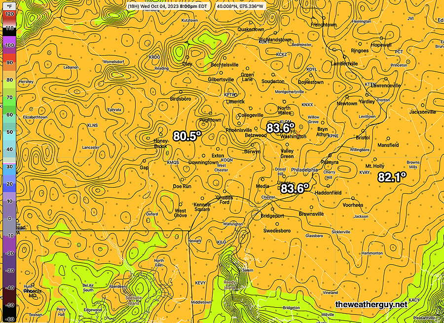
Updated Wed 10/04 @ 8:38 AM — Today is looking to be our warmest day this week, with highs near 83º (± 1.5º). High temps forecast are fairly uniform across our area—
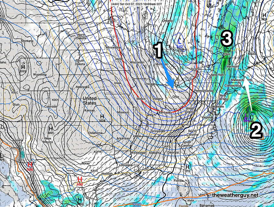
The weekend’s weather is looking less ‘interesting’ but still a dramatic change in temperatures and feel.
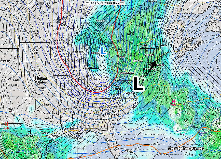
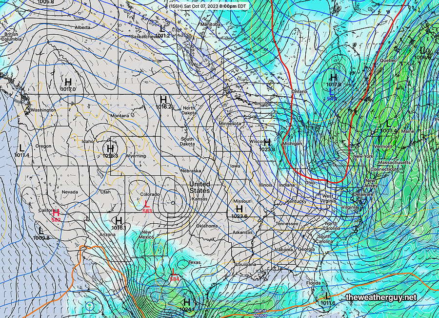
Here are the changes, summed in the latest ECMWF model forecast map for Saturday afternoon—
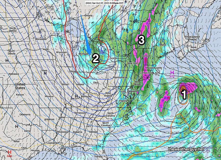
As described in the caption above, the previous forecasts have changed. There are differences among the models in the timing of the actual frontal passage on Saturday, and differences among models with the timing of showers.
There are signs that some light showers may break out as early as Friday morning, but the main front moves through sometime Saturday.
Continued Mild through Wednesday.
Updated Mon 10/02 @ 6:11 PM — No major news here, since one can’t watch a weather report without hearing about the great weather.
Here’s the latest NBM model forecast high temperatures—
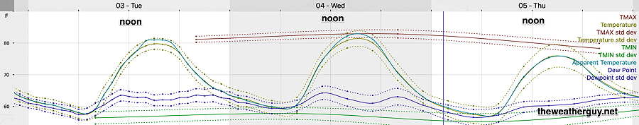
Temperatures still mild on Thursday, just below 80º
For the weekend, things continue to look ‘interesting’ as a sharp dip in the jet stream will induce low pressure somewhere. The NAEFS shows a coastal low, but the GFS and ECMWF differ significantly. Additionally, some moisture from a tropical system far off the coast may add some moisture to this developing system.
Here’s the NAEFS forecast for 5 AM Saturday morning—
Previously Posted Sun 8:03 PM —
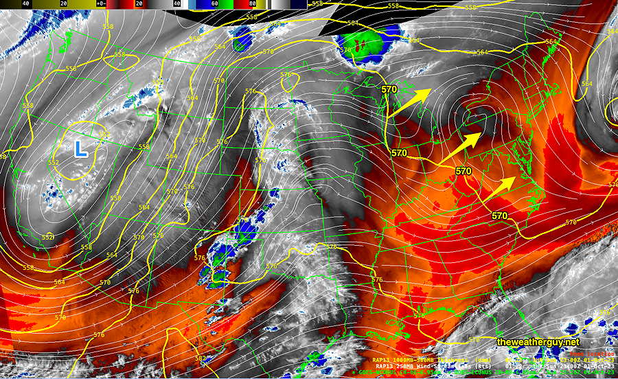
This week’s weather can be summed up with a single current water vapor image—
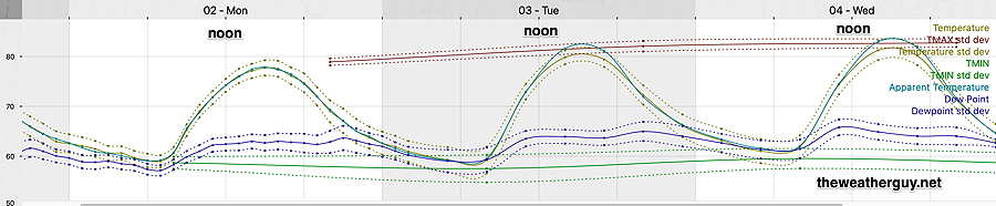
Monday through Wednesday will feature sunny skies and above seasonal average temperatures in the 79º-83º This warm up has been well-advertised on the tv/radio weather.
The latest NBM model shows the forecast high temperatures for Blue Bell PA —
By next weekend, the ridge that was over us will be replaced with a significant trough, with colder temperatures.
The NAEFS is forecasting rain with possible development of a coastal secondary low pressure system for Saturday—
This sharp change in temperatures is a possible set up for some ‘interesting’ weather later this week. Stay tuned.