The showers never materialized anywhere near Philadelphia yesterday. Except for an isolated shower near Reading, the entire area was dry. So much for the HRRR model, (which has been very good, but clearly not perfect.)
A cold front is moving towards us this morning, but its passage around noon will be dry, maybe with a few clouds. Cooler and low dew point air will be filtering in during the afternoon. Too dry aloft even for instability clouds. So it will be sunny and breezy. High 83.
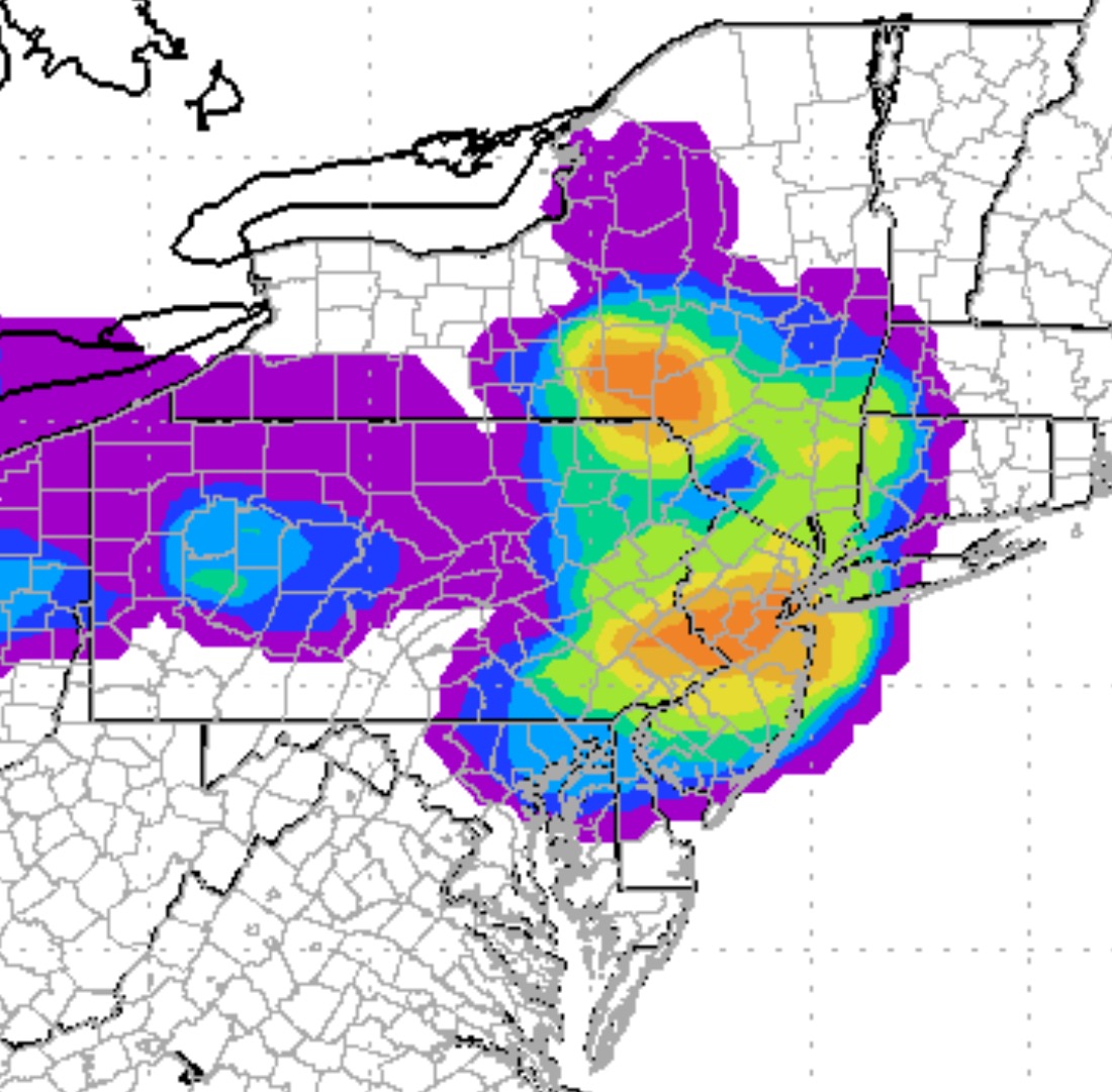
The NAM lifting index and vertical velocity now support showers and thunderstorms for Saturday afternoon, but the line of showers moving through may be broken up and scattered.
The highest probability of thunderstorms is north and west of PHL into central NJ.
The HRRR shows showers/thunderstorms moving into far northern/western suburbs by 2 PM and moving through Philadelphia between 3-4 PM.
The line sinks south and east with additional scattered showers possible through 8 PM. Note that the GFS-based LAMP forecasts show a lower chance of showers/thunderstorms somewhat later, between 4-7 PM.
The probability of thunderstorms is not very high (as compared to this past week’s storms), but high enough to plan for the possibility.
7PM Update: Not a single shower in the Philadelphia area! It wasn’t expected to be a high probability event and it wasn’t.
An intensifying low pressure system in eastern Canada will bring a frontal boundary through our area Saturday afternoon.
Conflicting instability indexes and lift indexes do not give a good handle on the chance of showers or thunderstorms for Saturday afternoon. Considerable cloudiness expected. The NAM cranks out showers/thunderstorms , mostly late afternoon. The GFS consistently has had the precipitation “jump” past the PHL area; The GFS MOS still shows a moderate chance of thunderstorms between 4-7PM. High temperatures are forecast to be near 88, but I think that may be too high.
I will use the HRRR model Saturday morning to get a better handle on the chances for thunderstorms. Check back for an update.
For Sunday, a pool of unseasonably cold air aloft and an upper cyclonic flow will like result in sunshine leading to instability cloudiness and even a chance of pop-up showers, even though the models keep us dry at this time. Windy. Again, the models are forecasting a high of 85, but I think that is too high.