
#Philadelphia #weather #PAwx
Cold Front on our Doorstep
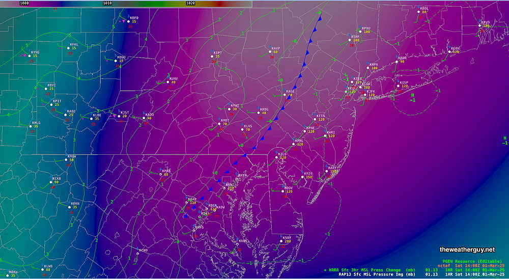
Posted Saturday 03/01/25 @ 9:10 AM — The cold front is just entering western suburbs at 9 AM—
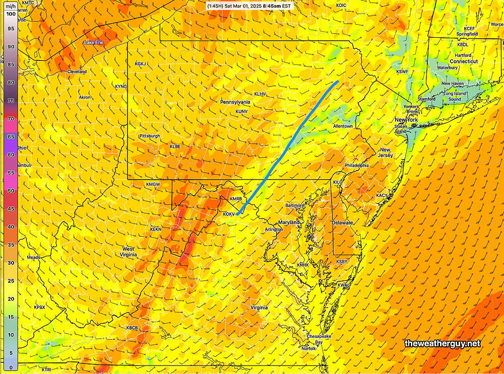
The RTMA at 8:45 captures the wind gusts behind the front. Currently not that impressive—
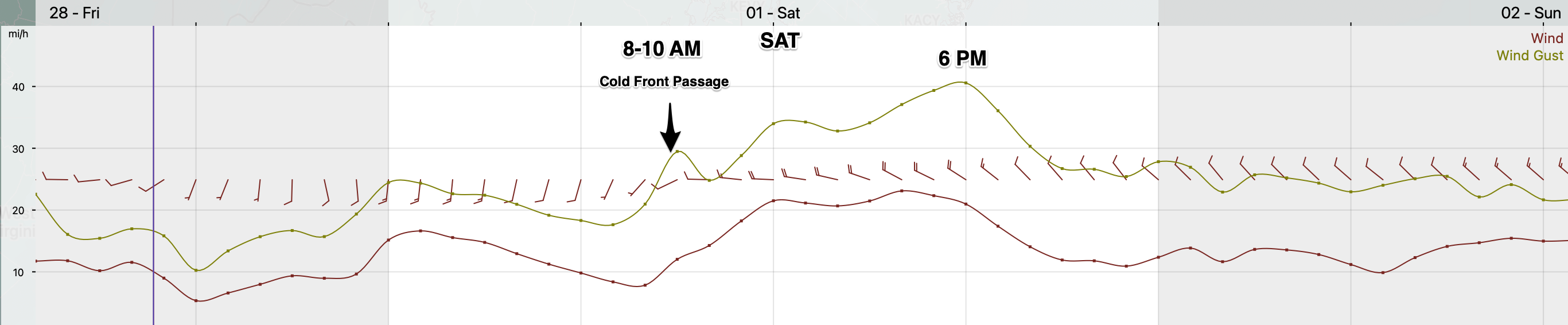
Previously Posted Fri @ 5:17 PM — —March will “come in like a lion” tomorrow, as a strong cold front moves through the area between 8 and 10 AM. The wind meteogram below shows the wind shift associated with the frontal passage—
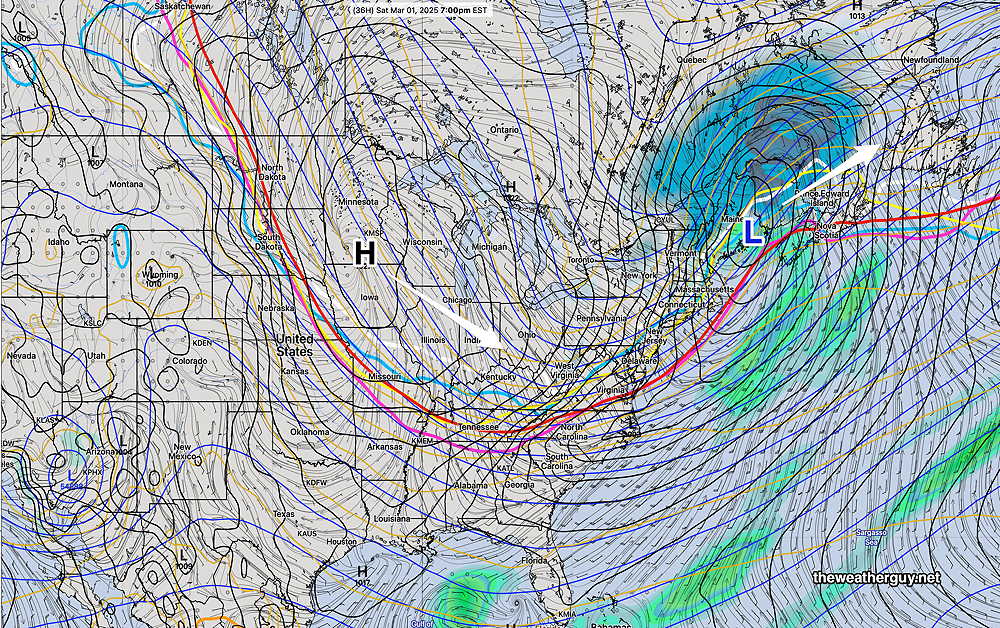
Cold high pressure builds in behind the front, as shown by the latest ECMWF-AI Single model—
Saturday Forecast
Some clouds after sunrise, then mostly sunny and increasingly windy in the late afternoon and evening. Some models show a period of cloudiness for an hour or so during the afternoon. Highest temperatures around noon, then temperatures drop during the afternoon.
NBM high temperatures: Blue Bell, PA 55º Philadelphia, PA 58º
High uncertainty (based on standard deviation): ± 2.3º
Sunday Forecast
Sunny, windy and cold. Decreasing winds by mid to late afternoon.
NBM high temperatures: Blue Bell, PA 34º Philadelphia, PA 36º
Average to Low uncertainty (based on standard deviation): ± 1.3º