#Philadelphia #weather #PAwx
Sunday Forecast Update
Posted Saturday 12/14/24 @ 5:18 PM — There is little change in the forecast for Sunday. Cloudy with low clouds moving in during the afternoon. An easterly wind, 6-11 mph, will make it feel colder than it is.
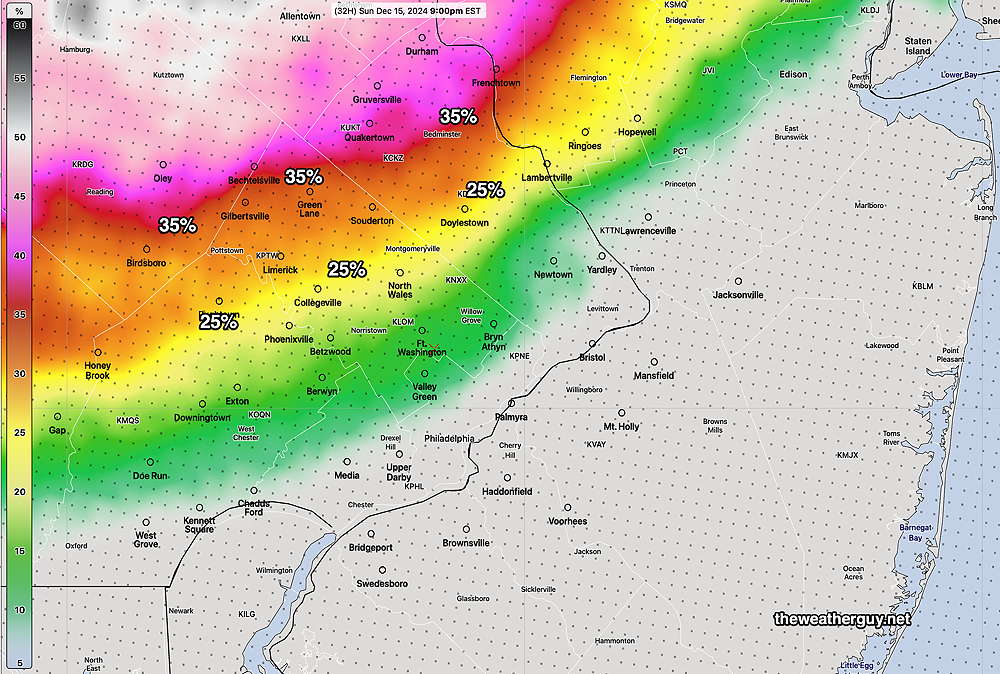
Light rain sprinkles move in from west to east about 7 PM to 10 PM, but a few sprinkles earlier are not out of the question. Areas in western sections of Chester, Montgomery and Bucks counties may have the precipitation start as wet snow with a coating possible before being washed away by rain later in the night.
The NBM shows a just 25-35% chance of just a coating of snow (falling at 0.1″/hour) for a couple of hours in these areas—

The warm front takes its time moving north of our area, as is often the case this time of year. Clouds, drizzle and fog for much of Monday.
Posted Saturday 12/14/24 @ 8:06 AM —The barometric pressure (adjusted to mean sea level) continues to increase to rarely seen high levels. Currently 30.93 inches (measured as inches of mercury).
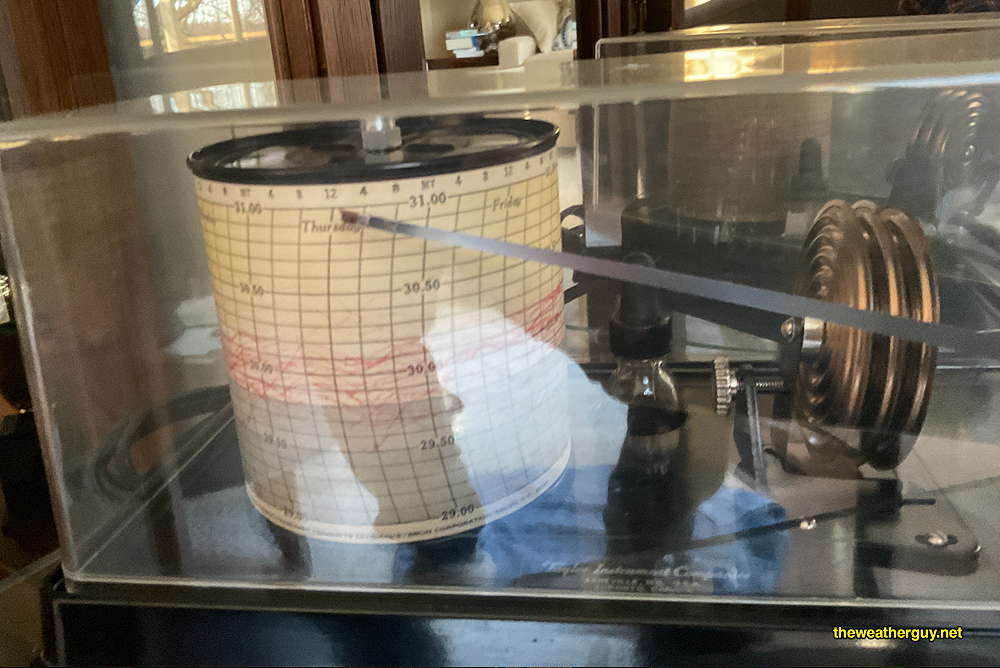
Being a ” weatherguy and barometer kind-of-guy”, I keep a barograph in our living room. It shows the pressure being almost off the scale—

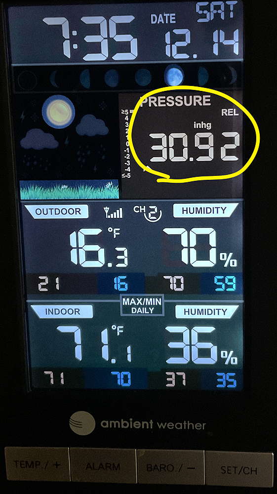
Of course, no weatherguy’s home would be without a simple digital “weather station” —
Researching recent high barometric pressures in Philadelphia, I discovered this site: https://barometricpressure.app/philadelphia. Who knew there was such a site!?
According to the above link-
“The pressure in Philadelphia, PA is expected to rise slowly in the coming hours. Over the next 72 hours, the pressure will climb to a high of 30.94 in Hg on Saturday at around 10am and then reach a low of 30.10 in Hg on Tuesday at around 4am. The average pressure for this period will be 30.61 in Hg, which is considered to be very high.”
https://barometricpressure.app/philadelphia
Update Fri 12/13/24 10:03 PM —For “Barometer Nerds” out there, the current adjusted sea level pressure is 30.81 inches. I can’t remember a reading so high in this region in recent years. Most wall barometers display only up to 31.00 inches.
I’m dating myself, but years ago, no TV or radio weather forecast was complete without the latest barometric reading.
Originally Posted Fri @ 9:02 PM — Cold high pressure remains with us on Saturday. As the high departs on Sunday, an easterly wind flow will bring in clouds.
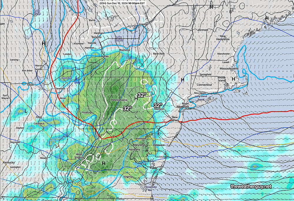
An approaching disturbance (weak warm front) will bring light rain, possibly in the evening but most likely after midnight. (There’s some uncertainty about the onset.)

Saturday Forecast
Sunny and continued cold.
NBM high temperatures: Blue Bell, PA 41º Philadelphia, PA44 º
Low uncertainty (based on standard deviation): ± 1.1º
Sunday Forecast
Increasingly cloudy in the morning. Cloudy late morning and the afternoon. Rain moves in between 10 PM and 1AM. Possibly some freezing precip or snow north of Allentown. Light winds.
NBM high temperatures: Blue Bell, PA 40º Philadelphia, PA 42º
Low Uncertainty (based on standard deviation): ± 0.9º

