#Philadelphia #weather #PAwx
Past 72 Hour Rainfall Totals
Posted Sunday 09/29/24 @ 10:31 AM — Through 9 AM Sunday, the MRMS rainfall totals for the previous 72 hours—
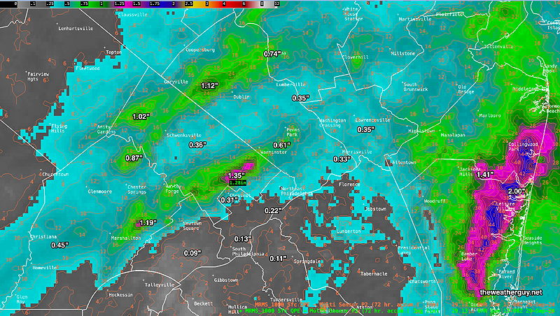
Not much additional rain expected through Tuesday, except in areas shown below.
Sunday Update – Week Forecast Outlook
Posted Sunday 09/29/24 @ 9:55 AM — Humid tropical air in our area overrunning high pressure to our northeast will continue to bring low level clouds, mist and the chance of light drizzle or light rain today, Sunday. Total rainfall looks to be less than Saturday. Northeast wind flow will keep us near 70º.
A break in the action with even some sun possible during the afternoon Monday, especially areas Philadelphia and northeastward, as high pressure builds down.
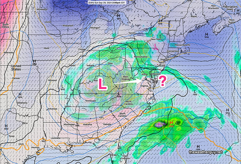
Low pressure developing along the Virginia coastline had been expected to bring us a decent rainfall Tuesday, but there’s been a consistent trend towards this low being too far to our south, suppressed by blocking high pressure. So very little rain now expected for Tuesday—
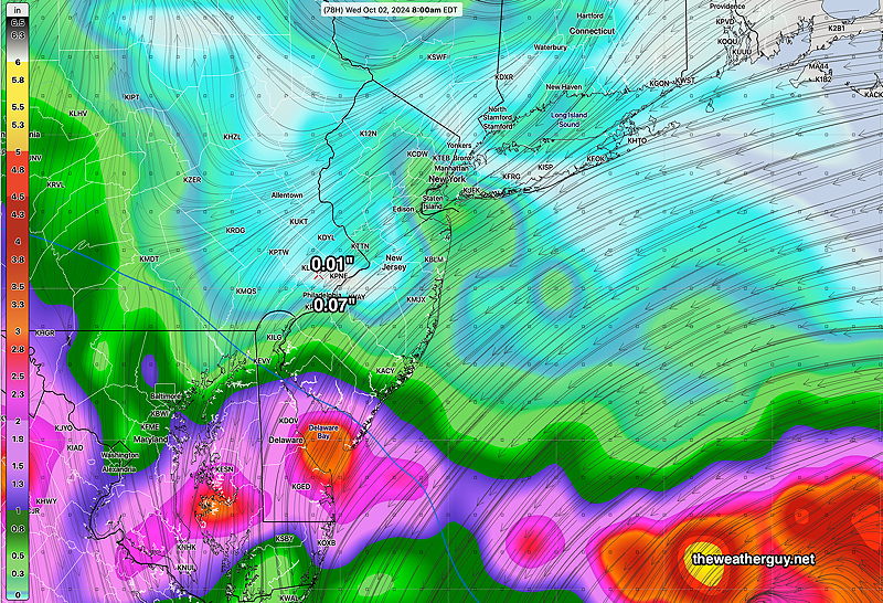
A cold front moves through Wednesday. Little additional rainfall here.
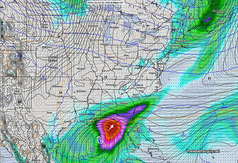
Incredibly, the extended range models are strongly hinting at another tropical storm or hurricane in the Gulf next weekend, with a track similar to Helene. The machine learning/AI model ECMWF-AIFS has also been consistently showing a storm forming by next Saturday—
Continued Cloudy with Varying Light Showers
Posted Saturday 09/28/24 @ 10:12 AM — Last nights 06z models and this morning’s 12z models continue to forecast low clouds and intermittent light showers through Saturday. Some models show some thinning of clouds in southern Delaware and Chester counties towards evening, but that reverses itself overnight.
There isn’t much change for Sunday according to the RRFS and REFS experimental models.
Here’s the current setup Saturday morning with light showers from very moist southeasterly flow—
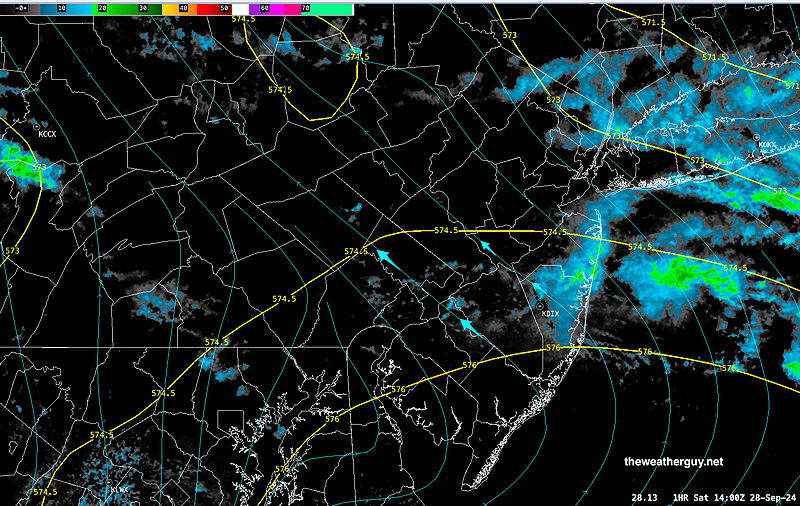
While some models continue with a more substantial rainfall for Tuesday, the GFS is suggesting a further southeasterly development of low pressure which would have the heavier rain miss us. Too soon to tell.
Total Rainfall So Far
Posted Friday 09/27/24 @ 5:44 PM — We need the rain. How much rain have we gotten over the recent days? Here’s the MRMS totals through 4 PM today.
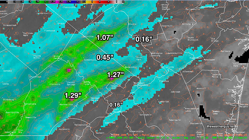
Quite a range of values over our region!
Originally Posted Fri @ 5:01 PM — —The remnants of Hurricane Helene continue to rotate into and merge with an upper air low over Tennessee.
Considerable moisture is being flung up towards Philadelphia from the south and southeast around this combined system and as it hits a high pressure ridge just northeast of us, the moisture is riding up over it and condensing out as rain.
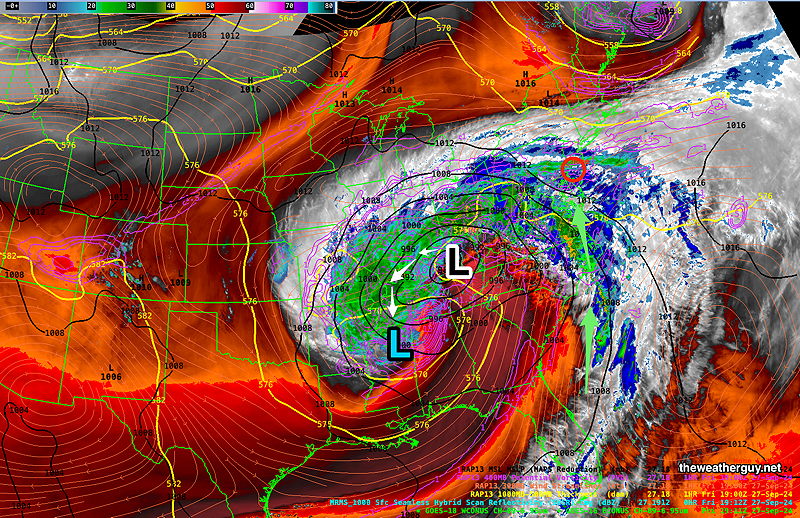
By Sunday afternoon, the upper low will have remained almost stationary, but will begin to move eastward and perhaps induce a surface low off the coast for Tuesday—
Sunday Forecast
Low clouds, fog, some sprinkles early, then cloudy in the afternoon but little in the way of additional showers.
NBM high temperatures: Blue Bell, 69º Philadelphia 71 º
Above Average Uncertainty (based on standard deviation): ± 2.7º
A break in the rain on Monday, widespread rain likely on Tuesday.

Thanks as always.
What are you thinking in terms of total rainfall between now and Monday (i.e., up to just before any potential coastal low Tuesday)?
NWS seems to be saying about .25 inches, which is welcome but certainly no drought-buster.
Yes, we need the rain. The NBM (model blend) is showing .35″ through Sunday midnight. I think that’s a reasonable expectation and in line with many models. It will be spotty and localized so your mileage may vary. I’m planning on posting the total rainfall we’ve received over the past 72 hours tomorrow morning. Regionally, it’s been quite a range of values so far.
The rain on Tuesday looks widespread and perhaps an inch or so. But let’s not count our chickens until they’ve hatched.
The latest Canadian just available has about 0.65 inches of rain through Sunday.