#Philadelphia #weather #PAwx
Forecast Outlook
Posted Sunday 08/11/24 @ 9:28 AM — As had been forecast, we have some cloudiness this morning that should be dissipating around noontime, from west to east. Sunny and comfortable for today.
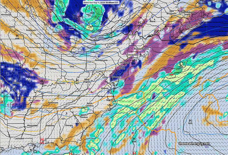
In summertime, it often appears that the approach and passing of a tropical system changes the overall pattern for an area. Such has been the cast with Debby. The dome of hot air that had been with us is now suppressed to our south in North/South Carolina. The hot, upper ridge that had been over us is now becoming more of a cooler trough.
A wave or two of low pressure will pass through on Tuesday.
An accentuation of this upper and mid level trough will occur later in the week, as a new tropical system will pass to our east over the Atlantic next weekend.
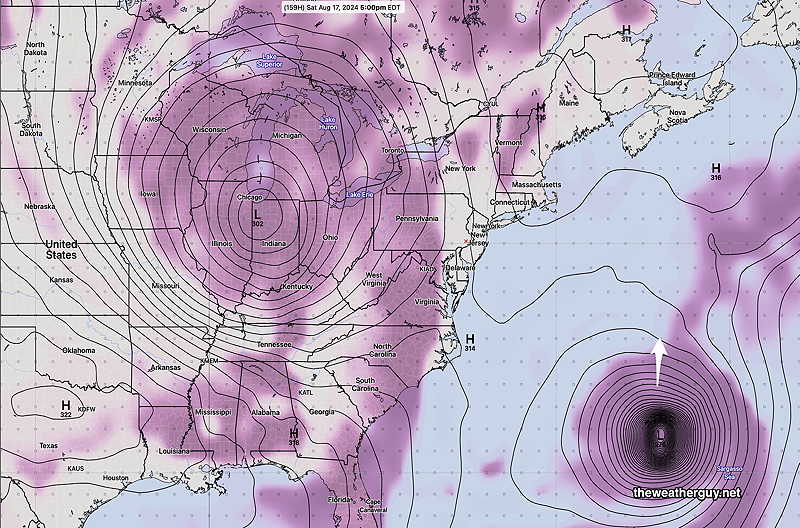
The interaction of these two systems will be interesting to watch. The tropical system is currently forecast to remain far east of the coast.
Originally Posted Fri 7:43 PM —I’ve posted the rainfall totals over the past 72 hours here.
High pressure slowly builds in for Saturday. Clear and sunny skies!
For Sunday, a disturbance in the western Atlantic along with a few upper air disturbances rotating around a large low pressure system in Canada will bring in some cloudiness for the morning especially east at the Jersey Shore. Skies clear west to east by early afternoon.