#Philadelphia #weather #PAwx
Sunday Forecast Update
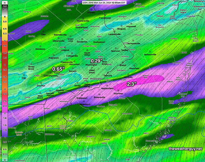
Posted Sunday 06/23/24 @ 4:18 PM —If you were expecting today’s rainfall to fully water your garden or lawn, you may be disappointed. Numerous models have the the showers diminishing in intensity in the immediate Philadelphia area. We could use the rain, but I’m not convinced we’ll see all that much. A few areas may get a good soaking but it seems that many won’t.
Posted Sunday 06/23/24 @ 10:27 AM — The approaching cold front is in Ohio this morning with a line of showers and storms in western PA—
This front will be a slow mover, not likely passing through here until 4-5 AM Monday.
Clouds well ahead of the front don’t appear to have changed the forecast high of 96-98º for the immediate Philadelphia area.
An increasing chance of thunderstorms after 1 PM with widely scattered storms possible west of the city as early 1-3 PM. Most likely period here in the immediate PHL area between 5 and 9 PM, but some scattered activity possible into the pre-dawn on Monday. It still appears that the heaviest activity will be in NJ this evening between 7 PM and midnight.
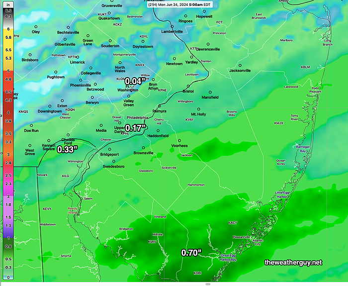
Total rainfall doesn’t look that impressive according to the NBM—
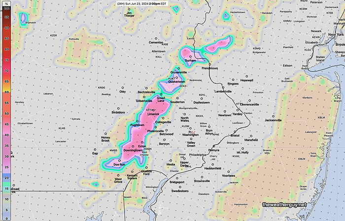
The Canadian HRDPS shows greater rainfall totals—
Sunday Forecast Update
Posted Saturday 06/22/24 @ 7:52 PM — We had some thundershowers in the early to mid afternoon Saturday, not predicted by many models. (The Canadian HRDPS forecast some early storms, mostly west). These showers kept the high temperatures ‘only’ in the 96º-98ª range.
For Sunday, a weak front is expected to move through late in the day, preceded by a line of showers and thunderstorms. Most likely time for the storms is about 4 PM far western areas, 5-6 PM in Philadelphia. As the storms enter NJ, they’re forecast to intensify.
It’s no secret that thunderstorms are best forecast with a probability-based approach. As such, I’m going to rely on the probability parameters of the HREF, NBM and the HRDPS, instead of my past approach of favoring one model’s timing and storm placement over another.
For Sunday, high temperatures look to be less than previously forecast. Highs will ‘only’ be in the 96º-98º range, similar to today. However, dew points will be near 70º, making it feel as hot if not hotter.
While there may be a main line of storms that move through 4-7 PM in Philadelphia, additional showers and storms, before and after the main line.
While the highest chance of storms in the immediate Philadelphia area will be between 4 PM and 7 PM, there are indications that some storms may move in from the northwest and blossom earlier in western suburbs, 1-3 PM —
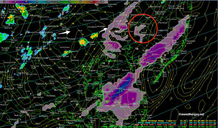
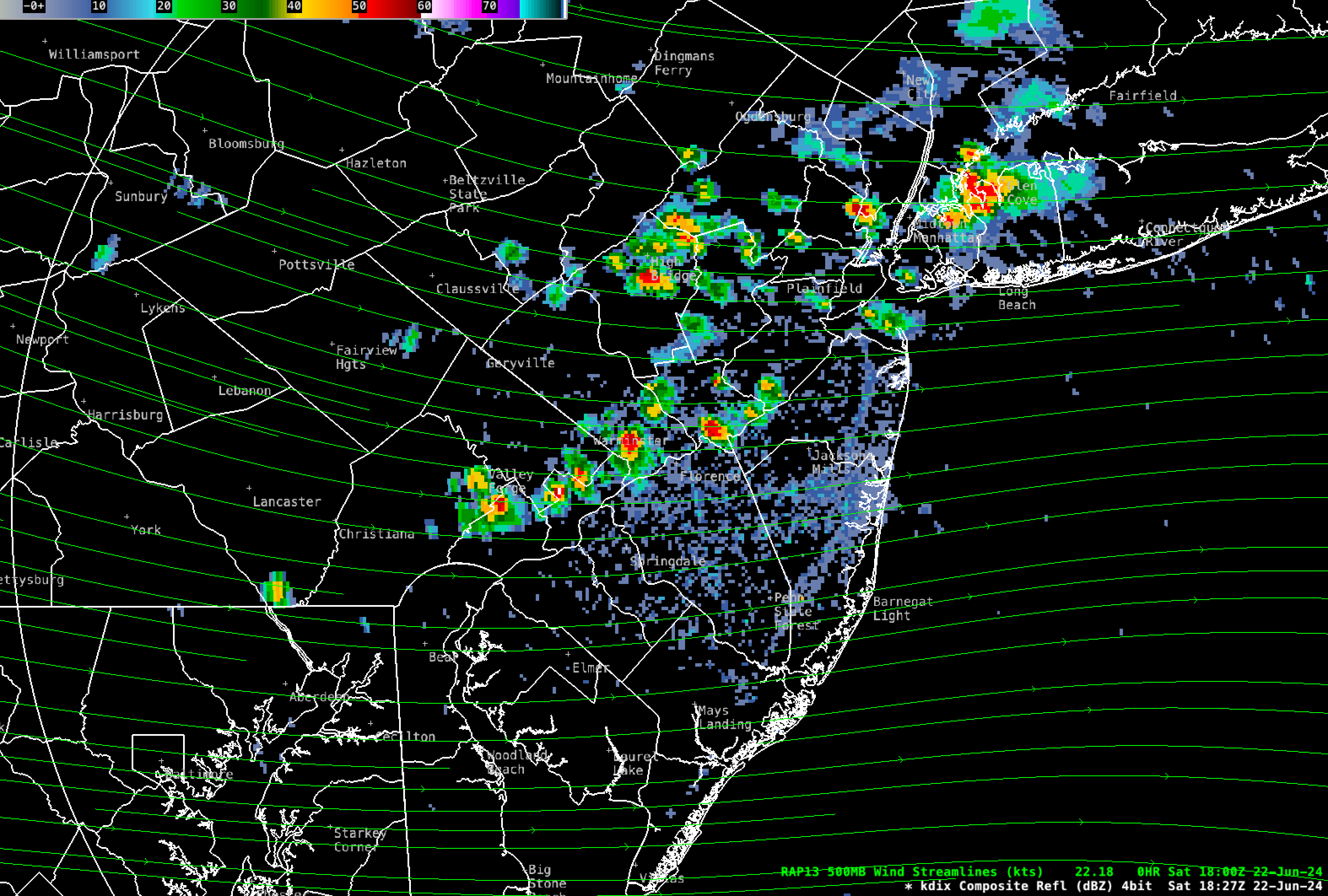
Most models show any storms that move through Philadelphia may become more severe in NJ. By 6- 7 PM, the highest probability of storms has entered into NJ and are expected to intensify—
While all thunderstorms may be locally severe, the overall severity parameters on Sunday are unimpressive, except closer to NYC.
Saturday Forecast Update
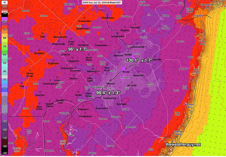
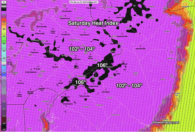
Posted Saturday 06/22/24 @ 10:16 AM — The model forecast guidance continues with a forecast of high temperatures in the 99º range in some areas today. Dew points are forecast to be near 70º, making the “apparent temperature” (heat index) over 100º around 3 PM—
As for showers/thunderstorms, while possible, the hourly probability in the immediate Philadelphia -Delaware Valley area is less than 13%. That’s not zero, so a widely scattered thunderstorm is possible later this afternoon, but when it comes to hourly probabilities, I usually look for 18% and higher. Those POPs great than 18% are far north of our area today.
The Canadian HRDPS has some storms as early as 2 PM around Doylestown and areas far west of the city. The experimental RRFS also has a few storms, mostly north. The HRRR has little in the way of storms around here, but a few in central and northern NJ.
Previously Posted Fri 5:33 PM —I’m pretty sure everyone reading this blog knows it’s going to be hot weekend. What value add can I provide to that forecast?
With high temperatures approaching 99º Saturday and possibly exceeding 100º on Sunday, there’s a slight chance of widely scattered thundershowers Saturday evening and a better chance of organized thunderstorms later Sunday evening or night with the approach of a cold front. Most areas will not see any showers Saturday.
A big factor this weekend will be the concomitant increase in humidity with the high temperatures. Some areas will have dew points in the mid 60s while others will have dew points near 70º
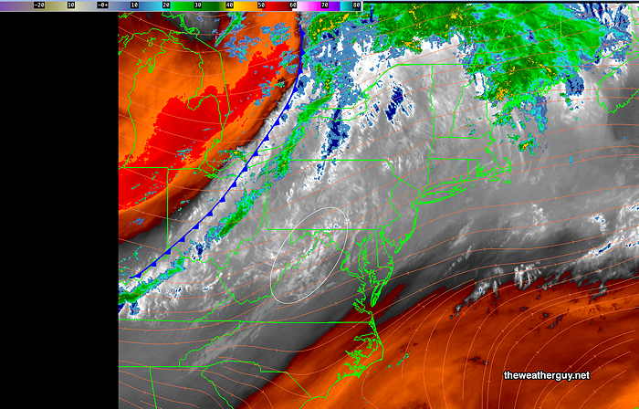
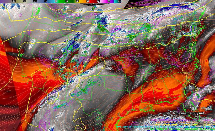
Current satellite water vapor image
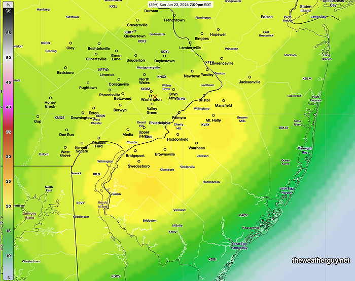
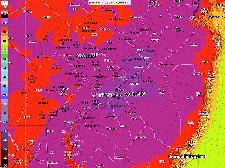
Low pressure is expected to form along the boundary to our north and its circulation will move a weak front through Sunday night. To mix it up a bit, here’s the latest ICON model forecast for 8 PM Sunday—
Saturday
Sunny and very hot and humid. Slight chance of widely scattered thermally driven thundershowers late afternoon or evening.
High temperatures (latest NBM model)
Sunday
Sunny in the morning, increasing clouds after 2 PM from west to east. Showers and thunderstorms early evening into night. Difficult at this time to access the the actual thunderstorm threat. I’ll update over the weekend.
NBM high temperatures—