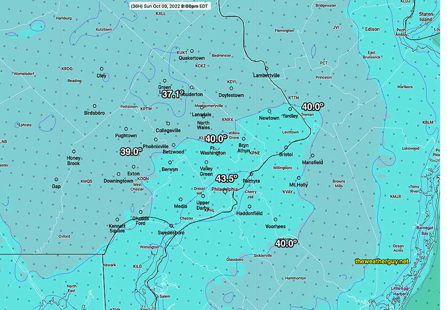
Update Sat 10/08 @ 5:43 PM — Latest NBM model shows low temperatures tonight to be the coldest so far this season—

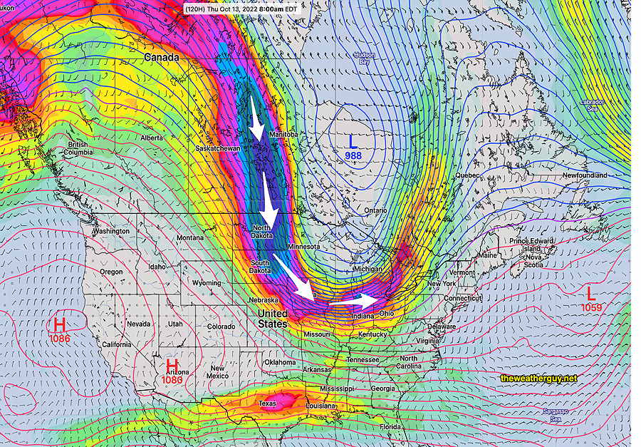
While we’ll see moderating temperatures through Wednesday, a sharp dip in the jet flow expected Thursday-Friday with a cold front moving through probably before daybreak Friday—

Previously Posted Fri 8:13 PM —
A cold front will pass through this evening (somewhat later than forecast yesterday) with a shift of winds to the north. Cooler air will filter into the area. Some light scattered sprinkles are showing on radar (as forecast by yesterday’s HRDPS) and this afternoon’s GFS is forecasting some additional sprinkles around midnight. Most areas dry.
The weekend will be sunny and cool. (Seasonal average high temperature is 67-68º this week.)
Saturday
There’s still a chance of brief period of clouds early afternoon Saturday, but otherwise quite nice.
High temperature 57.7º sd 1.9º NBM model Blue Bell, PA
Saturday night will feature fairly chilly temperatures, into the mid to upper 30s in some areas outside the city.
Sunday
Sunday will continue with fair skies and slightly warmer temperatures.
High temperature 61.7º sd 1.9º NBM model Blue Bell, PA
Outlook: Monday through Wednesday moderating temperatures. A strong cold front later in the week will bring much colder temperatures.
