
#Philadelphia #weather #PAwx
Strong Thunderstorms Possible Late Tonight
Posted Thursday 04/03/25 @ 4:32 PM — The warm front moved north of our area today, Thursday, allowing very mild and humid air to move into our region. The same air mass boundary will return tonight as a cold front.
The air over us is unstable and there is will be enough CAPE, vertical wind shear and helicity to aid in the formation of some strong, possibly severe thunderstorms in the 2 AM -6 AM time frame. Some heavy rain is possible. Here’s the latest HRRR forecast—
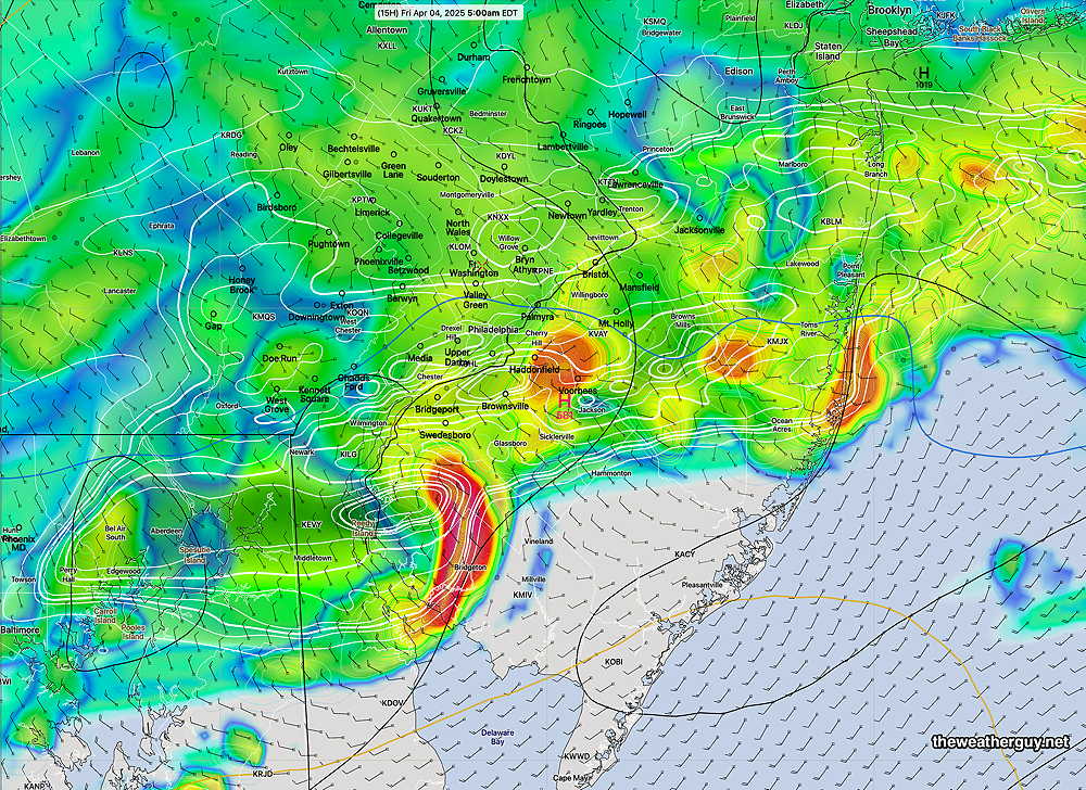
Rain will continue through Friday morning, ending northwest to southeast during the early afternoon.
The same boundary will move north again as warm front on Saturday, with showers, thunderstorms possible late morning into Saturday afternoon.
Interesting Forecast
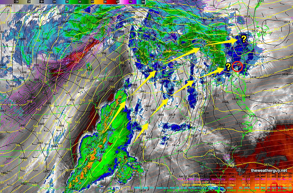
Posted Wednesday 04/02/25 @ 5:14 PM — The upcoming forecast period into the weekend will be interesting. The AI models are forecasting considerable rain in our area, while the regular numerical models are forecasting the axis of rain to be to our north. The current water vapor image illustrates this difference—
The latest HRRR has moved towards some rain over our area Thursday associated with a warm front moving through later tonight. Most of the rain will be ending around 12 noon – 1 PM from the city and westward.
There may be breaks of sun mid afternoon, but overall it will mostly cloudy. A weak cold front moves through Thursday evening with more showers into Friday morning. Then there’s uncertainty. The AI model shows plenty of showers for Friday Saturday and Sunday. Will need to see if/how the models are coming together!
For part of this month of April, this blog’s weather updates will be less frequent than usual.
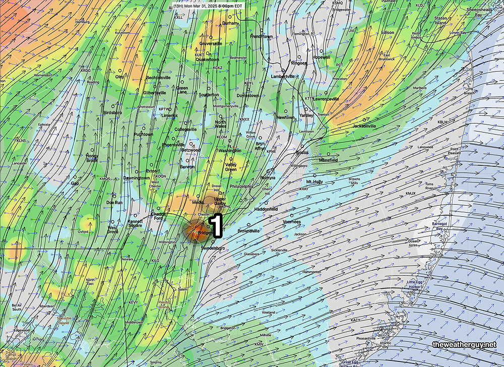
Monday Evening Storm Update
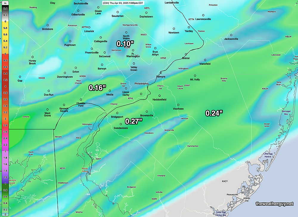
Posted Monday 03/31/25 @ 4:42 PM — No significant change from previous forecast update. Here’s the near-current water vapor/radar—
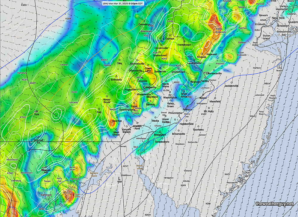
Here’s the latest HRRR forecast at 8 PM—
Monday Evening Possible Severe Weather
Posted Monday 03/31/25 @ 9:05 AM — A strong cold front approaches today and is expected to move through the Philadelphia area about 10 PM. Ahead of the front, unstable conditions will allow for the possibility of severe thunderstorms ahead of the front. The most likely timing is between 6 PM and 9 PM with a peak at 7-8 PM according to the latest HRRR.
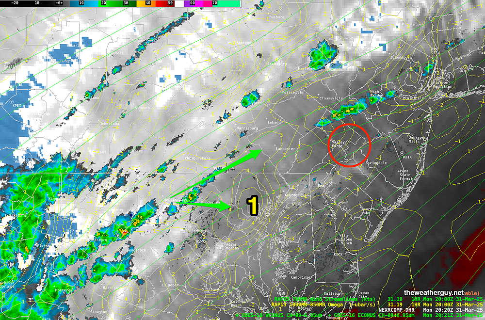
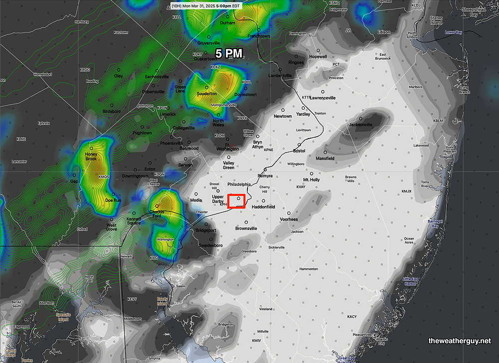
As for the Phillies opening game at 3 PM, most models keep any storms to the western suburbs, but the latest HRRR does show some possible activity closer to the city at 5 PM—
As mentioned, there’s the potential for severe weather, especially this evening. The HRRR shows areas of highly elevated severe weather parameters (vertical shear, helicity and upward helicity) approaching the city about 7 PM—
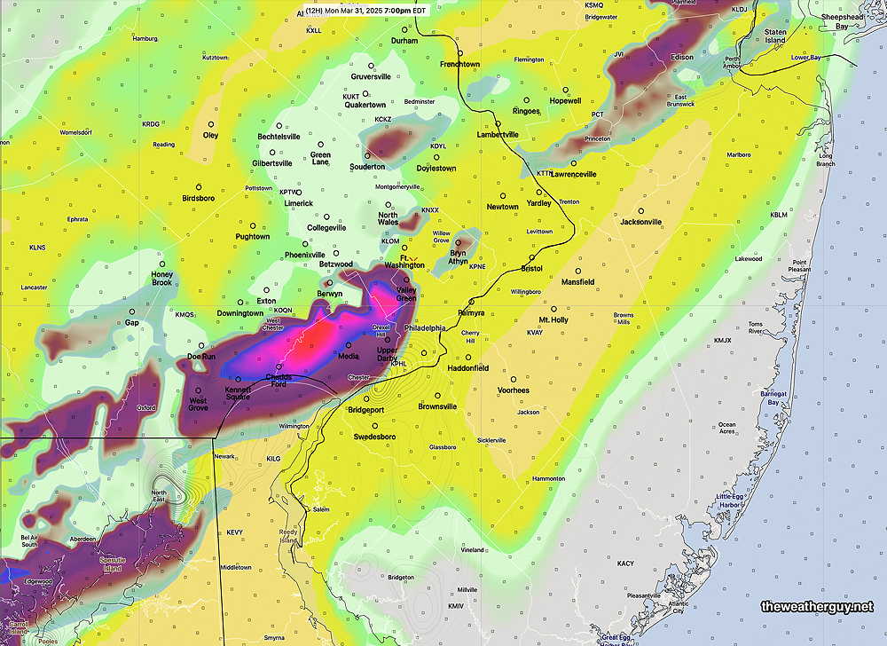
It should be noted that a high shear and helicity forecast at 8 PM shows possible low tornadic potential—
As always, the model placement for the potential severe weather is rarely exactly where it will occur. (It’s only a model.) But the potential and general timing is what’s important.
Stay tuned. I’ll update later this afternoon.