
#Philadelphia #weather #PAwx
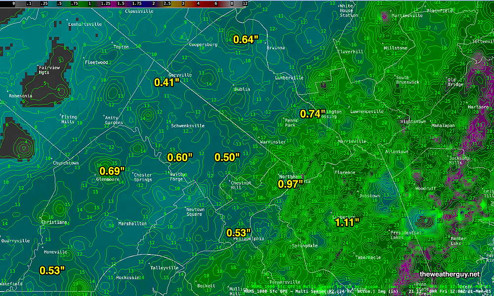
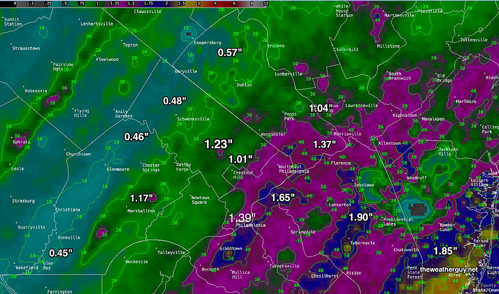
Here’s the MRMS QPE (quantity of precipitation estimate)
Thursday Forecast Update
Posted Thursday 03/20/25 @ 11:04 AM — It looks like the breaks of sun will be in the morning. Increasingly cloudy in the afternoon.
Posted Thursday 03/20/25 @ 8:42 AM —Today’s forecast mostly on-track. Low clouds this morning will give way to mid level cloudiness this afternoon. Some areas may see some sun for a period this afternoon, but most will remain cloudy. Showers and rain moves in from the west between 5:30 PM and 8 PM. Total rainfall this evening between 0.45″ and 0.70″ (western suburbs may receive the higher amount). Windy conditions later this afternoon and then again later tonight. The actual frontal passage may not have much in the way of winds.
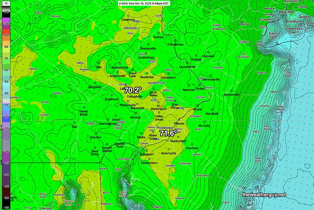
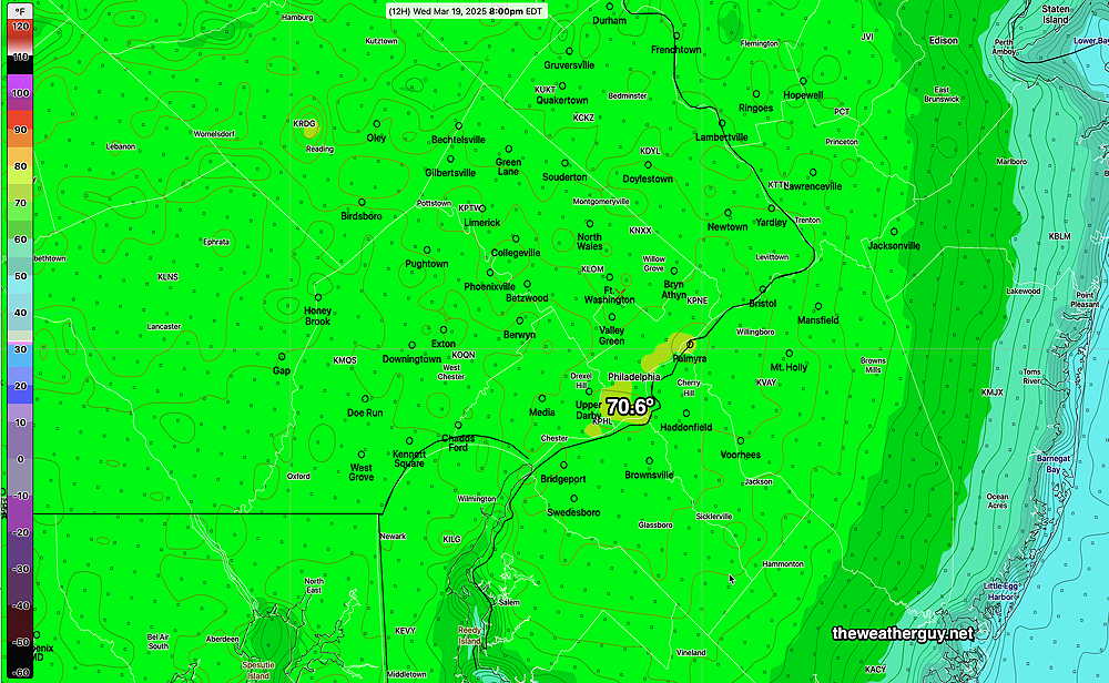
Posted Wednesday 03/19/25 @ 5:57 PM — The AI ‘experiment’ showed no winners, with the spatial and temporal resolution differences between the models over-shadowing any small differences in forecast high temperatures. That said, except for Center City, the NBM high temps were overall too low. Here’s the RTMA temps at 3:45 PM. the likely high temps for the day—
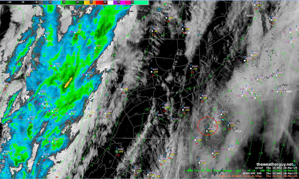
As for Thursday, a cold front (technically an ‘anafront’ type cold front, due to the rain following the frontal passage) will move across about 6 PM with showers and possible thunderstorms.
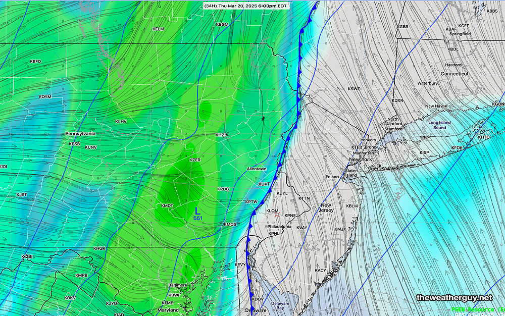
Low clouds in the morning with mid-level cloudiness in the afternoon. Some breaks in the overcast possible just before the front moves across about 6 PM. Low pressure expected to form along the anafront, bringing more windy conditions. About 0.4-0.6″ of rain expected during the evening Thursday.
Yet Another AI Model ‘Experiment’
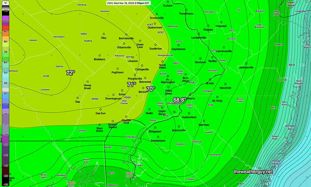
Posted Wednesday 03/19/25 @ 9:34 AM — There are differences today between the high resolution NBM model (our best model for temperatures) and the lower resolution ECMWF-AI-Single model regarding high temperatures for today.
The AI model has an easterly wind keeping temperatures from the city eastward below 70º, while large areas just west of the city are above 70º
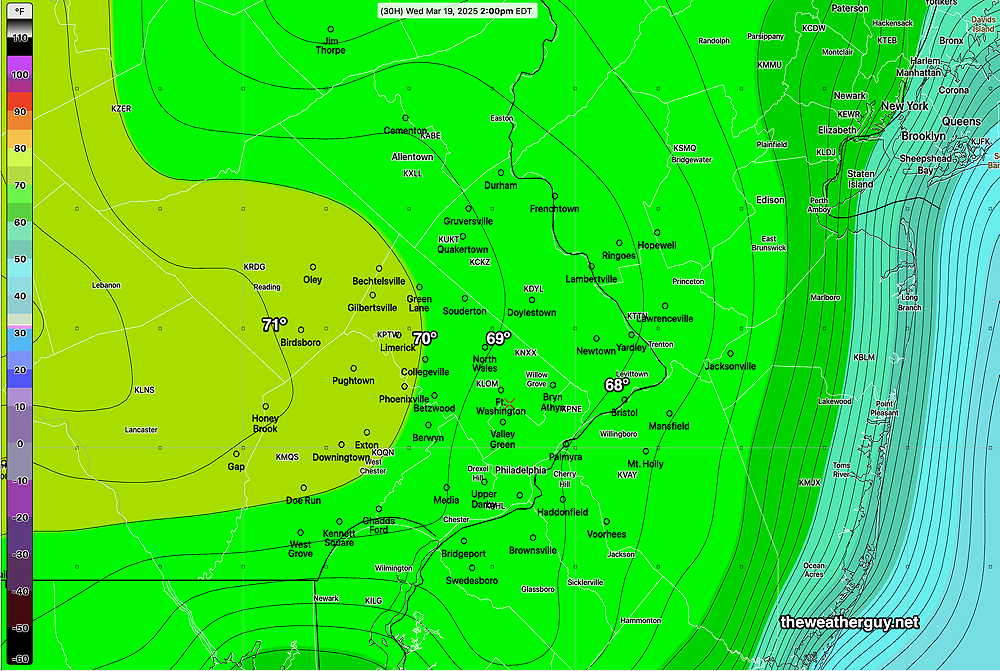
Here’s the latest 12z NBM model high temperature forecast for today—
An interesting and significant difference in the forecast. Either way, a very nice day, with some high thing cirrus clouds moving in about 3 PM.
Thursday will likely have rain moving in between 3PM and 6 PM ahead of a cold front. Some ‘interesting’ weather possible.
Wednesday through Thursday Outlook
Posted Tuesday 03/18/25 @ 5:34 PM — Wednesday promises to be a spectacular day, with mild temperatures just short of 70º. Sunshine in the afternoon will be through some thin cirrus clouds as moisture and milder air move in aloft ahead of a cold front expected late Thursday.
A strong cold front approaches on Thursday with some rain/showers moving in by mid to late afternoon—
About 0.5″ of rain is expected with this system.
Originally Posted Mon 8:04 AM —Some rain is still falling at the Jersey Shore and there’s a chance of a light shower this morning, especially east into NJ.
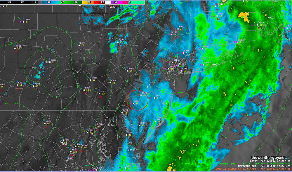
Clouds should break for some sun around noon or early afternoon.
The rain occurred later than forecast, the strong wind gusts preceded the rain. Many areas did eventually receive the 1+ inch forecast —
Our next chance for rain is late Thursday into Thursday night with a system somewhat similar to Sunday’s cold front passage.