
#Philadelphia #weather #PAwx
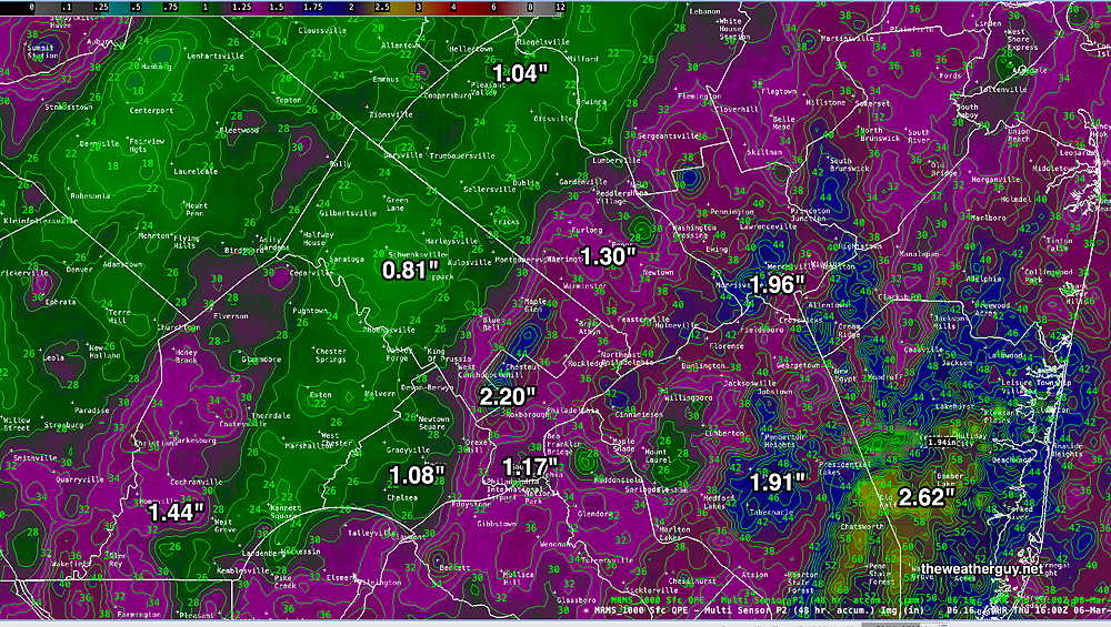
Posted Thursday 03/06/25 @ 5:42 PM — The MRMS total rainfall graphic I posted in yesterday’s “Forecast Review” was posted before the storm had fully exited our area. Here’s the final rainfall totals for the region, which are impressive—
There isn’t much happening weather-wise over the next several days and into next week. We’ll be in a colder upper trough for some of the weekend. The next storm to affect our region may be next Thursday or Friday.
The total rainfall was considerably greater than forecast by the models. The GFS was notably off.
It’s been a long time since we had such a heavy rain event.
Wednesday Forecast Update
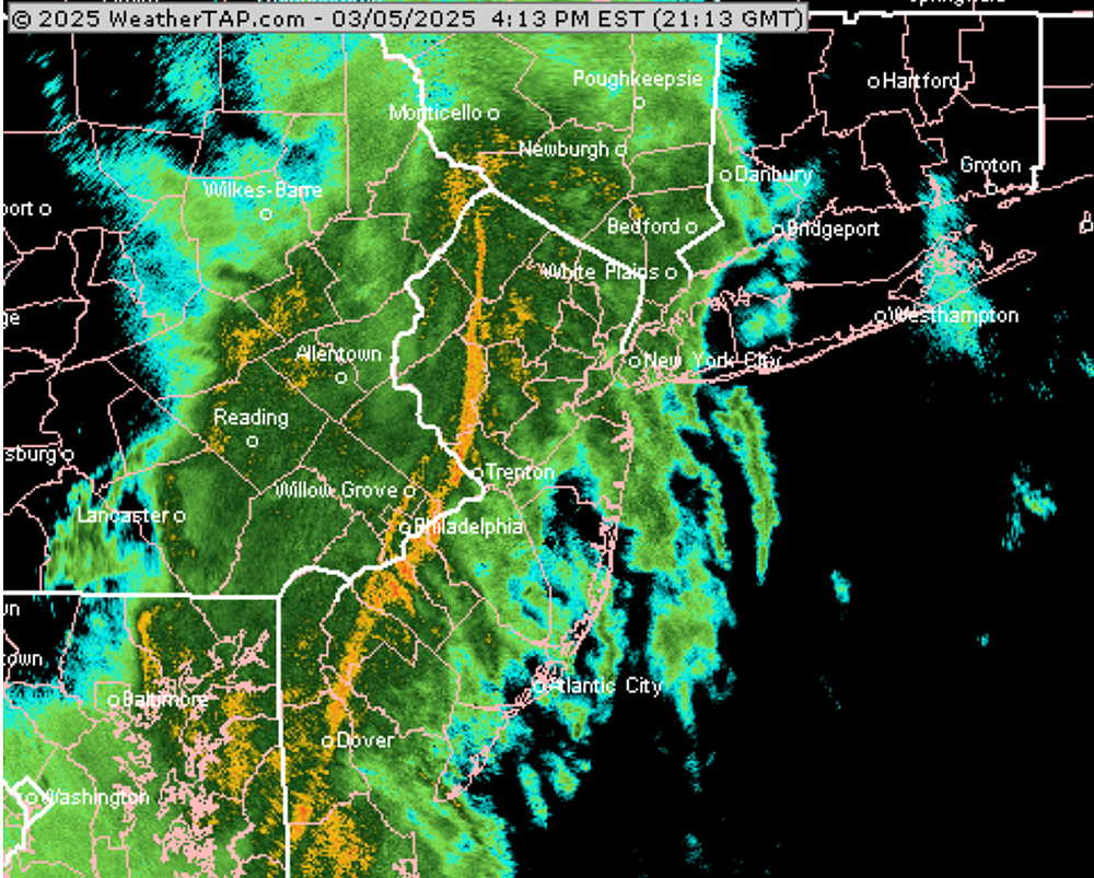
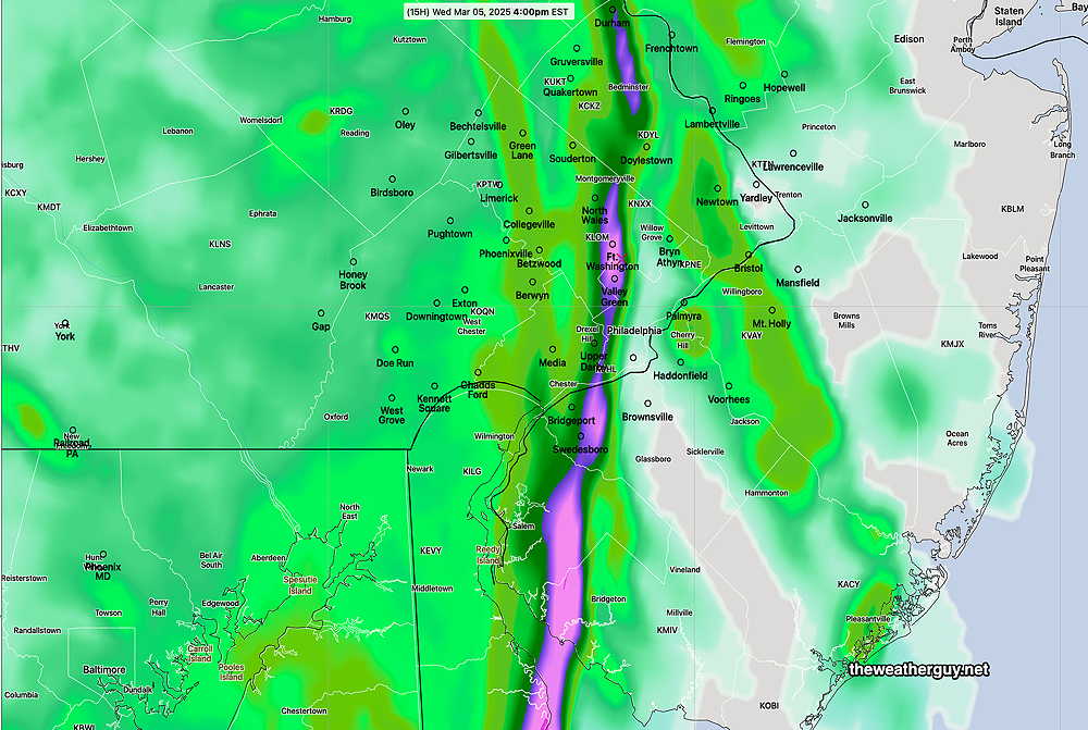
Posted Wednesday 03/05/25 @ 4:16 PM — The HRRR, despite being a little slow with the first batch of rain, did well with the main line. Here’s what the radar looked like at 4:13 PM—
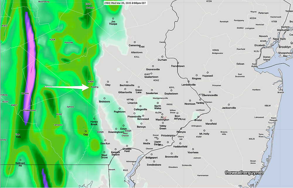
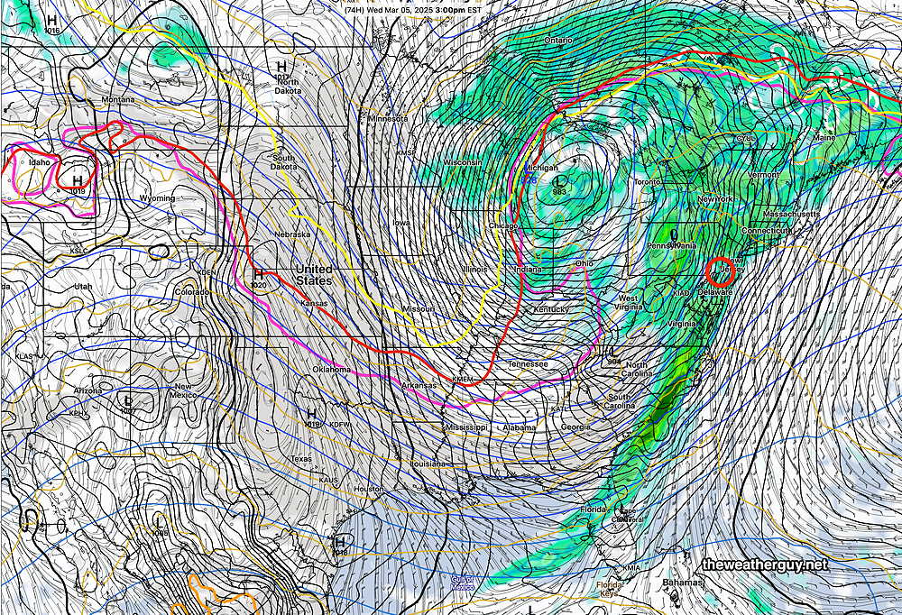
Posted Wednesday 03/05/25 @ 11:30 AM — Current radar shows the leading edge of rain much closer than the HRRR model has forecast. Even the 15z (10 AM EST) HRRR doesn’t show this.
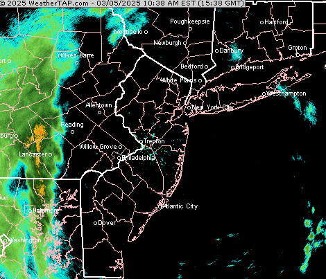
I would expect the leading edge of the rain to be into Philadelphia within the next two hours. There is a line of heavier rain entering central PA. That might be the line of storms the HRRR is predicting for 5 PM.
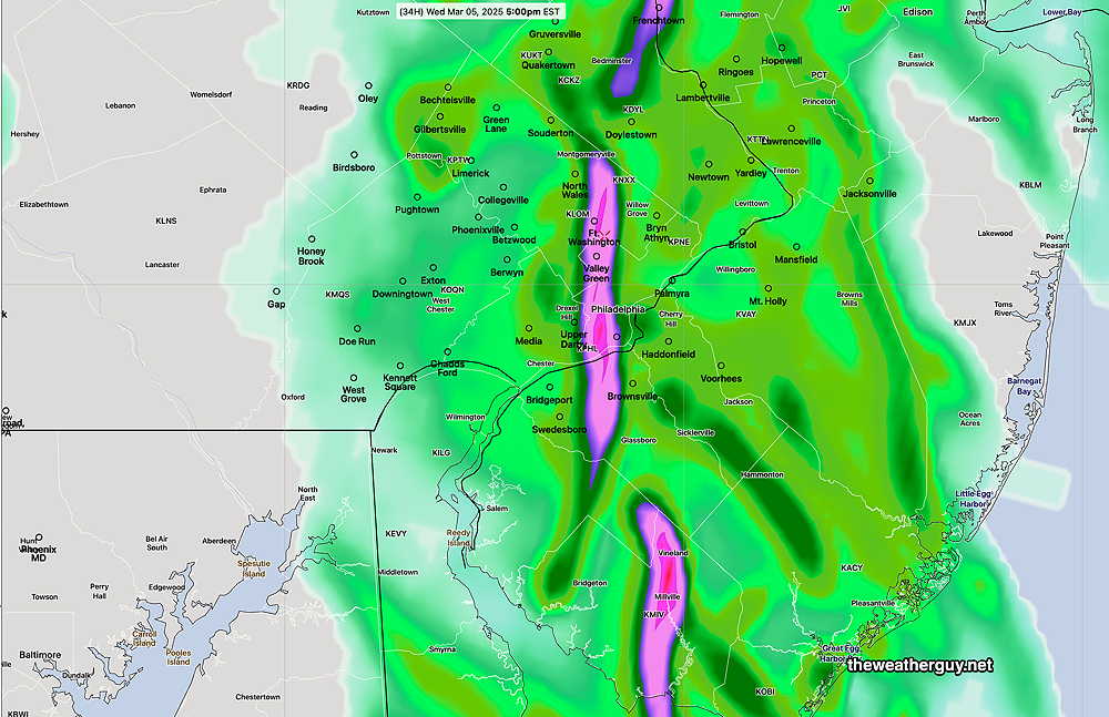
Posted Wednesday 03/05/25 @ 8:25 AM — The models are consistently showing a strong line of storms with heavy rain and gusty winds to 50 mph coming through the city about 4 PM-
Addition showers possible during the evening hours. The actual cold front doesn’t come through until 2 AM Thursday morning.
Wednesday Forecast Update
Posted Tuesday 03/04/25 @ 8:49 PM — Tonight’s HRRR continues with a forecast of a line of storms moving through Philadelphia between 3 and 4 PM.
At 2 PM, the line is to our west, but with some break-out showers ahead of the main line—
Tuesday -Wednesday Forecast Update
Posted Tuesday 03/04/25 @ 9:14 AM — The models are forecasting these early morning clouds to dissipate by late morning. High temperatures 58º Blue Bell to 60º in the city.
The rain on Wednesday is now forecast to begin somewhat later in the morning as light showers. The heaviest rain now appears to move in about 3-6 PM with potential thunder and wind gusts approaching 50 mph.
Here’s the latest HRRR Precipitation Rate forecast—
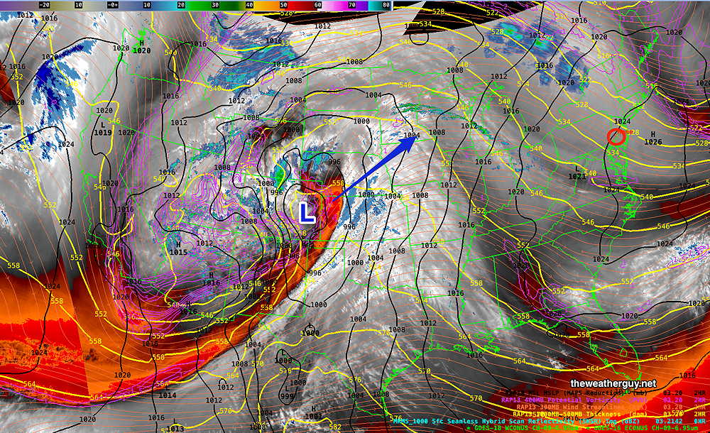
Posted Monday 03/03/25 @ 4:57 PM —A low pressure system is developing in the Rockies and will move northeast bringing rain on Wednesday. Here’s the current water vapor image—
The latest models show a consistent forecast of rain moving in around 6-8 AM Wednesday. Before that time, warmer air ahead of the system will be with us on Tuesday with sunshine through high clouds. Highs on Tuesday 53º -56º (high uncertainty: ± 3º)
The rain on Wednesday is much-needed and the AI models are forecasting about 0.80 inches of rain, more far northwest and less into NJ. The deterministic ECMWF is similar, with localized 1″ amounts. The GFS model is only forecasting about 0.50 inches of rain, less into NJ. There may be pockets of heavier rain due to localized thunderstorms. Some high wind gusts possible beginning mid-afternoon Wednesday.
A cold front moves through about 1 AM Thursday morning. There may be lingering shower activity Thursday morning in eastern sections of NJ.
Originally Posted Sun 7:43 PM —Another cold day on Monday, followed by a warmup on Tuesday with temperatures rebounding into the low to mid 50s.
A storm is expected to move across the country and affect our weather on Wednesday with rain developing before daybreak.
We need some rain and unfortunately, the trend of the past few storms looks to continue, with the heaviest rain occurring to our far northwest.

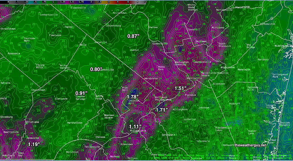
Another trend has been for the predicted rainfall in our area to diminish with each subsequent model run. Yesterday, the total rainfall was predicted to be in the 0.8-1″ range around Philadelphia. The latest GFS posted above (in agreement with the ECMWF) has about half that amount forecast. (The latest ECMWF AI model still has about 0.8″ of rainfall here.)
I wish I could identify why this trend is occurring. It’s been going on since late last Spring.
Cooler weather returns for Thursday