#Philadelphia #weather #PAwx
Weekend Preview
Posted Friday 12/27/24 @ 9:53 AM — No large changes in the forecast for this weekend. Two low pressure systems will affect us—
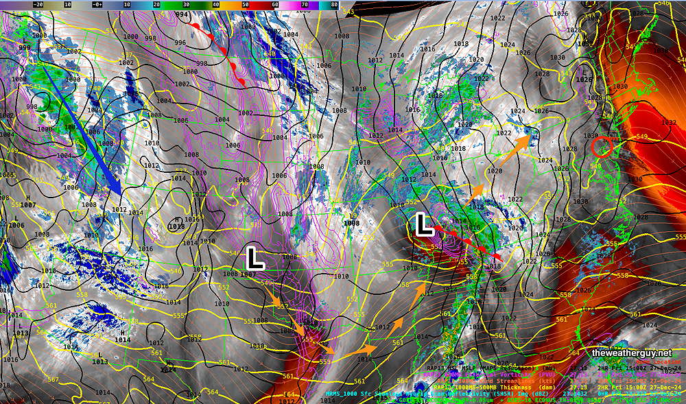
Rain begins Friday night, likely after midnight, (some scattered activity earlier) and through the day Saturday. Tapers off Saturday night.
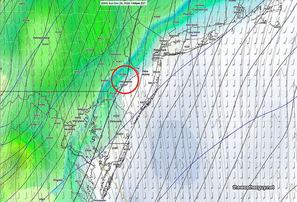
Rain early Sunday morning has a break in action Sunday afternoon, in time for the Eagles game. Heavy rain Sunday night.
Here’s the latest ICON model forecast for Sunday afternoon. The rain stays to our west—
Check back for more details for my regular Weekend Weather Forecast, probably posted during this evening.
Weekend Weather Outlook
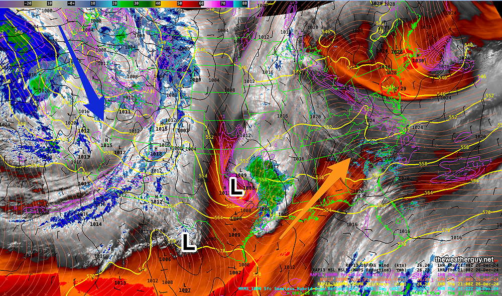
Posted Thursday 12/26/24 @ 4:42 PM — A southwesterly flow of increasingly warm and moist air along with an approaching low pressure system will bring periods of cloudiness to our area Friday afternoon along with an increasing chance of scattered showers by Friday evening and heavier rain by midnight.
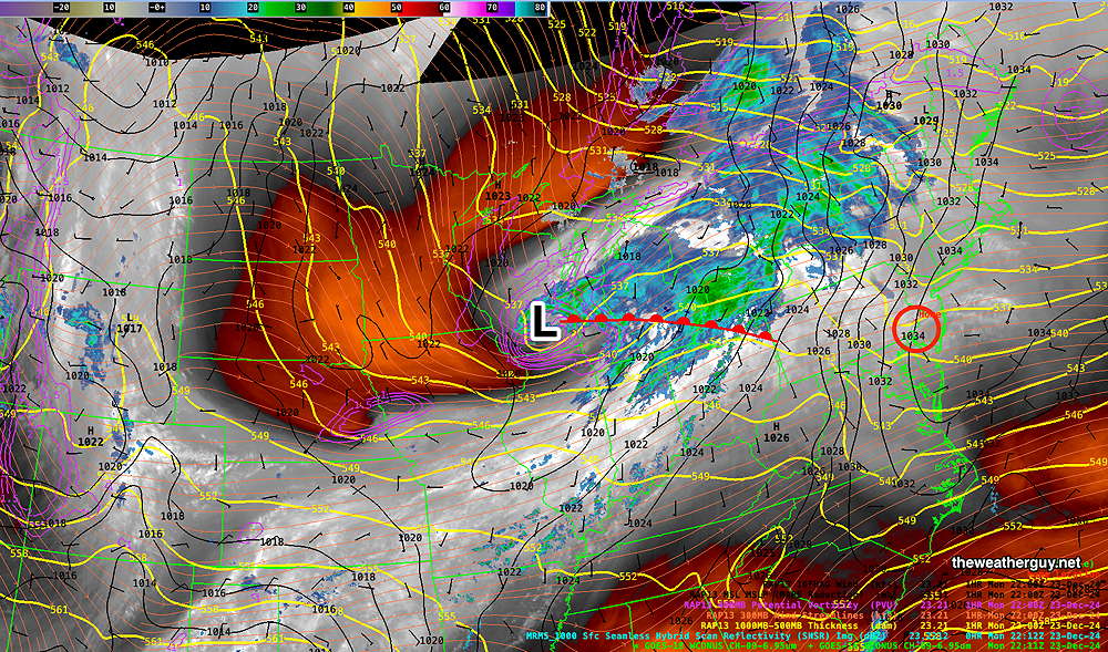
Here’s the current water vapor image showing the low pressure systems and the conveyor belt of warm moist air—
Mild temperatures on Saturday will be accompanied by periods of rain. Areas of fog and lighter, scattered showers Saturday night.
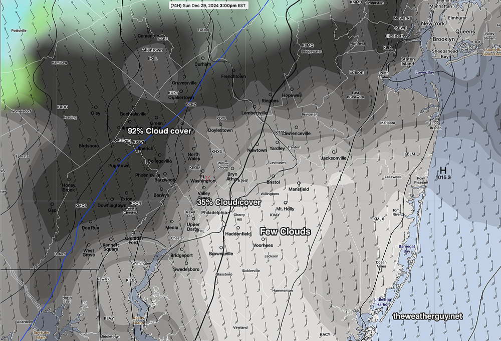
For Sunday, the ECMWF still shows a dry period during the Eagles game before some heavy rain moves in for the evening and night time. Supporting the hiatus in the rain is the AI model version of the ECMWF and the NAM. The latest Canadian RGEM also shows this break in the rain before heavy rain returns for Sunday night. We may even see some sun mid afternoon.
RGEM Cloud Cover Forecast Sunday afternoon—
However, the latest GFS suggests a faster approaching system with rain moving in about 1 PM during the Eagles game Sunday afternoon. The rain continues through Sunday night. Too soon to tell, but the GFS tends to bring systems up to fast from the southwest.
The models are cranking out 1.6 to 2.2″ of total rainfall by Monday morning with greater amounts far northwest in Lehigh and Berks counties.
Weather Outlook
Update Wed 12/25 8:41 PM — A quick update. Thursday looks to be sunny but still cold. A bit milder on Friday, with sunshine through high cirrus clouds. The weekend is still looking cloudy and wet, but with very mild temperatures, in the upper 50s. Some moderate rain is possible late Sunday.
Unfortunately, New Year’s Eve and New Year’s Day are looking wet. Another plunge in temperatures Thursday.
Posted Wednesday 12/25/24 @ 9:23 AM — Moderating temperatures through the weekend. A moisture ‘conveyor belt’ is setting up for the weekend with possible rain Saturday and Sunday. Timing remains uncertain and there may be a rain-free window for the Eagles game early Sunday afternoon. Another wet period is possible around New Years Eve or New Years Day.
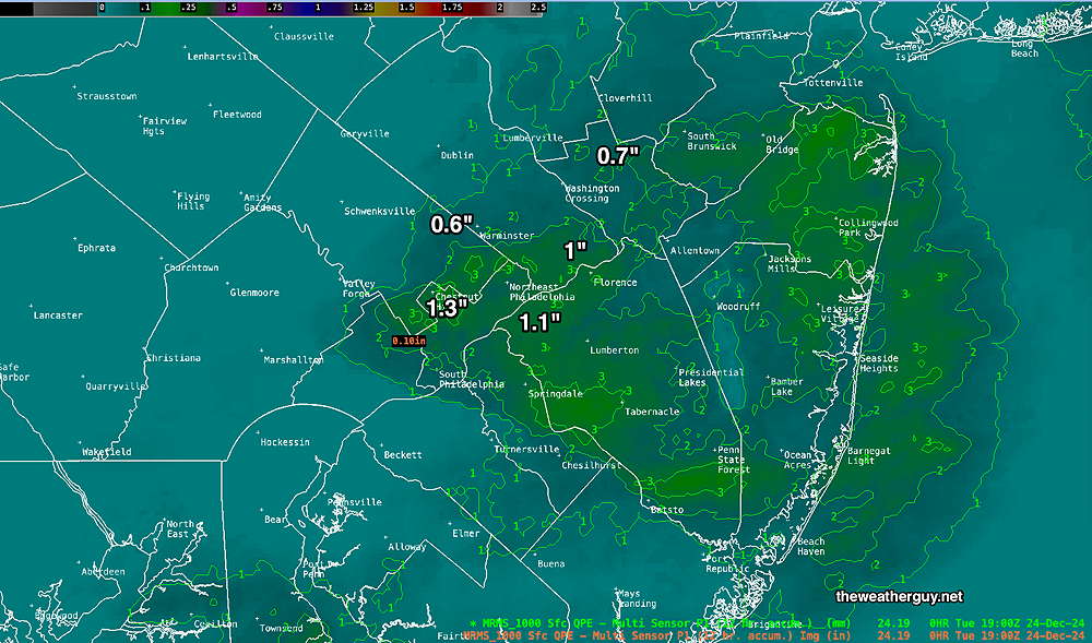
Here’s the MRMS precipitation summary which records rain and snow-water equivalent —
Tuesday Morning – Light Snow Update
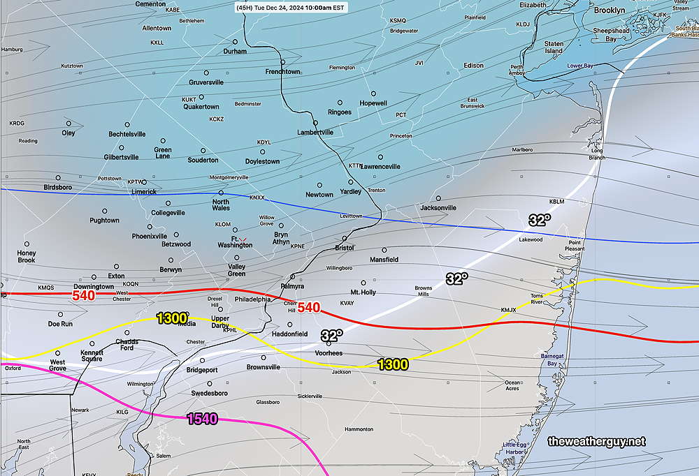
Posted Monday 12/23/24 @ 5:48 PM — Not much change with the latest models. Cold temperatures at the surface through 11 AM and “critical thickness” temperatures for snow are still forecast, although a change to sleet or freezing rain toward the end can’t be ruled out.
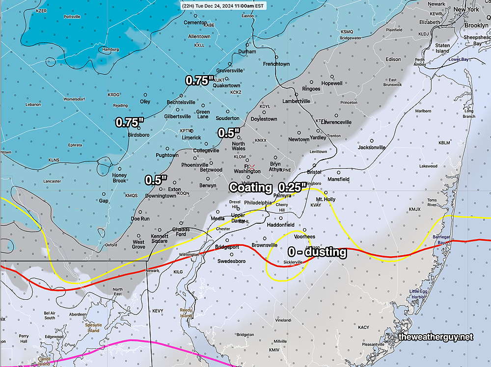
Light snow start about 7 AM and tapers off by noon, as temperatures rise above freezing. The latest HRRR forecast for snow totals—
Light Snow Tuesday Morning
Posted Monday 12/23/24 @ 10:33 AM — This morning’s models continue with a forecast of light snow as a weak disturbance drops down from the northwest. The trend with some models has been for a more northern placement of the the light snow, while the higher resolution models continue to forecast a coating to 0.75 inches, with the upper range in the northern suburbs.
Light snow is expected around 7 AM and last through about 11 AM, as temperatures rise above freezing.
Here’s the latest HRRR—

Originally Posted Sun @ 6:39 PM — —The current cold pattern will continue on Monday, but temperatures will slowly moderate through Christmas/Chanukah. as the current dip (trough) in the jet stream changes into a ridge—
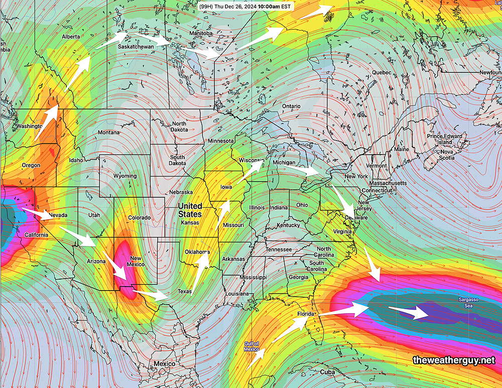
No major active systems are expected, but several models are showing some light snow or flurries Tuesday morning, mostly in northern sections—
It looks like it will be cold enough for snow and at most only 0.5″ is currently forecast in these northern sections. (It should be noted that the latest ECMWF has some light snow further south but the AI version of the ECMWF shows no snow at all on Tuesday.)
The rest of the week is uneventful, with a gradual warmup. A system may bring rain the end of next weekend, possibly lasting through New Years Day.
When it comes to weather, things can change, so stay tuned.

