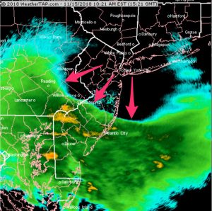
I’ve been looking at the latest GFS and NAM models from this morning. Sunday night into Tuesday promises some interesting (at least for this season) winter weather.
Two systems will affect us, one Sunday evening and the other starts Monday evening. The first approaches Sunday with light snow developing sometime during the evening and ends early morning Monday.
There are differences in the models with the QPF. The NAM is showing 0.23 inches water, the GFS less. With the prior two winter weather events, the NAM out-performed the GFS. So it appears that 2, possibly 3 inches of snow will have accumulated when it ends Monday morning.
Monday will be mostly cloudy as another more intense storm moves to our west. Cold air in place at the surface with warm, moist air over-running the the cold air will result in snow initially.
The GFS has the snow starting early on Monday evening. Critical temperatures in the upper atmosphere warm by 3-5 AM Tuesday morning, with the snow changing to sleet and freezing rain at that time. It’s possible that 3-4 inches of snow will have accumulated before the changeover.
Surface temperatures may remain at or below freezing until 7 AM Tuesday, so things will be icy and messy Tuesday morning.
North and west of the city, the freezing rain and sleet may be prolonged into late morning.
By noon on Tuesday everything should have transitioned to all rain. This looks messy and the temperature profiles and QPF predictions will likely change in the next few days. Stay tuned.

