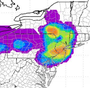
The NAM lifting index and vertical velocity now support showers and thunderstorms for Saturday afternoon, but the line of showers moving through may be broken up and scattered.
The highest probability of thunderstorms is north and west of PHL into central NJ.
The HRRR shows showers/thunderstorms moving into far northern/western suburbs by 2 PM and moving through Philadelphia between 3-4 PM.
The line sinks south and east with additional scattered showers possible through 8 PM. Note that the GFS-based LAMP forecasts show a lower chance of showers/thunderstorms somewhat later, between 4-7 PM.
The probability of thunderstorms is not very high (as compared to this past week’s storms), but high enough to plan for the possibility.
7PM Update: Not a single shower in the Philadelphia area! It wasn’t expected to be a high probability event and it wasn’t.
