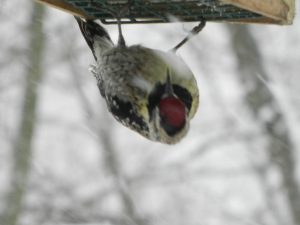
With the snow today, we had a new visitor to our suet feeders- a female Yellow-bellied Sapsucker! A first sighting for us!
Here’s a video of it on our suet feeder:
This morning’s NAM and GFS data is available. The GFS has a QPF of 0.21 inches water and the NAM 0.32. Taking the average, we’ll say that 0.25 QPF is approximately correct. That comes to 3, maybe 4 inches of snow in PHL and immediate areas. Areas in southeastern NJ will have considerably more and areas to the north and west significantly less.
The NAM and GFS model’s 1 AM runs have come together with a QPF of about 0.15 inches water for Philadelphia, or about 2, maybe 3 inches of snow (due to a higher snow:water ratio).
For Philadelphia, the snow starts about daybreak or so and the models have light snow continuing through about 4PM. For 8 hours of snowfall, 2-3 inches total snowfall is very light.
It still looks like a much more significant snowfall for southeastern NJ.
While the current radar trends are consistent with last night’s models, this is still a lower than usual confidence forecast. Any late change in intensification could throw the snow totals off in either direction.