WEEKEND WEATHER UPDATE- SUN AM

I’m always on the lookout for the best forecast model. (Anyone into weather is probably on this ongoing search.) The issue is that some models do better in different weather patterns.

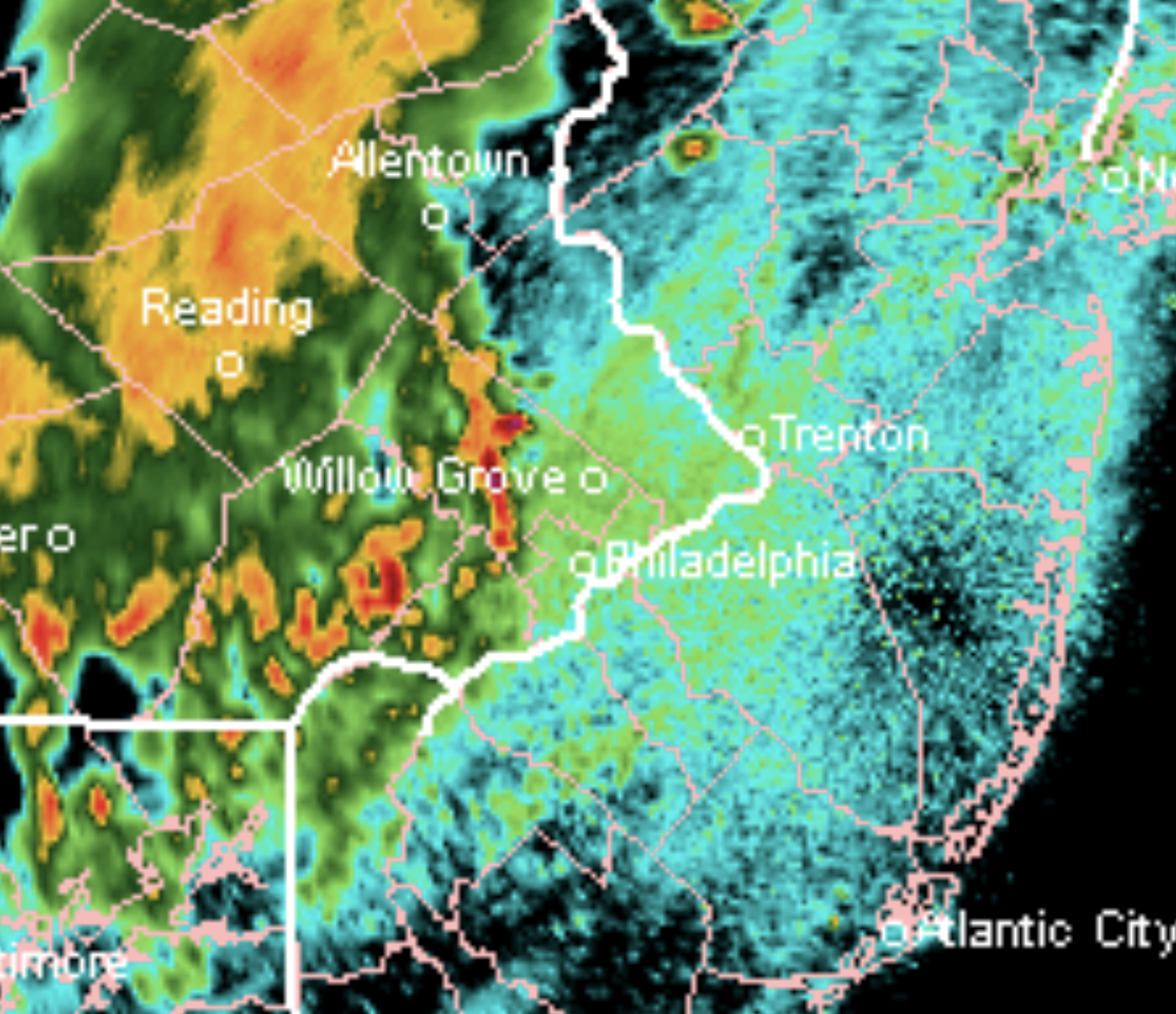
The only model that got close to predicting the thundershowers last night that affected the northwest suburbs and some of the Philadelphia area was a model that I haven’t until recently focused upon- the WRF with its two variants- the WRF-NMMB and the WRF-AFW.

The WRF (Weather Research Forecast) model is a short range (48 hour) model that has a high resolution. It’s only run twice a day for the US.

It did well last night and also with the storms last week. So let’s see how it does today.

The WRF is forecasting showers and thunderstorms to develop as early as 2:30 PM (earlier far northwest suburbs).  Most likely time for Philadelphia is 3-5 PM.  High temperature forecast for today is 84-85 before the showers move in.

WEATHER UPDATE

Tonight’s models are doing extremely poorly predicting the thunderstorms that are on our doorstep at 11 PM.

NEXRAD radar image 11pm Saturday (weathertap.com)

This doesn’t bode well for Sunday’s forecast; if the models can’t get the 3 hour forecast correct, what confidence can one have for the 20 hour forecast?

There’s a wide range of times for the thunderstorms expected on Sunday.  They may start as early as 2:30 in the afternoon, or they may move through as late as 7 PM.  A low confidence forecast with tonight’s models.


WEEKEND WEATHER FORECAST

The forecast for the weekend has already changed a bit from my “forecast outlook” of yesterday.

Low pressure that moved to our south today (Friday) had brought some unexpected cloudiness at times during Friday afternoon.

This low pressure system is expected to consolidate off the coast and will result in a general easterly flow on Saturday, keeping temperatures a bit cooler than previously forecast as a result of cloud cover, especially in NJ.

While tonight’s major models are not yet available, the short range models just available show a fair amount of cloudiness during the morning and early afternoon on Saturday. The GFS was showing a high 87-89, but the NAM and latest short range models show much lower highs of 81-84.

[su_note note_color=”#d9f2da”]11 PM Tonight’s NAM has much more sunshine on Saturday than the earlier short range models.[/su_note]

A weak wave ahead of an approaching cold front moves through around midnight Saturday with some showers and possible thunderstorms, although the latest trends show the showers falling apart before arriving in Philadelphia.

For Sunday, a cold front will approach during the day, ahead of a significant amplification in the jet stream.  Mostly sunny early with cloudiness moving in during the early to mid afternoon.  Current models show showers and thunderstorms about 3-6 PM Sunday.   High 80-84.

Weather… and Other Things 'Up in the Air'