Despite the corona virus, they haven’t closed or cancelled the weather…at least not yet.
This coming week’s main weather event will be a wet low pressure system that moves through Thursday into Friday. A warm front associated with this low pressure system will pass north of us early Friday and will bring very warm temperatures for Friday.
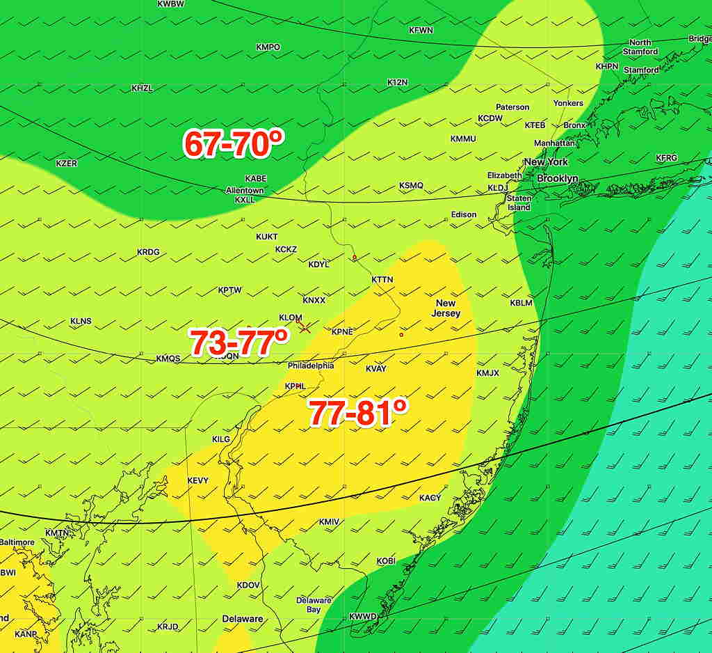
Here are the current high temperatures predicted for Friday, based on the the GFS Ensemble Model—
GFS Ensemble (“Bias Corrected”) Max Temp forecast for Friday. Click for larger image
Tonight’s models have mostly thin, high cloudiness for most of Saturday afternoon with lower clouds moving in later in the afternoon.
Another change— showers expected to be south of us will move in Saturday night. Clearing mid morning Sunday. (However, one model has clouds lingering into the early afternoon .)