Forecast revisions added Fri 10 PM highlighted
Sunday Forecast updated Sat 11 PM highlighted
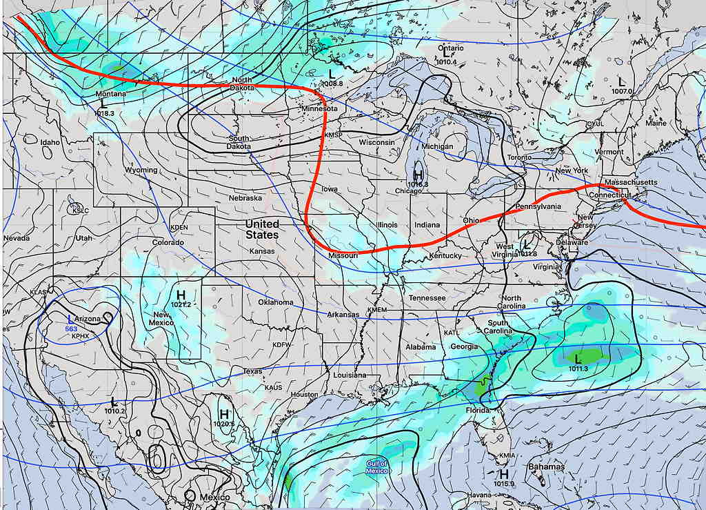
The forecast for the weekend has changed (and improved somewhat) from what I posted yesterday for the weekend outlook . An upper air cyclonic flow around the low pressure system near Cape Cod will bring instability cloudiness for Saturday.
Of some concern about this weekend’s forecast— none of today’s models captured this evening’s showers in central NJ. This suggests a lower confidence forecast for the weekend.
The models have backed off on the light widely scattered sprinkles considerably.
Basically, what we have for the weekend is similar to what we had on Friday, but without the light rain sprinkles. Possibly more sunshine on Sunday.
The low moves further east on Sunday, but a weak trough still associated with the same Cape Cod low brings the chance of some clouds Sunday afternoon.
Saturday
Mostly sunny skies in the morning will give way to instability cloudiness late morning and in the afternoon. Like Friday, there may be breaks of sun at times. High temp 57.6º ± 2.4º (NBM model, Blue Bell)
There’s a chance of a light sprinkle late afternoon or early evening.
Sunday
The Cape Cod low moves east, but a weak trough will bring some clouds in the afternoon.
A similar forecast to Saturday— sunshine in the morning giving way to clouds, but milder with little or no chance of sprinkles. High temp 62.5º ± 2.3º (NBM model, Blue Bell)
Sunday may not be as cloudy as as Saturday. Clouds move in about 12-2 PM.
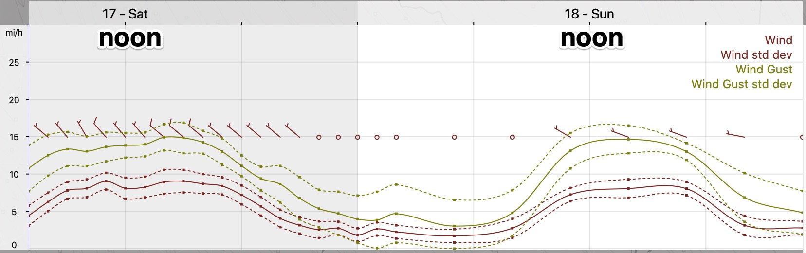
Wind forecast