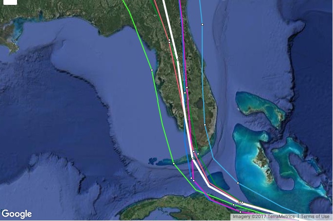
Last night’s models have moved the track a bit to the west, possibly making landfall near Naples FL and then moving up through west-of-center of the state. The storm is expected to hit Florida as a Category 4. The consensus track (white) on the graphic below is the current most likely track. The National Hurricane Center’s track is a bit east of this line.