
[su_box title=”Forecast update Sunday 11pm” box_color=”#defcdc” title_color=”#000000″]Too warm for snow tonight and the NAM has reduced the QPF in Phladelphia to zero. [/su_box]
First, will the Eagles win again with Foles? Yes.
That said, let’s turn to tonight’s forecast which may be a more difficult call. A front will pass through tonight between midnight and daybreak. Weak low pressure is predicted to move along the front. Each model run has increased the intensity of this wave of low pressure.
The models are consistent with low temperatures being above freezing (36 degrees in Blue Bell). The latest NAM has several critical temperatures of the atmosphere supporting snow, except for the lowest level. QPF values are now 0.07 inches water. Currently the models have a general consensus of light snow with a slight grassy coating in the areas in blue –
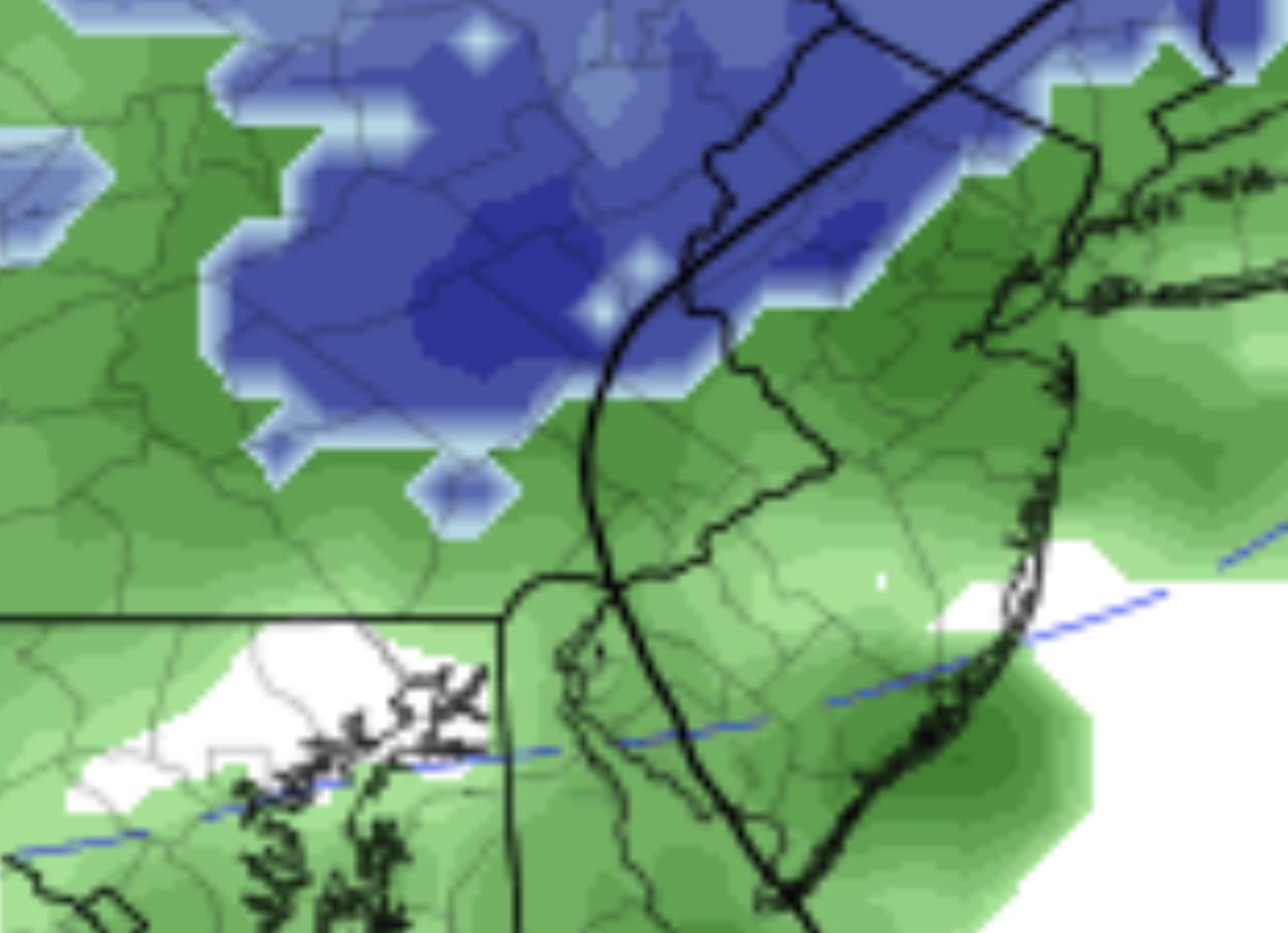
If there is further strengthening of the low, dynamic cooling may move this area of snow closer to the city. Right now, the areas shown are the best bet, but it wouldn’t surprise me if there’s some very light snow falling closer to the city. Since it will occur before daybreak, we’ll have to see if anything is left on grassy surfaces. This is the best we can do this year for a white Christmas.
[su_note note_color=”#d9f2da”]Of more interest is the period around New Years Day. For almost a week, the GFS and FV3-GFS have been showing some sort of major storm (rain, ice or snow) in the Jan 1-2 timeframe. Something I’m watching. [/su_note]