Category Archives: Winter Storm Outlook

Philly Winter Weather Outlook

Early Saturday Parallel GFS Model Forecast

The next arctic outbreak will reach us on Wednesday and will remain with us through Friday.

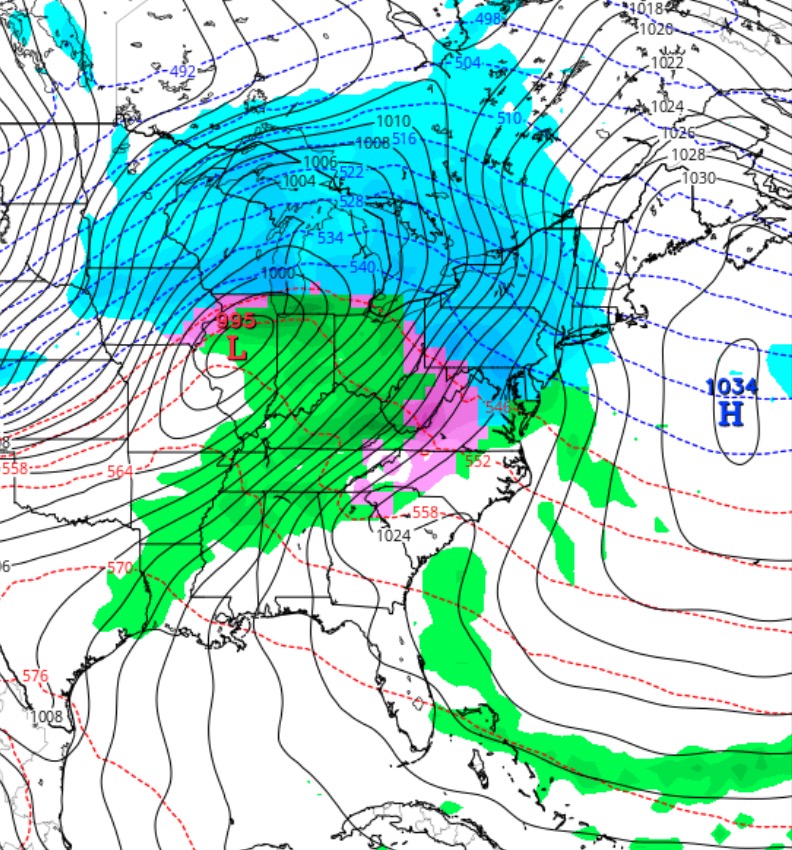
The active pattern continues and an impulse coming in from the Pacific will intensify into an intense low pressure system in the middle of the country.

As mentioned in my followup comments yesterday, we’re in a pattern where precipitation that moves in will be accompanied by a warm up.  For the rest of the month, the models are depicting us in the warm sector of storms that move up to our west.

The warmup is expected on Saturday, but with such prior frigid weather in place, the change to rain will likely be delayed with a prolonged period of freezing rain.

Right now, it looks like we’ll wake up to some snow Saturday morning, but it will change to freezing rain in the morning.  A prolonged period of freezing rain may be a possibility during the day on Saturday.

It should be said that this potential winter weather storm is a recent development in the models.  Much can change in the upcoming days, so don’t hang your hat on this forecast; expect changes.

Philly Winter Weather Update

A quick update.  Latest NAM and GFS have come closer together in QPF. The afternoon runs have 0.12 (NAM) and 0.16 (GFS) falling as snow, mostly before 7 AM Friday.   This translates into about 1-2 inches of snow, less north and west.

The tv weather people’s phrase, “mostly on grassy surfaces” doesn’t apply here.  The snow will be falling during the night time hours– insolation through the clouds won’t be a factor until after sunrise, when the snow will be essentially over.  Once the sun angle increases (behind the clouds), most snow on roadways will quickly melt, leaving any accumulations on grassy surfaces.

But those hitting the roads for an early commute will likely see some snow on untreated surfaces, since temperatures will be below freezing during the snowfall, especially north and west.

Fri 7 AM: The northernmost cutoff of the precip was sharp and here in the Chestnut Hill area, we hardly had more than a coating.  (In this scenario, “on the grassy surfaces applied”, but not for reasons I had considered- too light snowfall.). It appears that just south and east  of PHL airport, snowfall has been more significant. )