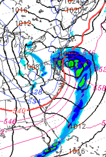
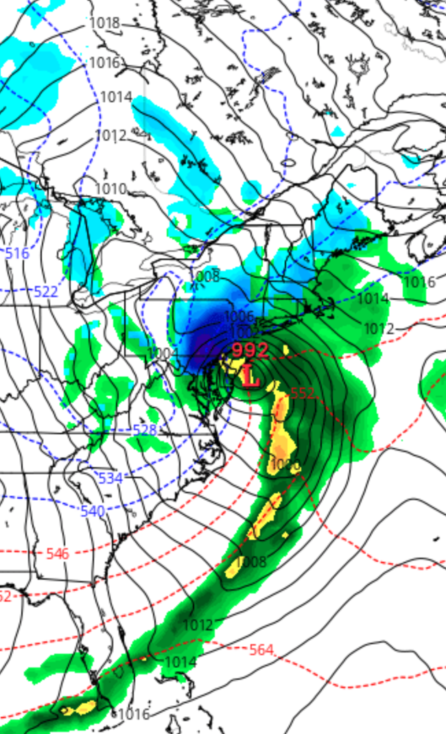
Category Archives: Winter Storm Outlook

WINTER WEATHER OUTLOOK

[su_box title=”Winter Weather Update: Monday 12 Noon” box_color=”#defcdc” title_color=”#000000″]Based on this morning’s models, the snow will start later in the morning in Philadelphia. The NAM has it starting about 10 AM Wednesday, while the GFS about noon in Philadelphia. Earlier starts southwest of the city, later northeast of PHL.[/su_box]

Details from earlier…

About last night… pockets of sleet developed about 11 PM around Philadelphia and areas to the west north and west.  The colder thermal profiles of the NAM did better than the warmer GFS.

So what about this storm on Wednesday? Wednesday features a similar set up as the several past snow—> sleet—> rain scenarios we’ve had this  winter. Low pressure will be to our west and blocking cold high pressure will be to northeast –

GFS forecast
GFS Forecast for 1 PM Wednesday

An ample flow from the same jet flow discussed last week will bring the moisture.

Unlike many snow ‘storms’  we get with deep low pressure developing along the coast in most winters, this will be another “warm air aloft over-runnng cold air at the surface” type system, actually a warm frontal type system.  The actual low pressure system is weak and unimpressive.  (There is some suggestion that low pressure may develop off the coast, but that is just one of many uncertainties now.)

This time, we are expected to have a somewhat deeper cold air at the surface, allowing for lingering snow and sleet before the changeover to rain.

With thermal profiles aloft playing such a huge role, we won’t have a firm handle on things until sometime Tuesday evening.

[su_note note_color=”#d9f2da”]Currently there is a range of snow totals.  Precip starts early morning 7-10AM from southwest to northeast…Current estimates are in the 3-6 inch range for Philadelphia, then prolonged sleet, changing to rain in the evening.  [/su_note] Stay tuned.

WINTER WEATHER UPDATE

An Interesting and active weather period is unfolding for the next several days.  Model differences promise to make the forecast more challenging.

Tonight’s NAM has snow developing early Sunday evening and extending into early Monday morning.  QPF values have increased over the day and are now at 0.40 inches water. If the NAM is correct, 4-5 inches of snow will accumulate by early Monday morning in and around the immediate Philadelphia area.

The same event is depicted differently by the GFS, which has high pressure blocking the moisture’s northward movement.  QPF values tonight are about 0.10 inches water, even less just north of Philadephia.

I’m leaning towards the NAM, which has done the best for the last two wintery weather events. So the current predicted amount is 3, possibly 4 inches of snow Sunday night, ending early Monday morning.

Another larger system will affect us late Monday afternoon through Tuesday.  Let’s get through the first one before focusing on details, but the trend is for snow, several inches, changing to sleet and freezing rain Tuesday morning. An extended period of freezing rain is possible even in Philadelphia.  An eventual change to all rain later Tuesday morning.

Further complications include the possibility of a secondary low formation.

Stay tuned.