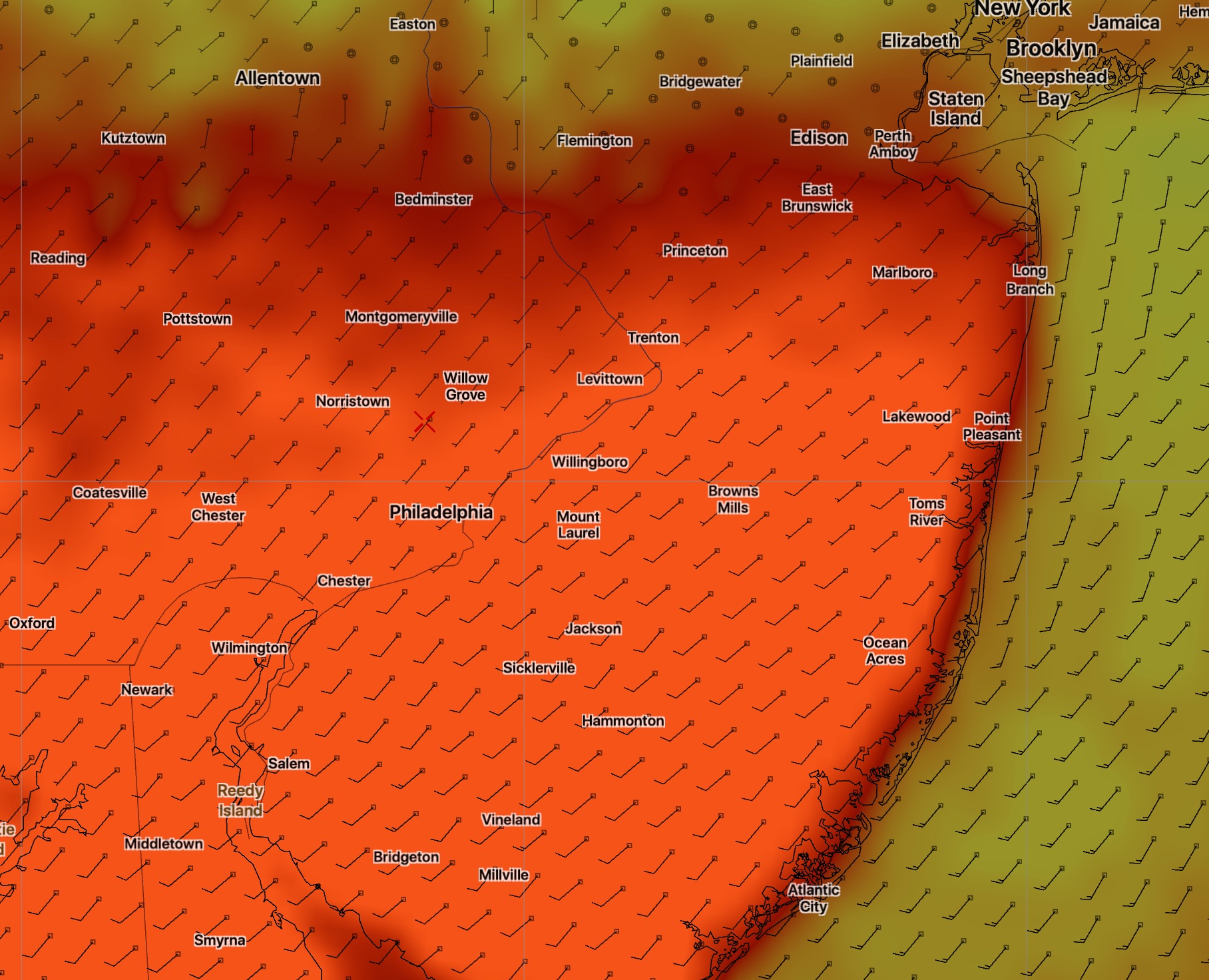
Whoops….we may need to cancel those sunny breaks I forecast within the past hour. I took a look at the very low level cloud deck and it hangs firm until very late.
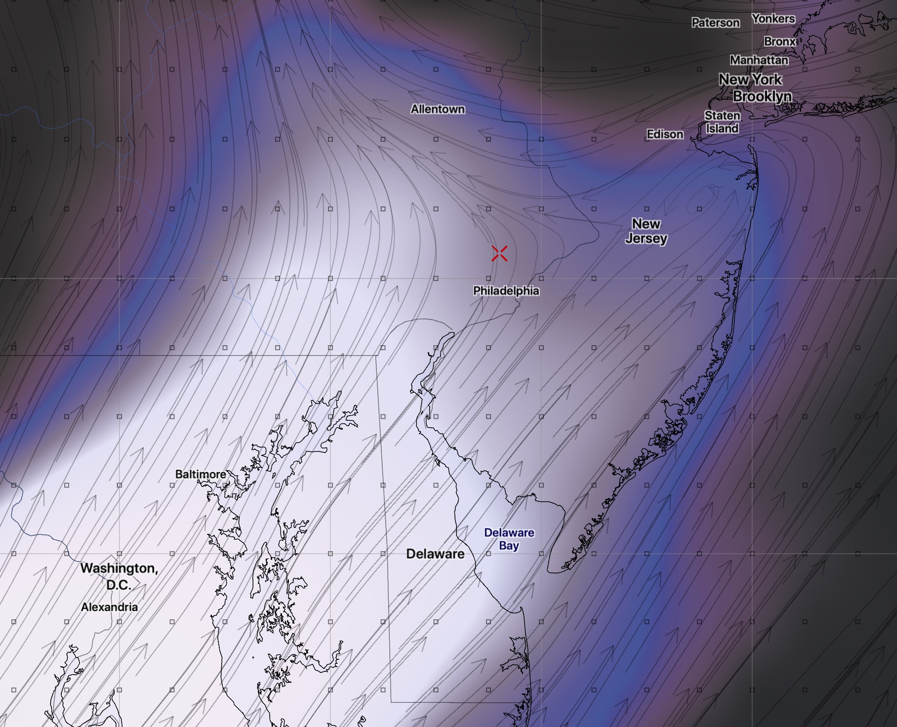
Very low level clouds
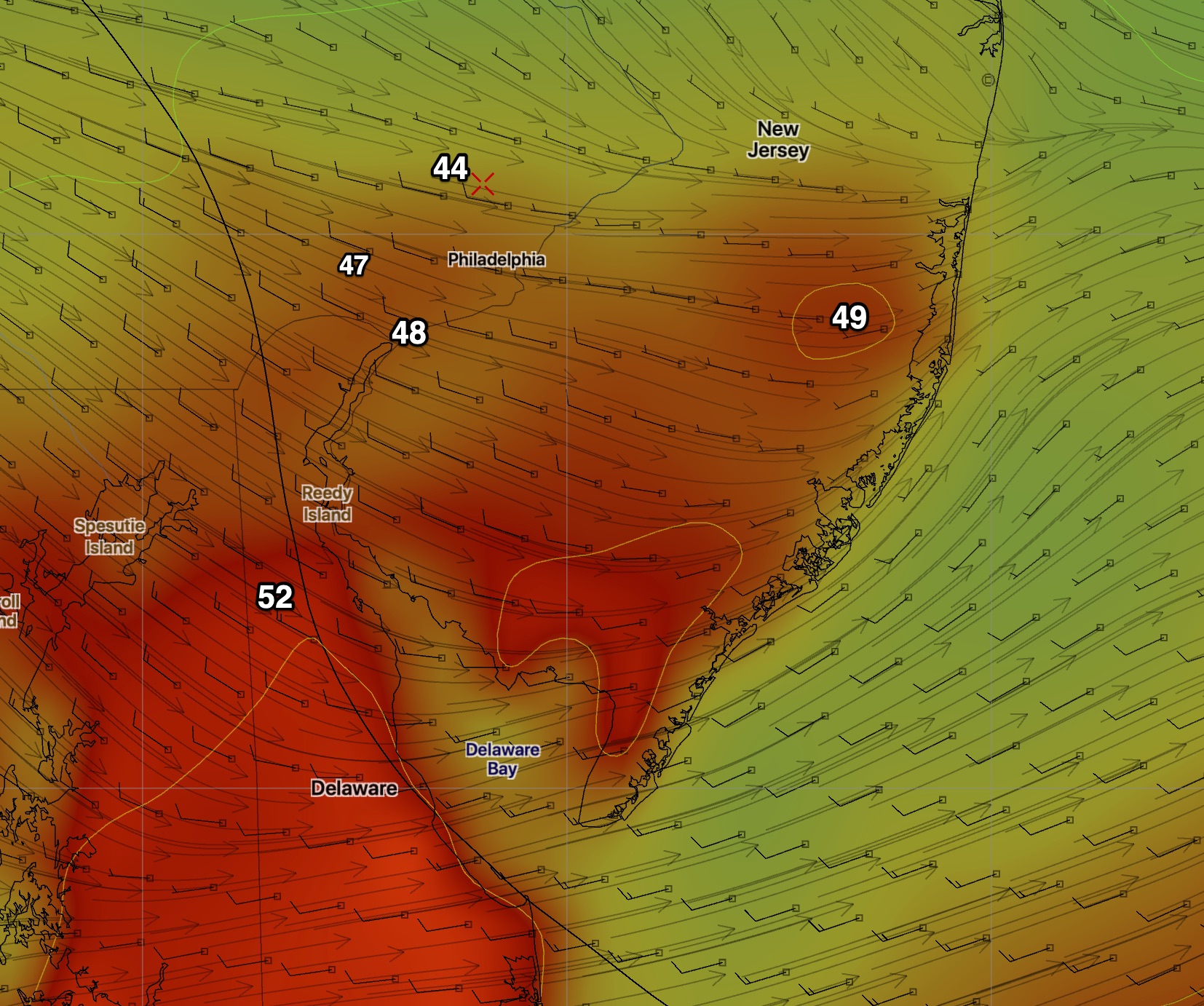
The latest GFS has some breaks of sun coming in sometime between 1 and 5 PM due to a dry slot from the south.High temperatures are also coming in much lower than predicted-
Revised High Temps
High temps in the 53-55 range, occurring later in the afternoon:
As mentioned in yesterday’s post, when predicted QPF values are in the 0.10 range or less from a clipper-type system, the trend can be for the precip to become negligible.
Such is the case with today’s NAM where QPF values have fallen to 0.01 inches water and the GFS 0.03.
A flurry, at best for Friday afternoon/evening. Cancel that 1 inch snowfall.
[su_box title=”Forecast Update Sat 11 AM” box_color=”#defcdc” title_color=”#000000″]So this morning’s GFS continues with a QPF of 0.15 inches water at Philadelphia airport, dropping off rapidly as one goes further north. The NBM has a good chance of snow continuing until at least noon on Sunday.
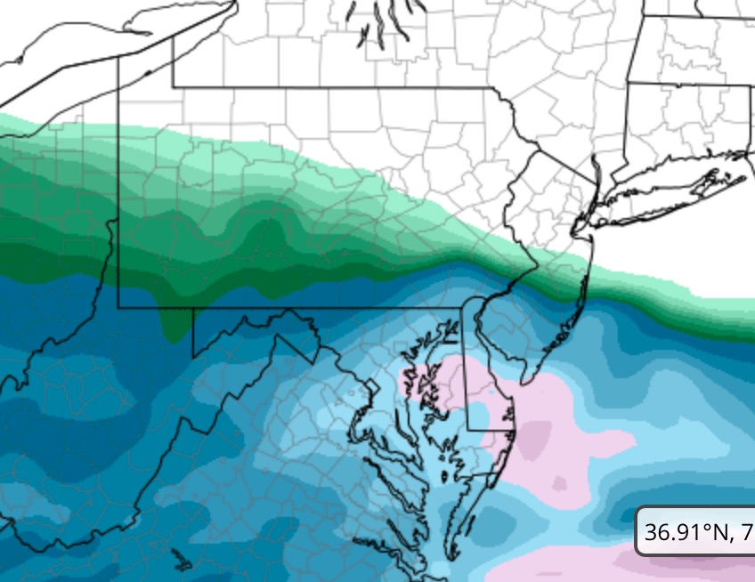
NAM showing storm total QPF The NAM shows intensification near the coast. An error??
We will have to assume that the NAM’s very high QPF is a modeling error, but we need to keep in mind that there’s a chance that it’s not and that higher snow totals than currently predicted may occur just south of our immediate area. Always interesting![/su_box]
[su_box title=”Forecast Update Sat 9:55 AM” box_color=”#defcdc” title_color=”#000000″]Wow, this morning’s NAM has a QPF of 0.92 inches water at the Philadelphia airport, dropping off rapidly to 0.12 inches water at Trenton Airport.
This is either a modeling error or a significant change in the northern-most position of the heavy snow. It would mean the same graphic below, but with the darker blue being 1 foot of snow!
NAM model total snow accumulation by Sunday morning with darker blue 1 foot at Philadelphia airport and well over a foot in Baltimore. Two inches in Trention!
Will have to wait for the GFS model due out in about 45 minutes to assess. [/su_box]
Last night’s 1 AM model runs (06 UTC) display slight differences. Most of the QPF differences are the result of differences in model resolution and the fact that we’re trying to predict an “edge” or “boundary” area condition – where moisture meets dry colder air. Models have a limit in accuracy in such boundary conditions.
Another way of putting this is that we’re ‘trying to split hairs’. This is going to be a minor weather event for our area. It doesn’t merit the designation “snow storm” and there are times when snow flurries or fast moving snow squalls put down heavier snow than what’s expected here.
Put another way, when we get rain, does anyone really know or care if we get 0.06 inches of rain vs. 0.11 inches?
Now that I got that out of my system, let’s talk about the current model predicted QPF:
The latest NAM still comes in high at 0.14 inches water. The GFS comes in at 0.06, the NBM at 0.04 and the ECMWF at 0.15. (For data point KPHL- Philadelphia airport)
This graphic probably captures the best precipitation breakdown:
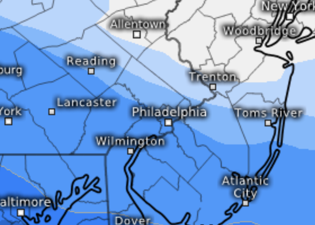
ECMWF model total snow accumulation by Sunday morning.
Philadelphia is cut in half – 0.15 at the airport, 0.08 in Mt Airy 0.04 in Langhorne. (Multiply by 10 or 12 and you get the snow total in inches.)
My preference in these situations is the NAM or NAM/GFS average with the slightly higher snow total,
Other differences are with the start time of the light snow. The GFS starts early, about 8 PM while the NBM is later, after 10 or 11 PM.


 High temperatures are also coming in much lower than predicted-