It’s about that time of year when I take a stab at the long range winter forecast. I always preface this with the disclaimer that predicting a seasonal trend is really climate science, not weather forecasting. Climate science isn’t as advanced as weather forecasting. That said, there’s always interest in this, so here goes:
Basically, the current pattern suggests colder than average temperatures this winter due to the nadir in the sunspot cycle and higher precipitation due to an El Niño. Let me explain-
Climate forecasts boil down to temperature, moisture and jet stream position.
Regarding temperature, we are about to entering a solar minimum.The solar cycle is a regular, periodic change in sunspot number and the mimimum correlates with reduced total solar irradiance. The Lasco Project has shown that total solar irradiance drops almost 1 watt/m2 during solar minimums.
While not universally accepted, solar minimums allow for these colder conditions.
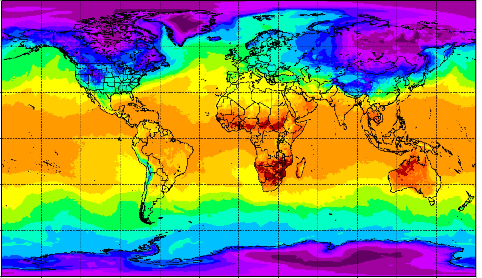
The current global models show very cold temperatures already developing in the polar region, Siberia and Greenland. The appearance now is similar to that seen in the middle of winter.
So we have one ingredient- very cold air this season. This winter will likely be colder than average in the Northeast.
Regarding the moisture component, an expected El Niño in the Pacific is developing – warm ocean temperatures that will provide a stream of moisture along what is referred to as the southern jet stream.
So we have a second ingredient- moisture picked up from the warmer Pacific ocean. Precipitation will likely continue above average in the Northeast.
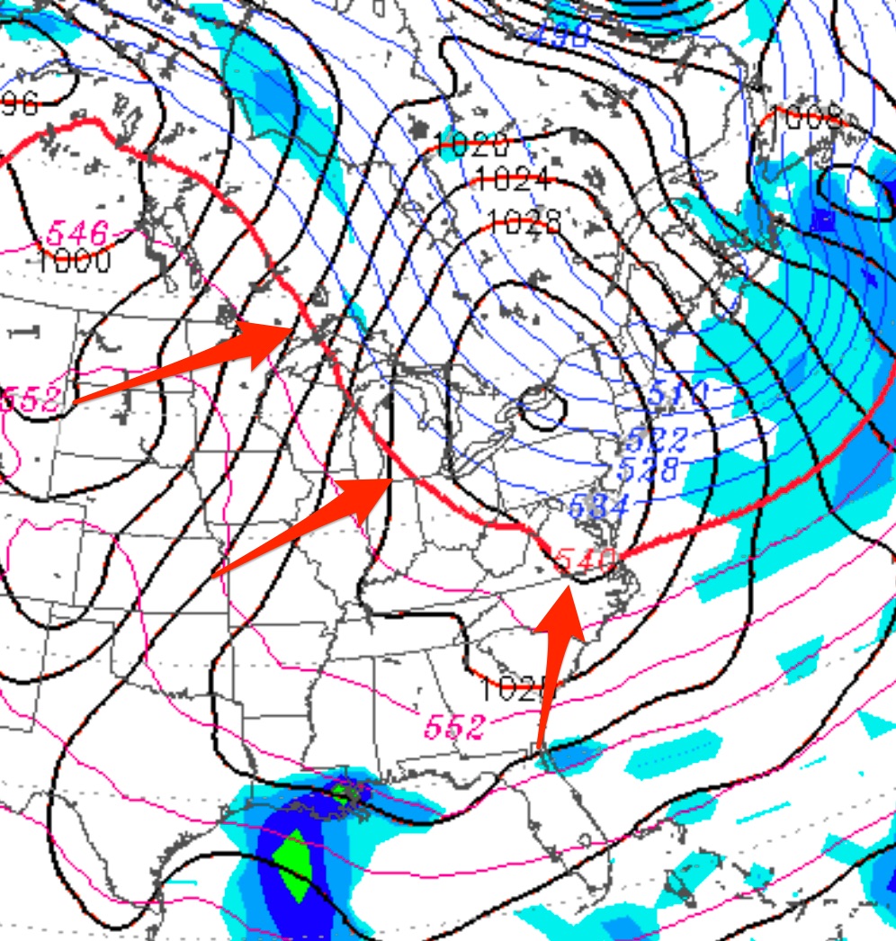
Does that mean we will have more snow than average? Probably, but not necessarily. That depends on the jet position.
While TV forecasters often suggest the jet stream is moving in ways with a mind of it’s own, the jet stream really flows between boundaries of air masses. It’s the edge of the air masses that determine the jet position, not the other way around. Large cold air masses developing at the poles have to sag down and mix. In doing so, their boundary sags and dips, causing a dip in the jet. Warm air masses in the tropics push their edge north. The boundary is where jet stream is and where low pressure systems develop,
While it would make sense that we get more snow, the actual random shape of the cold air mass boundary (jet stream) might spin up storms to our east (snow) or to our west (rain).
One more thing— With plenty of warm air in the southern hemisphere from global warming, it likely that wide swings in temperature will occur, with extended below average cold periods interrupted by much shorter periods of warm temperatures.
This is my best guess for Winter 2018-2019.