[su_note note_color=”#defcdc”]Thursday 1 PM Update: The Canadian Model has joined the NAM in predicting a much later onset of rain on Sunday — Both wait until evening for the rain to move in.
This morning’s GFS has moved the rain later, from early afternoon to mid afternoon Sunday.
So there are timing uncertainties with the rain onset on Sunday.[/su_note]
…from earlier Thurs morning:
A belated “Happy Holidays”!
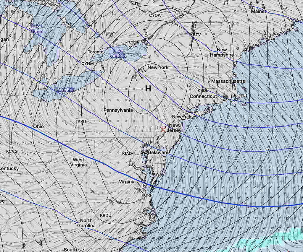
The current pattern of an upper air ridge over the eastern US should continue, bringing mild temperatures, especially late Sunday and Monday.
A weak surface high pressure system has been persistent and will begin to break down as low pressure approaches from the west on Sunday.
For Saturday, high cloudiness and mild temperatures is the outlook. High upper 40s to near 50º.
For Sunday, most of the models (with the exception of the NAM) have showers moving in by early afternoon the precipitation increasing to moderate rain during the late afternoon and evening.
It will become increasingly mild on Sunday with a southerly flow. Temperatures will rise into the 50s late in the day and may approach or exceed 60º by Monday morning!
Monday will be unsettled but very mild early (~60º+) ; temperatures will gradually fall during the day.
Most years, I put out a winter seasonal outlook in early December. I did not do that this year, since there appeared to be no “pattern” that was apparent.
[su_note note_color=”#bceaed”]Most years, I put out a winter seasonal outlook in early December. I did not do that this year, since there appeared to be no “pattern” that was apparent.
However, I would say that a winter pattern has recently developed and is quite different than last year, where we had a persistent high pressure and an upper trough in the Northeast.
The Canadian (CMC) Global Deterministic Model forecast for this coming Monday (below), shows a persistent upper low and surface low over Great Lakes, which a good example of a pattern that has repeated.
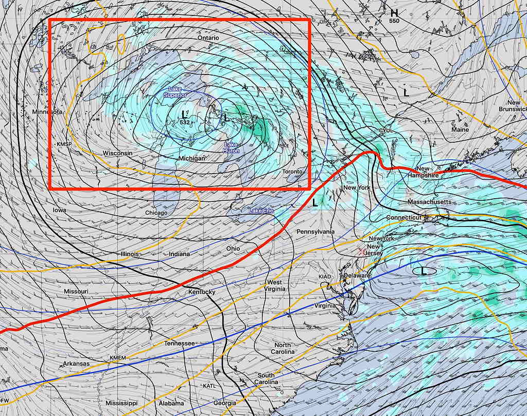
This year, there have been persistent surface and upper air lows low pressure systems over the Great Lakes that seem to recur.
Instead of cold high pressure dipping southward like last year, we have low pressure systems to our north and west. We remain on the warm sector of these lows.
There have been no sharp dips in the jet stream over the northeast, which is to be expected with the pattern as described.
With the current pattern, I don’t see much in the way of cold temperatures or snowstorms. Patterns change, but right now, I don’t see anything different developing in the short term of the next couple of weeks.[/su_note]