The forecast for this week has been a moving target with each day’s model forecast being different from the forecast of the previous day.
As an example— a cold front had been expected to move through, initially Wednesday evening, then Wednesday night and now Thursday morning according to the GFS and NAM NEST models.
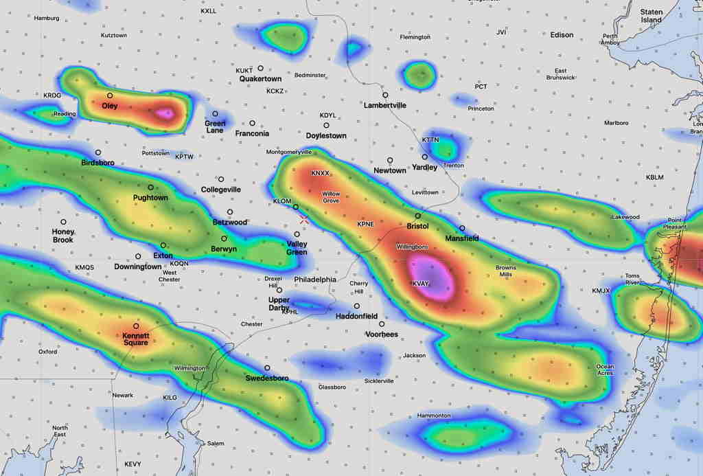
GFS 1 hour Convective Precipitation Rate (Thunderstorm) for 12 Noon Thursday (Click on image for a larger view.)
The Canadian GDPS and the German ICON are somewhat different, with each having a wave of low pressure develop along the front, slowing it down; the front moves through Thursday afternoon to late afternoon according to these models.
The timing differences will result in differences in weather severity; an afternoon frontal passage will occur during a time when the atmosphere is more unstable and result in more severe weather.
Obviously it’s too early to accurately model but the trend has been towards mid to later in the day Thursday. Stay tuned.
[su_note note_color=”#ffffff”]Updated Tue 10:52 PM —Tonight’s models have widened the time window for thunderstorms on Wednesday. Some severe storms will form in the Allentown area as early as 12-1 PM. A fast moving bow echo formation is forecast for this batch. They may or may not make it into Philadelphia. Additional storms will form around 3 PM in our area and several rounds of severe storms afterwards, especially around 5-9 PM. [/su_note]
[su_note note_color=”#ffffff”]Updated Tue 07:12 PM — Some showers and thunderstorms are possible after midnight tonight, before daybreak Wednesday morning. Most likely north of the PHL area.
Most of today’s models have been more consistent with a forecast of severe thunderstorms between 3 PM and 8PM Wednesday in the PHL area. The instability parameter values are very impressive and severe storms are likely. However, the GFS model still seems to keep the heavy activity north of the PHL area. .
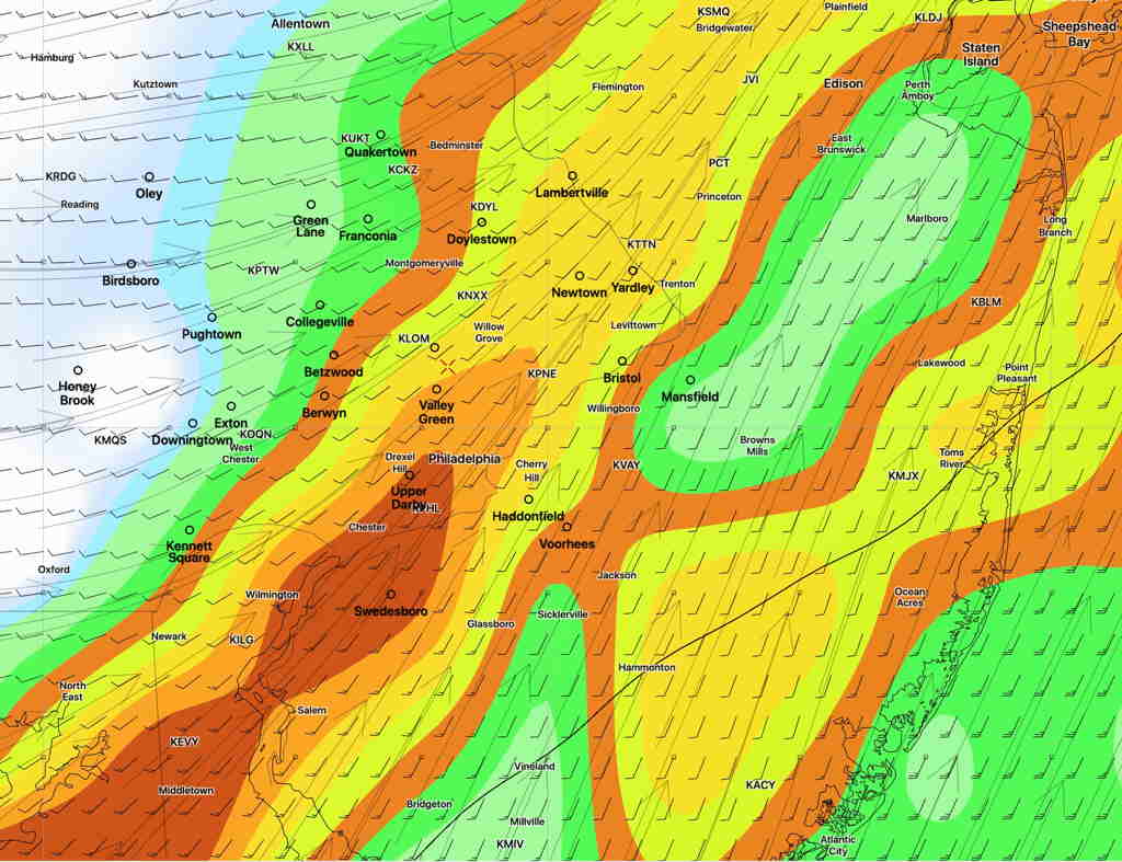
Here’s a new HIREF (Experimental) model displaying “Maximum Updraft Helicity“; high values are associated with potential tornadic development for 6 PM Wednesday—
HIREF Experimental3 Model “Maximum Updraft Helicity” 6 PM Wednesday (Click on image for a larger view.)
We’ll have to wait for tomorrow morning’s models to pin down the exact placement of the most severe weather. [/su_note]
There’s much uncertainty with the specifics of the weather forecast over the next few days. While the general setup I discussed here on Sunday’s outlook post remains generally intact, the difficulty is in the details.
First, for today, there are wide differences in the model forecasts for the amount of cloudiness today. Some models have it very cloudy; some like the NAM-NEST have considerable breaks of sunshine.
For the showers tonight, some models have them falling apart as they approach Philadelphia, others have the bulk of activity moving just to our north or just to our south.
The same is true for Wednesday, where the timing and placement of the largest storms varies between models; the gist is that the strongest activity may miss Philadelphia.
An active week, weather-wise, is on tap for Philadelphia.
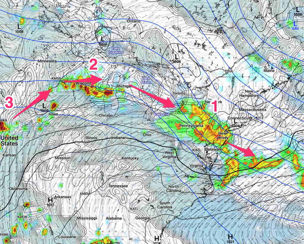
An upper air high pressure system has set up in the center of the country and disturbances are forecast to rotate around the the edge of high pressure system, moving through our area from the northwest almost every 24 hours.
Following another cool and dry day on Monday, clouds move in Tuesday. The first disturbance approaches from the northwest Tuesday night with showers and thunderstorms. A second and third disturbance is forecast for Wednesday night and again Thursday night.
Here’s the current GFS forecast, with the three disturbances shown—
GFS forecast Tuesday midnight. (Click on image for a larger view.)
Expect some changes in the exact track (for instance, the current NAMNEST has the first disturbance moving more to our south) and timing of each disturbance.