Here’s an update on the storm potential for Monday. Latest trend continues to keep the storm to our south, missing Philadelphia. Even the GFS has joined in the other models with this trend. That said, the NAM moves the storm closer to us then last night’s run, still missing us.
There’s still a possibility that things may still change, The statistical version captures the uncertainty of this forecast —
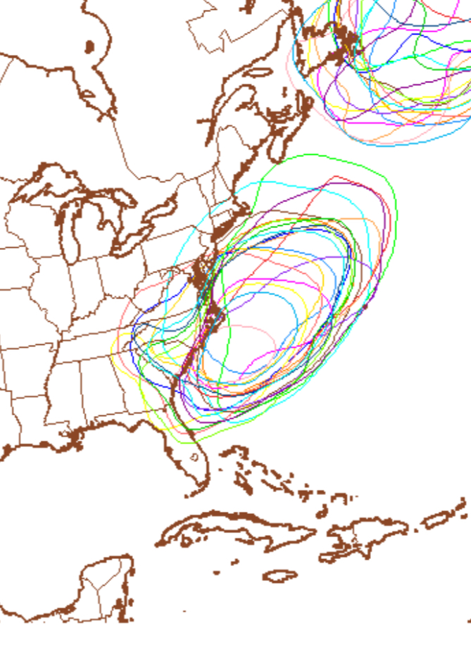
Spaghetti Diagram 1008 millibar GFS Ensemble Monday— each color represents a possible position and contour of the low pressure system on Monday. This is quite a “spread”.
What is becoming apparent that for next week, we’re entering a hopefully short period of below average temperatures.
I’ll post my regular Philly weekend weather forecast later this evening.
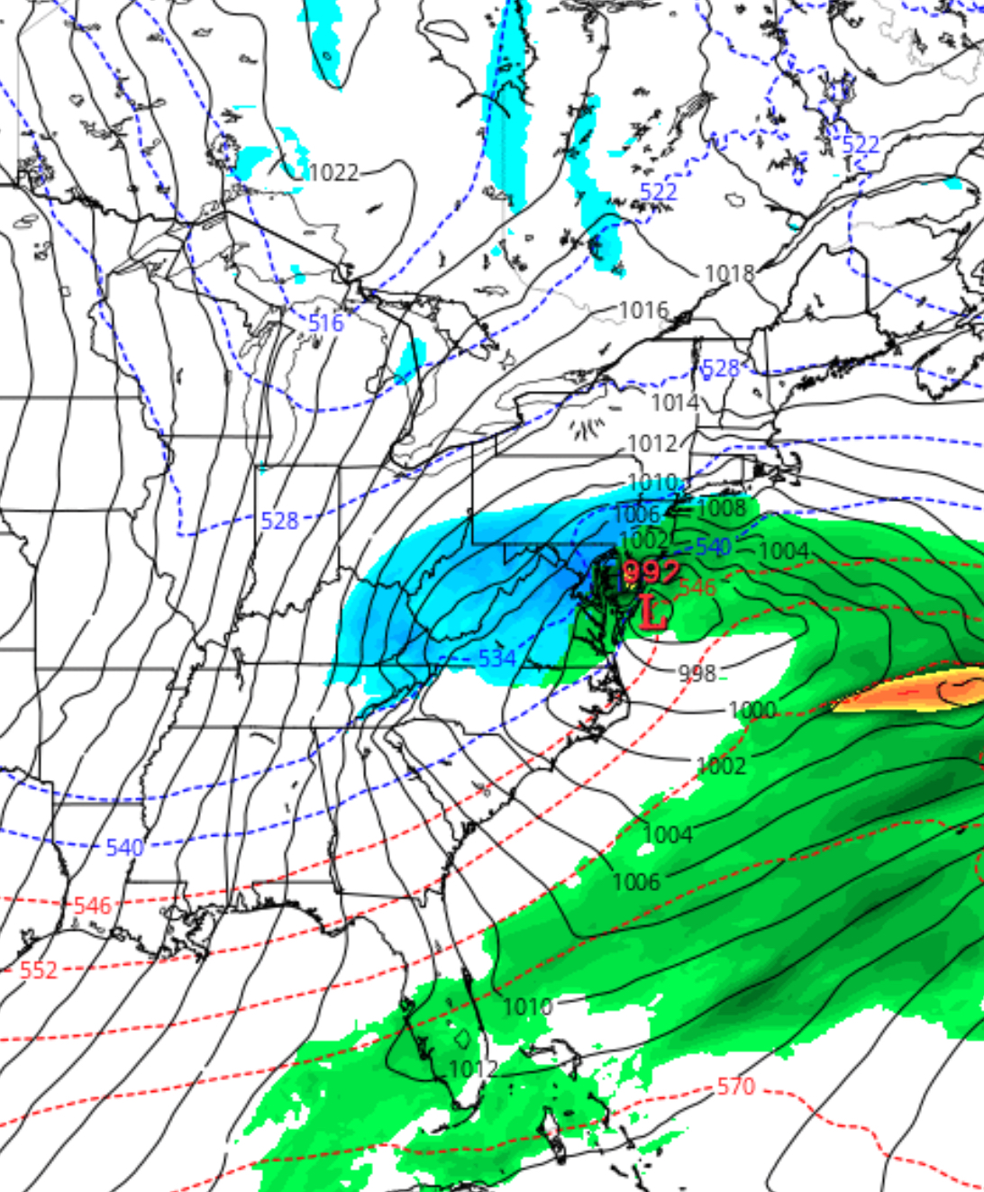
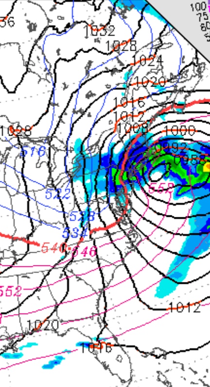
As mentioned in past posts this week, two areas of low pressure will combine Thursday night to form a significant coastal storm off the Delmarva coast Friday. This storm will intensify and become somewhat fixed in position as blocking high pressure in the Atlantic prevents its usual movement away.
While the temperatures during Thursday and Thursday night will be well above freezing, intensification and heavy precipitation rates during the morning on Friday (QPF values over 0.75 inches in 6 hours) will cause dynamic cooling.
The NAM shows rain changing over to wet snow in Philadelphia sometime during the morning hours Friday and earlier north and west of the city.
While warm ground surface temperatures and spring-like solar insolation effects (radiant energy through the clouds) will seriously reduce the chance of accumulations, it will look quite stormy out with windy conditions adding to the mix on Friday.
Some surface accumulations possible especially on grassy surfaces, if the precipitation continues into the evening Friday.
An interesting and unusual weather system setup! Expect changes to this forecast.