Category Archives: Philadelphia Area Weather Forecasts

WEEKEND WEATHER FORECAST

#weather #paweather #wx #pawx #philadelphia #phillywx

Update

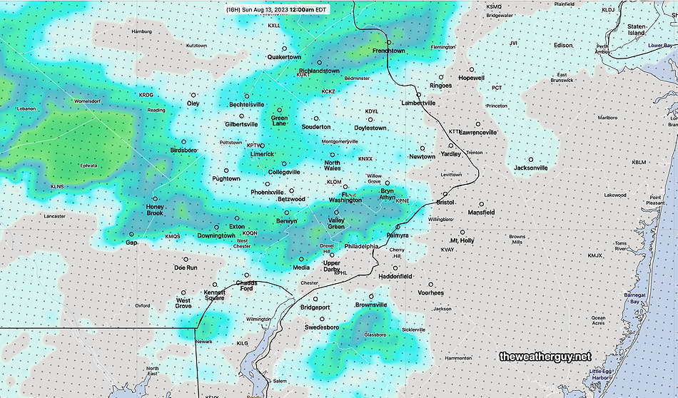
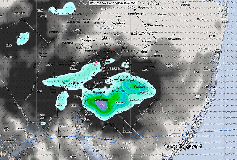
Updated Sun 08/27 @ 7:41 PM —It didn’t look like it would happen, but some showers have been popping up, just as several models had predicted earlier this morning, occurring a just a bit later later than forecast.

MRMS radar image at 7:35 PM. Showers are expected to slowly drift around and will dissipate later tonight. Many areas won’t see a drop of rain. (Click on image for a larger view.)
MRMS radar at 7:57 PM (Click on image for a larger view.)

Sun 10:05 AM Forecast Review — There were plenty of clouds on Saturday, the result of the short wave that moved through, affecting South Jersey with some showers.

Did anyone hear the TV or radio weather people talk about the cloudiness that occurred?

Radar at 3 PM Saturday showed some localized showers in South Jersey. The wind convergence line is visible on radar as well. Not as much activity as predicted by the HRDPS, but still reasonably accurate.

Today, Sunday, the HRDPS is predicting a similar shortwave to move through, this time affecting areas closer to Philadelphia. Will it happen?

HRDPS forecast for today, Sunday, at 6:30 PM. A period of clouds and some showers. Will it happen?

Saturday Forecast Update

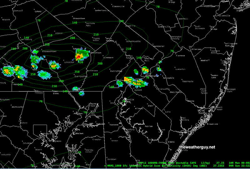
Updated Sat 08/26 @ 9:23 AM — Sunshine is expected by late morning. The HRDPS has been consistently predicting a mid level wave to form during the afternoon over South Jersey. Combined with low level wind convergence and high dew points, showers and some thunderstorms are expected to form between 2 PM and 6 PM this afternoon in South Jersey.

Todays’ 06z HRDPZS shows showers and thunderstorms in South Jersey this afternoon. (Click on image for a larger view.)

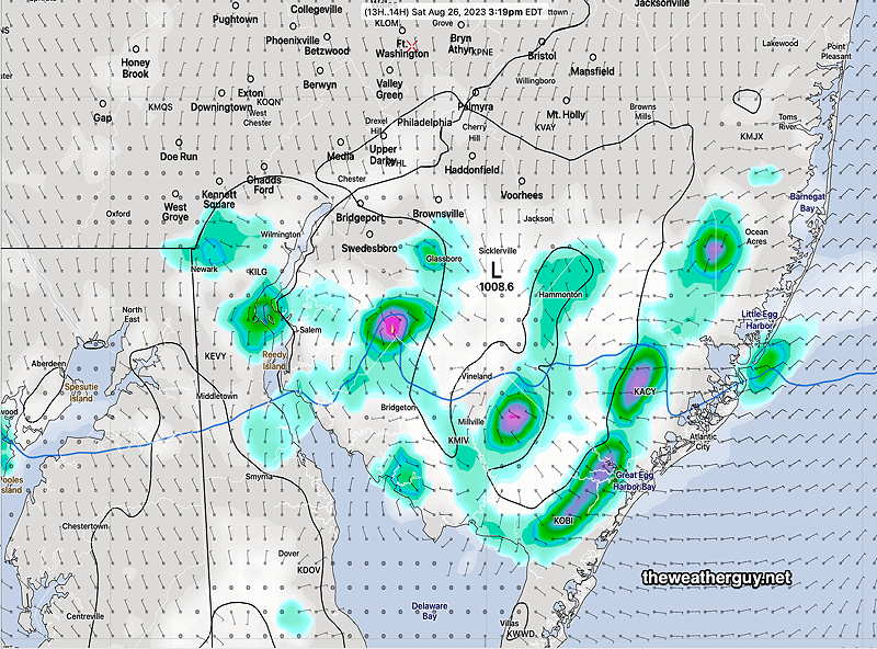
The NCEP models weren’t emphatic about this possibility, but the latest HRRR suggests the same.


Update

Update Fri 8/25 10:55 PM — A review of tonight’s models still suggests that Sunday will have a period of cloudiness and even some light sprinkles during the mid to late afternoon, mostly southern areas. Still a low confidence forecast regarding this possibility..


Previously Posted Fri 5:14 PM —


A cold front will move through Friday night into early Saturday. A few widely scattered showers possible tonight, but most areas will be dry. High pressure will build in for much of Saturday. A secondary cold front moves through Saturday evening.

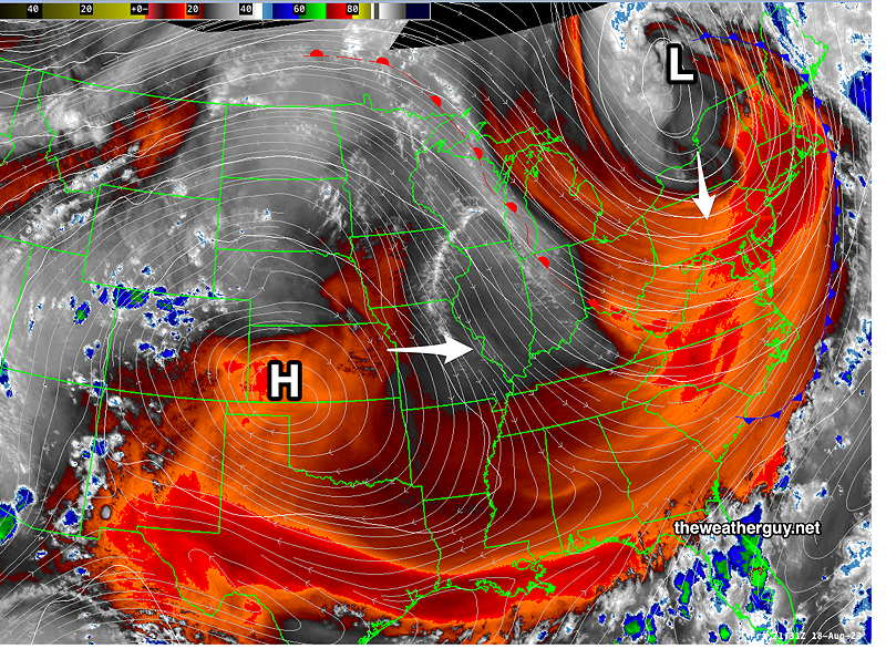
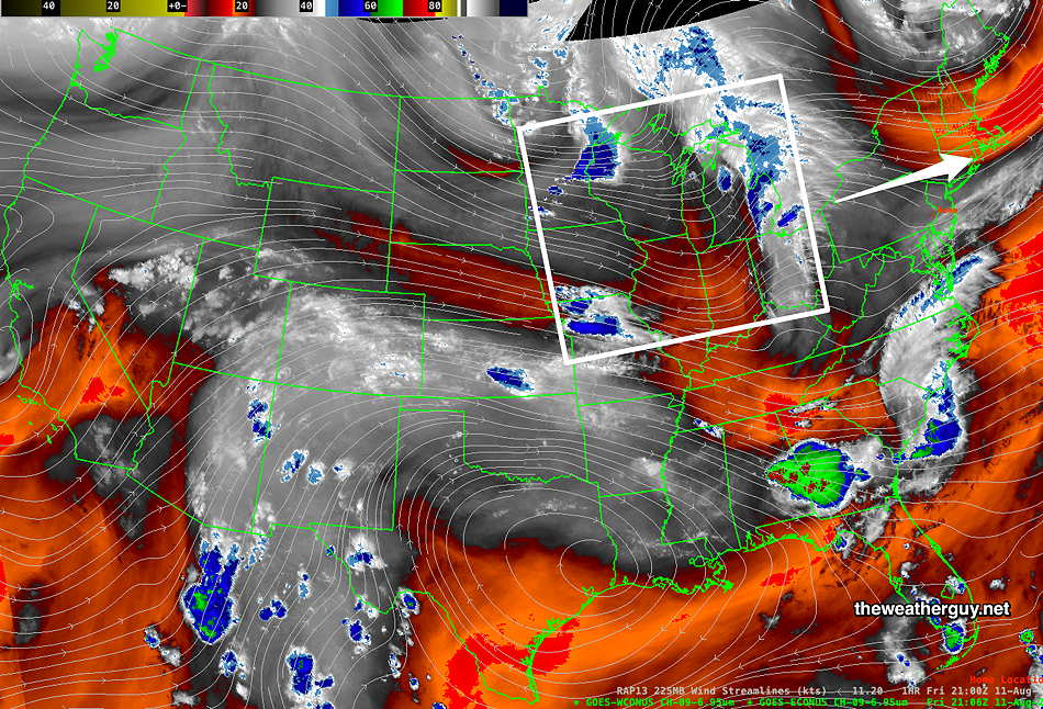
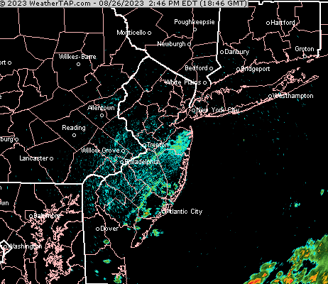
The current water vapor image shows the weak low with the secondary cold front and the possible area of low pressure development on Sunday—

Water Vapor image with superimposed RAP model jet windstreams (white)_and 500-1000 mb contours (orange) Secondary Cold Front (blue). Disturbances will track south of us over the weekend, with some uncertainty for Sunday in southern areas of Chester County and Delaware/ South Jersey. (Click on image for a larger view.)

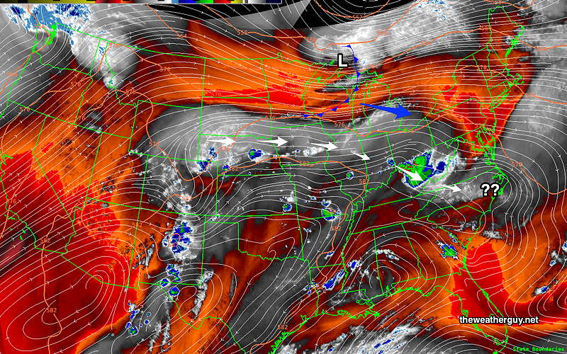
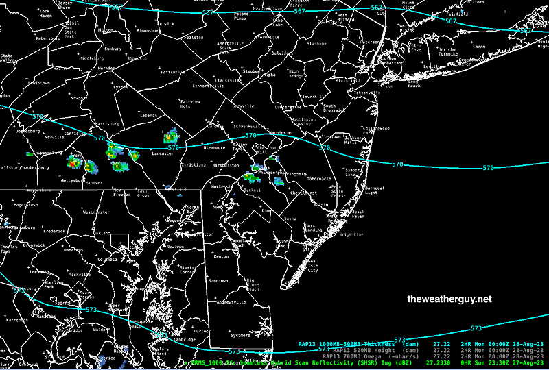
For Sunday, there’s been a question about low pressure developing along the coast to our south, possibly with clouds and light showers for southern areas, especially South Jersey. Latest models have begun to downplay this possibility.

Saturday

Cloudy in the morning, becoming sunny by afternoon. Very warm and still somewhat humid. Breezy.

High temperature 86º ( NBM model— location Blue Bell, PA)
High temperature 89º ( NBM model— location Philadelphia, PA)

Sunday

Sunny with periods of considerable cloudiness. (There’s lower then average confidence in cloud cover forecast at this time.) More cloudiness likely in areas of southern Chester and Delaware counties as well as southern NJ.

High temperature 81º ( NBM model— location Blue Bell, PA)
High temperature 84º ( NBM model— location Philadelphia, PA)
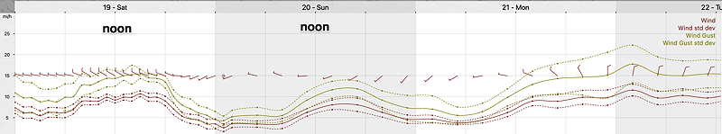
Winds
18z NBM model wind Meteogram for Blue Bell, PA. (Click on image for a larger view.)

WEEKEND WEATHER FORECAST

#weather #paweather #wx #pawx #philadelphia #phillywx

This weekend’s forecast has been unchanged for most of this past week. Sunny and delightful with increasing temperatures by Sunday.

The heat dome in the middle of the country will be kept mostly at bay by upper low pressure in eastern Canada, although some heat will move in for Monday and part of Tuesday —

Satellite Water Vapor imagery shows heat dome (H) over Kansas and upper low over eastern Canada. The heat dome will try to move eastward Sunday through Monday, but the upper low in Canada will rotate a cold front across our area sometime on Tuesday. (Click on image for a larger view.)

Saturday

Sunny and delightful. Breezy.

High temperature 79º ( NBM model— location Blue Bell, PA)
High temperature 81º ( NBM model— location Philadelphia, PA)

Sunday

Sunny and warmer.

High temperature 87º ( NBM model— location Blue Bell, PA)
High temperature 89º ( NBM model— location Philadelphia, PA)

Winds

NBM wind meteogram for location Blue Bell, PA

WEEKEND WEATHER FORECAST

#weather #paweather #wx #pawx #philadelphia #phillywx

Sunday Forecast

Update Sat 8/12 11:01 PM — The second area of showers /thunderstorms forecast this morning to be here around midnight are now expected about 1-3 AM, if they hold together.

Sunday’s original forecast below still looks good.


Saturday Update

Updated Sat 08/12 @ 10:26 AM — Quick update. This morning’s NAM-NEST and HIRESW show showers/thundershowers possible as early as 3 PM in our area today.

Updated Sat 08/12 @ 9:39 AM — As shown in the water vapor image yesterday, there are several upper air impulses expected move near our area today. The models show several complicated jet streaks and it seems they’re having trouble with a definitive forecast.

Water Vapor Image shows jet level disturbances moving towards our area. A combination of 1 and 2 may trigger showers/storms at 5 PM. Disturbance 3 developing may cause showers/storms about 11 PM. (Click on image for a larger view.)

I’m leaning towards the NBM model forecast for today which is closest to the HRDPS—

This morning’s 12z NBM model 1 hour precip forecast for 6 PM today. The NBM and several (but not all models) has some shower activity further south into Philadelphia between 4 and 6 PM. (Click on image for a larger view.)

In addition to the above shower/thunderstorm activity between 4 and 6 PM, the NBM shows a second area of showers moving in around 10 PM to midnight tonight. This forecast is also similar to the HRDPS—

NBM forecast 1 hour precip at midnight. (Click on image for a larger view.)

Update Fri 8/11 11:06 PM — Tonight’s early models are keeping any showers and storms on Saturday confined to far northwest suburbs. I’ll update tomorrow morning.


Previously Posted Fri 6:16 PM —

For most of the summer, we’ve been under the influence of the flow around an upper low centered in Canada. Earlier, in the late Spring, this upper level low was over Hudson Bay. Over the summer, the center of the upper low has moved eastward and somewhat southward. With a few exceptions, the upper low’s flow has kept the very hot weather in the southern US from becoming entrenched over the Northeastern US.

We continue to be affected by upper level disturbances that flow around this upper low, as well as disturbances that flow around the top of the hot dome over the South.

Here’s the current water vapor satellite image showing yet another disturbance to rotate through, later on Saturday—

Satellite Water Vapor image around 5 PM Friday. This image is show upper and mid-atmosphere features; it does not show clouds. A few weak upper level disturbances (white box). are shown that will rotate just north of our area on Saturday afternoon. Most of the moisture and energy will be to our north. (Click on image for a larger view.)

Another, more potent disturbance will rotate into our area on Monday.

Saturday

Periods of sun and clouds in the morning. A bit more cloudiness than sunshine at times in the afternoon. Some areas may see some light showers/thundershowers as early as early afternoon, but they will be widely scattered. Scattered showers. thundershowers a bit more likely in and around Philadelphia during the evening hours.

(The HRRR’s forecast of showers is minimal. The HREF and HRDPS are more emphatic about showers/thundershowers especially late afternoon and especially just north of Philadelphia.)

Humid. Dew points in the low 70s.

High temperature 89º sd 1.1º ( NBM model— location Blue Bell, PA) High temperature 91º ( NBM model— location Philadelphia, PA)

Sunday

Sunny. Humid in the morning. Dew points in the low 70s will fall in the mid 60s by afternoon.

High temperature 88.2º sd 1.2º ( NBM model— location Blue Bell, PA)
High temperature 90.2º sd 1.1º ( NBM model— location Philadelphia PA)