[su_note note_color=”#bceaed”]We had the clouds and light snow flurries. High temps were much lower than forecast, closer to 32º.[/su_note]
Quick Update: Don’t let the early sunshine this morning fool you. The models are all-onboard for upper air disturbances to move through late morning into the afternoon; expect clouds by late morning and very light, scattered snow flurries mid-afternoon. High temps look closer to 37º.
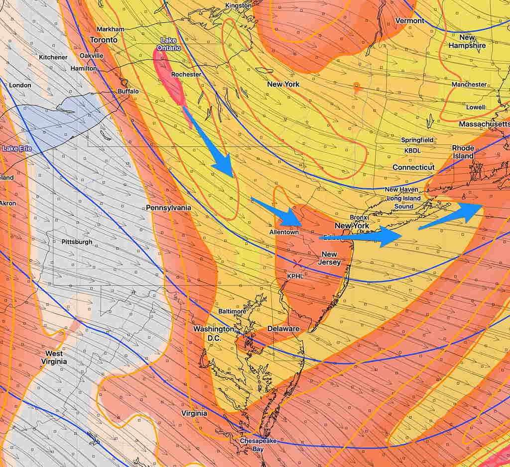
The graphic below is from this morning’s RAP (Rapid Refresh Model) showing upper air disturbances expected to move through beginning late morning (10-12 PM and through the afternoon.) Expect an increase in low level cloudiness.
Rapid Refresh Model forecast for 12 Noon- orange-yellow color shading is “absolute vorticity”
[su_note note_color=”#bceaed”]Today’s high in Blue Bell was 48º, 49°, not too far off from the new NBM forecast. I know a lot of phones and watches in the area probably showed highs of 50 or more.
The very localized temp readings you get on your watch are done from a network of weather spotters that do not necessarily adhere to the standards of measuring temperatures in a white louvered/ventilated wood box with double roof covering. It must be 2 meters above ground level over a grassy surface and at least 100 feet away from any concrete or other structure. (Called a “Stevenson Box”.)
And of course, Philadelphia Airport’s official reading is done in such an enclosure, but it’s near the river, at the far southeastern corner of our area. KPHL, Philadelphia Airport’s temperatures tend to run 1-3º higher than Blue Bell, KLOM.
Sundays’s predicted high is expected to be about 56º. [/su_note]