The rain developed about 1 PM and stayed mostly in Philadelphia and areas south.
Wed 07:32 AM Update — The rain last night did stay to our north. Last night’s models have backed off on the extreme rain totals for this afternoon. 0.75-1.5 inches looks to be the generalized amount later this afternoon.
Tues 10:44 PM Update — Tonight’s models just becoming available vary in the location of the first batch of rain tonight (maybe staying north of the immediate area) and tomorrow afternoon (which may be later in the afternoon or early evening and mostly from Philadelphia and to its south.) The models seem to vary with the location of the stalled front.
A frontal system will stall near our area. Two separate rain events will move through.
The first disturbances will move in before daybreak, about 3-6 AM Wednesday morning with heavy rain.
Another disturbance will move through during the mid to late afternoon. The afternoon disturbance will bring the heaviest rains.
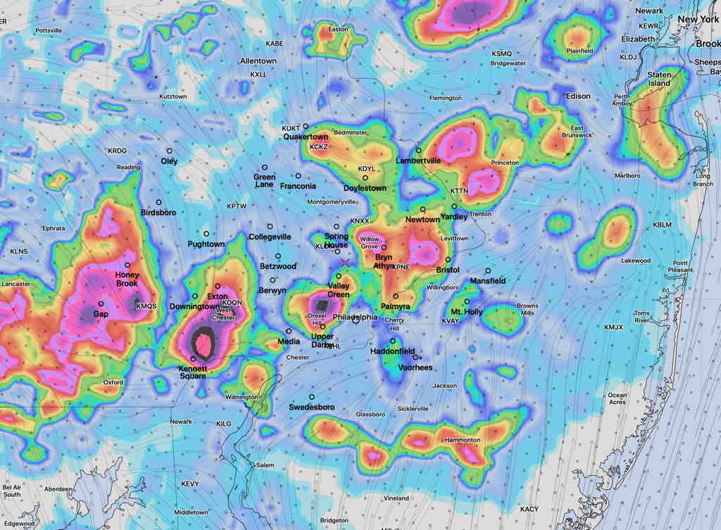
High moisture levels (“PWAT” or “precipitable water”) along with strong dynamics and slow storm motion due to light winds will result in localized areas having 1-3+ inches of rain.
The latest Model Blend (NBM) depicts the localized nature of the rains tomorrow. (The locations shown with the heaviest rain should not be taken literally; almost every area will have some heavy downpours. )

