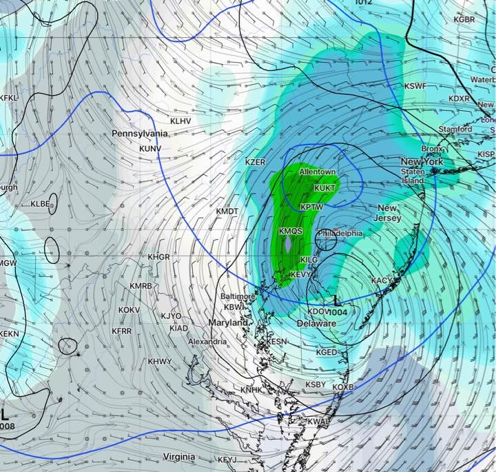
Updated Wed 10:42 PM — Tonight’s NAM NEST model has generalized 4 inches of rain Friday, starting early morning and ending in the evening.
The coastal low expected to take on tropical characteristics and affect our area Friday has had an interesting history as far as the model predictions are concerned.
It was just a day ago that the much touted European model (ECMWF) and the GFS model were predicting it to just brush the coastline, missing us. Meanwhile the current track had been predicted by the NAM and SREF models, often wrong about such storms.
The new GFS, still under development and experimental, had picked up the current track sooner than the current operational GFS model. It suggests that weather forecast accuracy may improve when the new GFS is released in 2021.
It appears that the storm will affect us starting early Friday morning. About 1.5 -2 inches of rain will fall on Friday, with locally heavier amounts possible. Heaviest amounts just west of Philadelphia.

