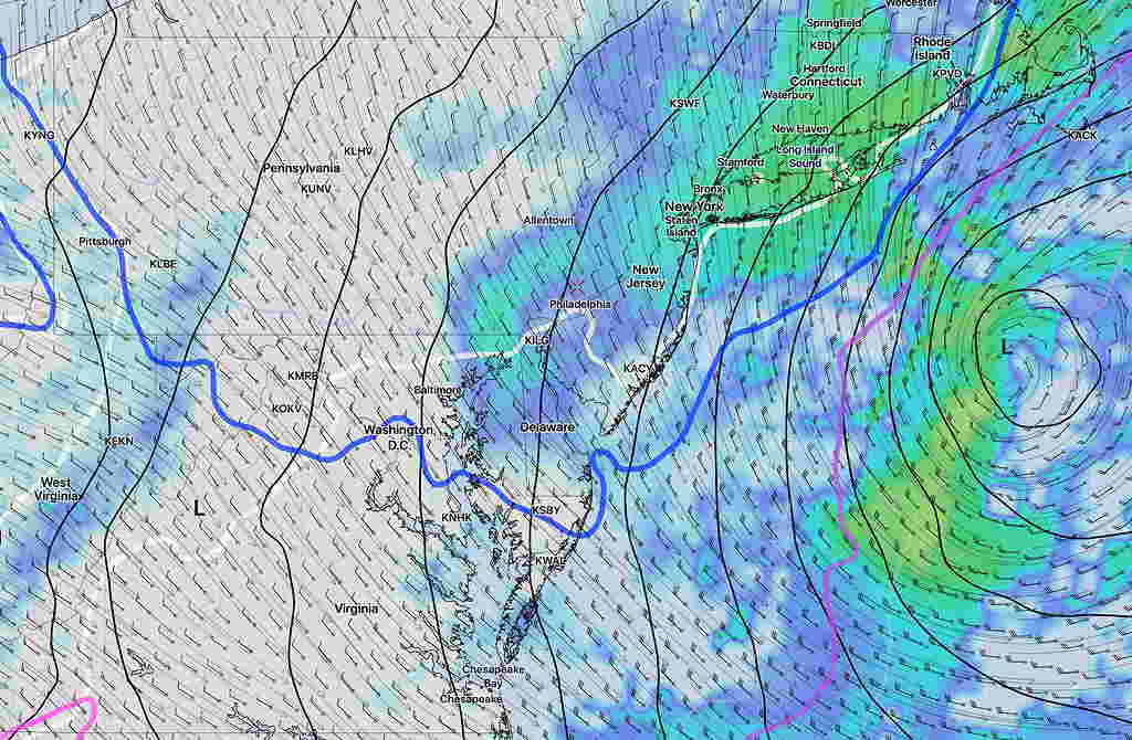
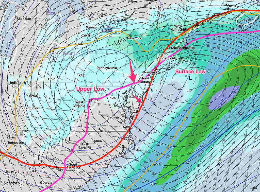
[su_note note_color=”#defcdc”]Fri Late Afternoon Update: The forecast for the weekend remains on track. I’m updating because the Monday forecast period now falls into the range of the NAM model.
For Monday: The latest NAM model supports the scenario discussed as a possibility over recent days— a secondary coastal surface low is held back or regenerated along the coast due to the upper atmosphere low pressure system to the west playing catch-up with the surface system.
Once they come together and become “vertically stacked”, the coastal system will further intensify. This setup allows the collision of cold air and wrap-around moisture to create the chance of snow Monday afternoon and evening over our area. About an inch is a possibility by daybreak Tuesday morning, although warm surface temperatures may interfere with accumulation. I think there’s still uncertainty about the amount of snow on Monday and I expect better clarification over the weekend. Stay tuned.

[/su_note]
…from Friday morning—
[su_note note_color=”#defcdc”]Fri AM Update: There’s still uncertainty with the forecast for Monday. As mentioned over past days, the strong upper atmosphere low remains west of the surface low on Monday. Precipitation lingers while the “critical thickness” levels indicating lower level/upper level temperatures supporting snow moves to our south and east, allowing a change from rain to snow.
So the possibility of light snow or snow showers on Monday still a possibility. A range of warmer surface temperatures may keep us from getting much, if any, accumulation. Below is the SREF (Short Range Ensemble) “statistical mean” forecast. Stay tuned.

[/su_note]
….from Thursday night:
Happy Thanksgiving!
A wet and windy Sunday….
The trends mentioned in the previous posts continue. A deep low pressure system will spawn a secondary coastal low late Sunday as the upper atmosphere low pressure system hangs back.
Saturday will be dry. Sunny in the morning with increasing cloudiness expected by early afternoon. High 48. Precipitation, originally forecast to start Saturday afternoon is further delayed until the hours before daybreak Sunday.
For Sunday, precipitation will be rain, heavy at times. QPF values around 1 inch of rain. There is a possibility the the precip starts as wet snow before daybreak but warm temps will change everything to rain. High 43. It will be windy.
The deep low pressure will intensify off the coast. Colder air will be brought in before daybreak on Monday. There is the chance of change back to wet snow at that time. No accumulation is forecast by the models.
Monday will be cloudy, windy and colder. High 40. The upper atmosphere low and the coastal low will combine to our east. The models are forecasting snow showers during the day Monday, but surface temperatures will be above freezing. Little or no accumulation is forecast by the models.
I think there’s some uncertainty in the model forecast for Monday. Some of the snow showers could be more than forecast, but I don’t like to second guess the models. Monday is just beyond the forecast window for the shorter range, higher resolution models. Stay tuned.
