
#Philadelphia #weather #PAwx #PhillyWx
Sunshine through… Smoke
Posted Sunday 06/01/25 @ 10:37 AM — Ordinarily, I find the the expression “sunshine through high cirrus clouds” to be a useful description of a day’s cloud cover when the predominant cloud type is cirrus. Many people might not notice that the sunshine is filtered by high clouds.
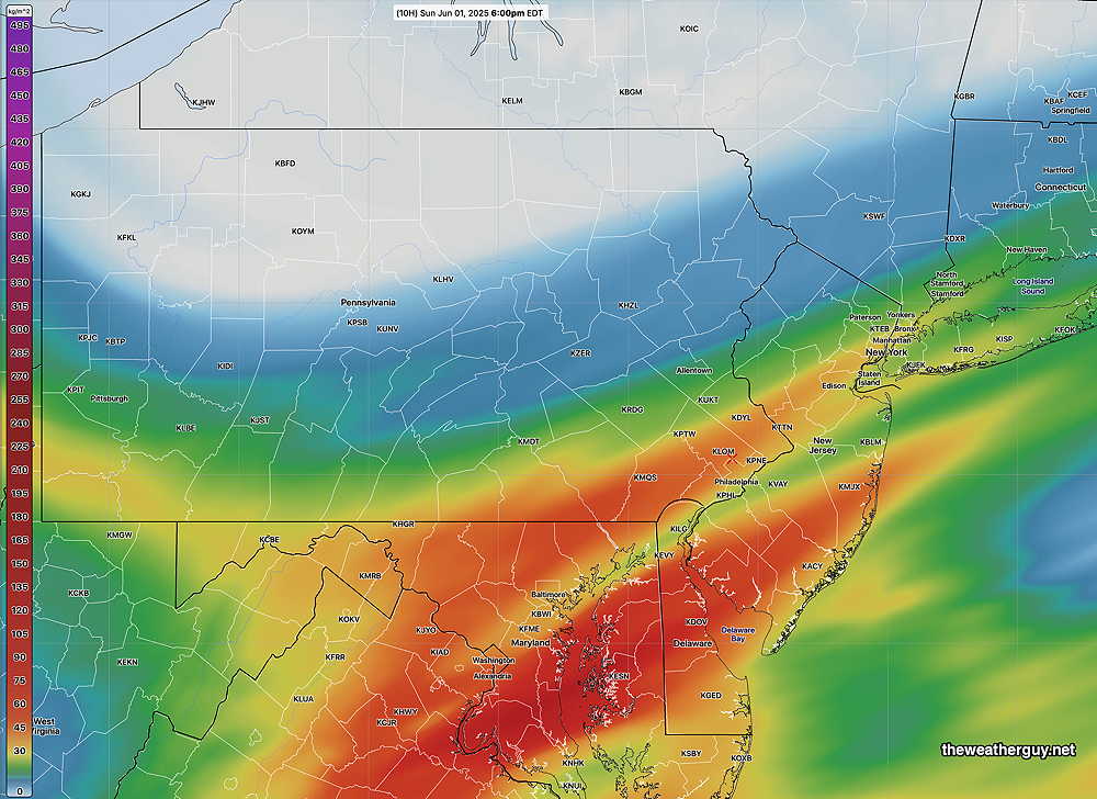
Today, the appropriate sky forecast description is sunshine through smoke. The smoke from wildfires in Canada has made its way to our area in a reduced way. Here’s the latest HRRR smoke model forecast for this afternoon showing plumes of smoke —
Saturday Weather Update
Updated Saturday 05/31/25 @ 9:48 AM — Latest RREF shows the scattered showers as early as 1 PM.
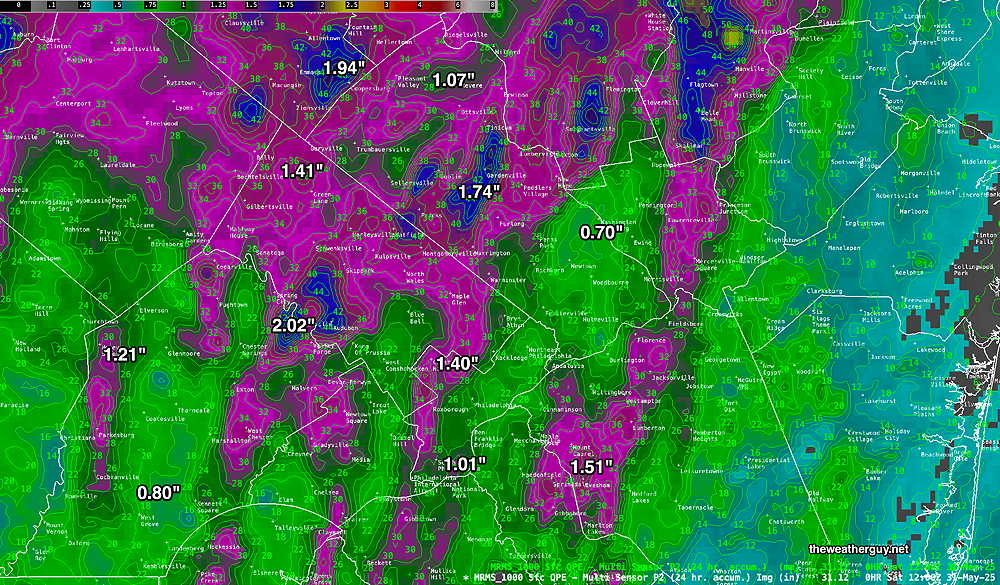
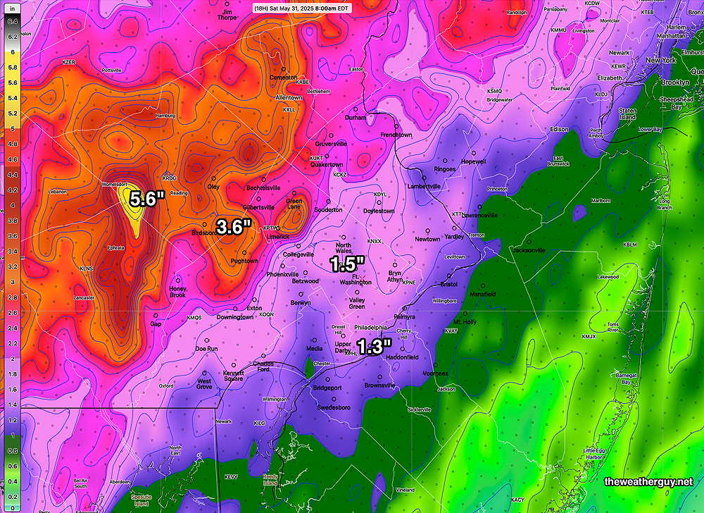
Posted Saturday 05/31/25 @ 9:30 AM — We had the heavy rain last night; rainfall amounts and severity here were not as great as had been forecast possible.
Total rainfall received—
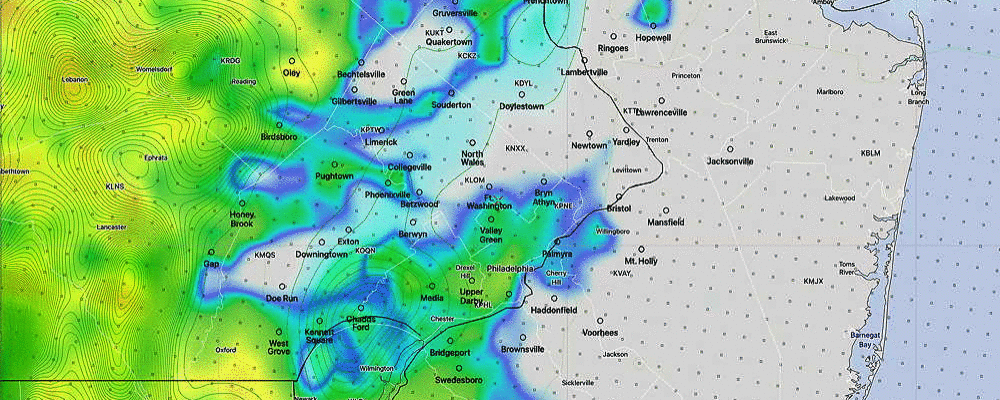
Additional showers are expected with the passage of a cold front this afternoon. Currently, these showers are in northwestern PA—
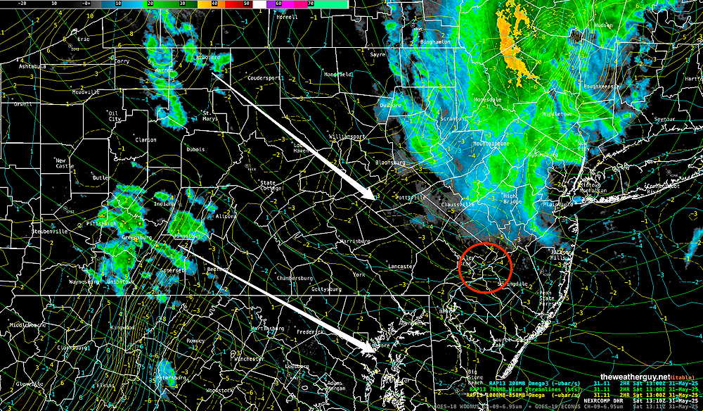
Most models show two areas moving towards us, as shown above, with the heaviest rain to our north and more so to our south.
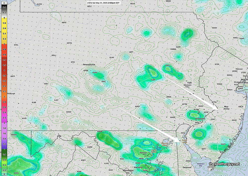
Here’s the current HREF forecast for this afternoon—
A dry day for Sunday with sun mixing with instability cloudiness.
The weather really warms up next week, with temperatures in the mid to upper 80s Tuesday through Thursday.
Heavy Rain Possible Tonight
Posted Friday 05/30/25 @ 6:11 PM — One more thing. Helicity and vertical shear values become highly elevated between 10 PM and 1 AM. The potential for severe thunderstorms and even a tornado is possible, most likely in western suburbs.
Posted Friday 05/30/25 @ 6:11 PM — I’m a little short on time for this forecast, so I’m simply going to focus on Friday night at this point.
Showers and thunderstorms are developing to our south and will move in as early as 8-9 PM and will quickly become widespread by 10-11 PM.
Flood Watches have been issued for parts of the area. Total rainfall by 8 AM Saturday—
Following a break Saturday morning, more rain is expected Saturday afternoon. I’ll update tomorrow morning.