#Philadelphia #weather #PAwx
Looking at the final MRMS totals for yesterday’s storm, precipitation amounts (water or water equivalent) were in some cases 2-4 x as much as the models had forecast and banding occurred directly through Philadelphia—
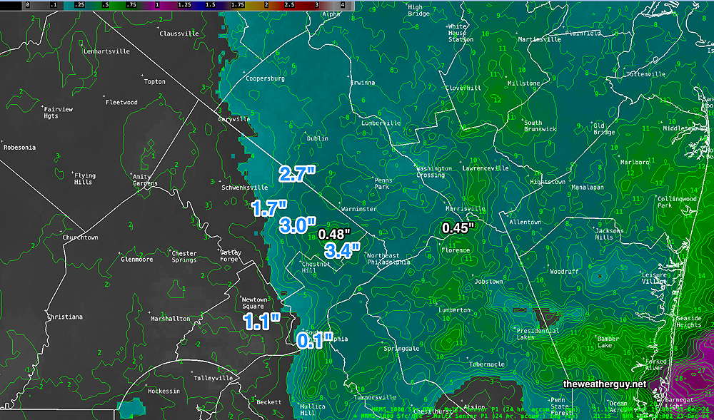
Snow totals can be seen at the NWS site The increase in precipitation rates caused dynamic cooling and temperatures dropped correspondingly in those areas.
The MRMS shows where the most precipitation (water equivalent) fell —
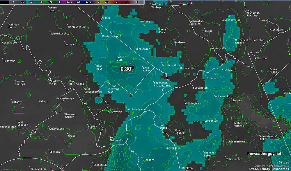
With 0.30″ plus water having fallen in that band, I wouldn’t be surprised if some of those locations have received 2-3+ inches of snow on some surfaces.
Snow Update
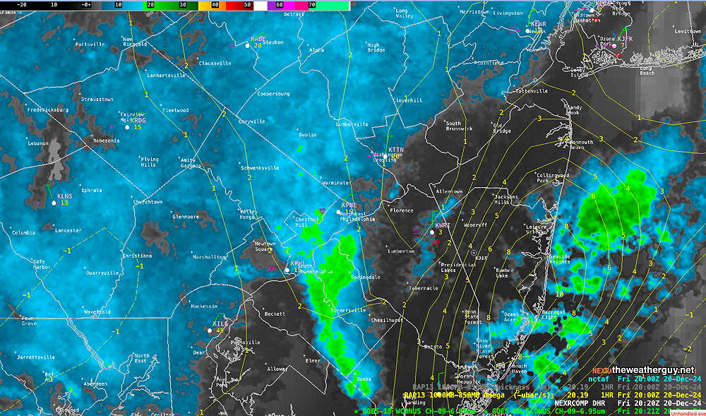
Posted Friday 12/20/24 @ 3:31 PM — As predicted, the snow developed mid afternoon and there are signs that it will increase in intensity later this afternoon into this evening. The on-again, off-again forecast for light snow accumulation is on.
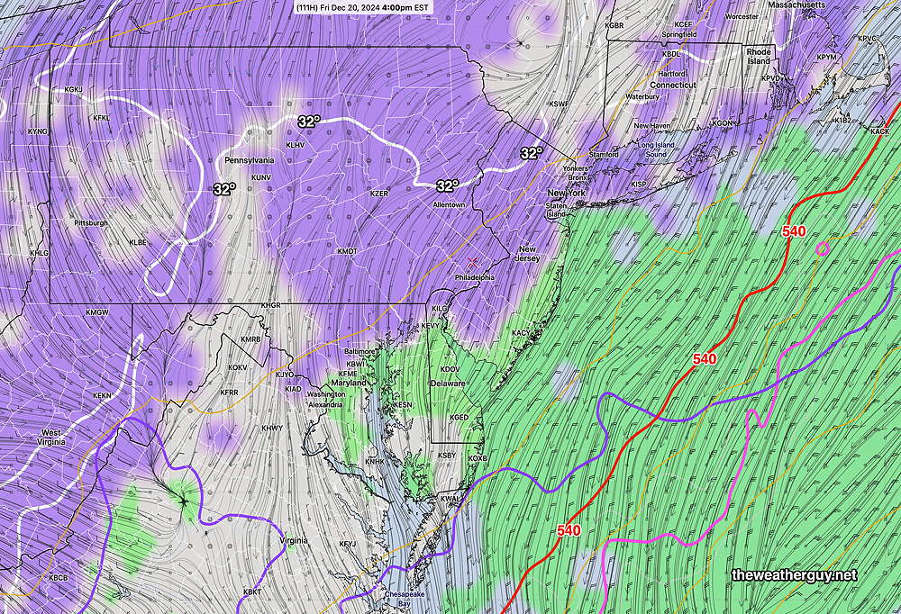
Here’s the current radar/water vapor image—
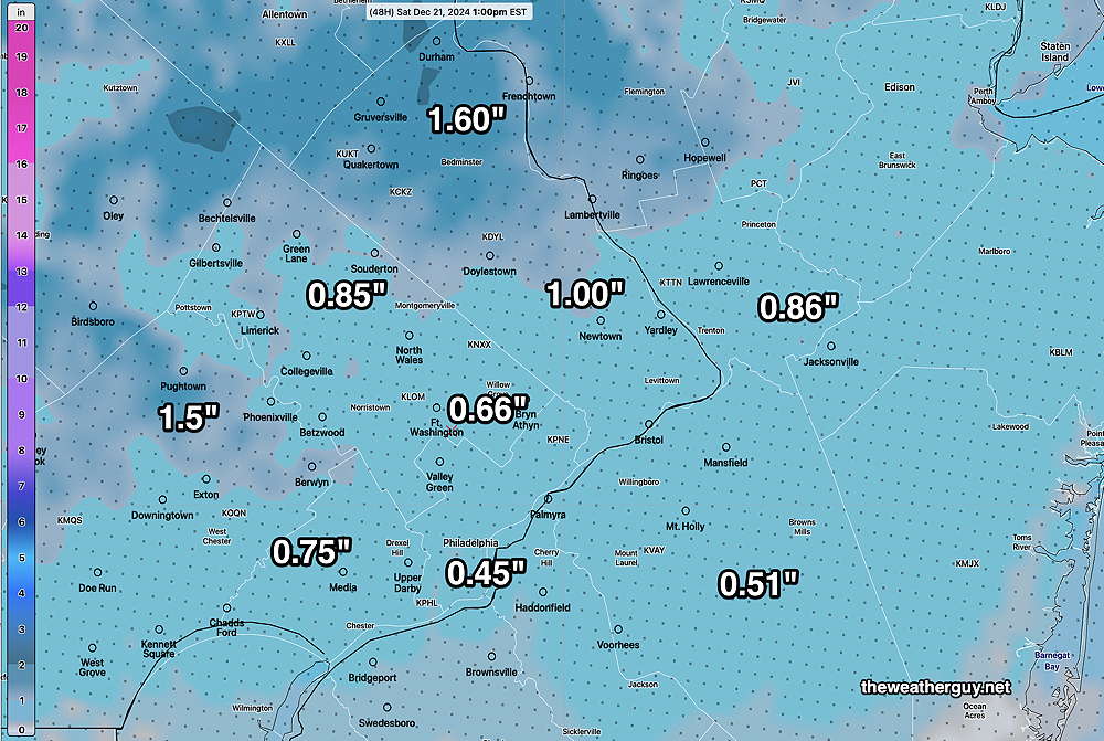
The latest NBM has increased its snow accumulation forecast somewhat. Here’s the NBM (model blend) mean snowfall forecast—
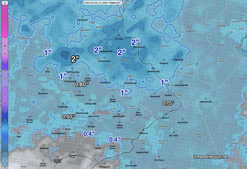
There may be some snow showers early Saturday morning, but most of the accumulation will have ended by dawn.
Another Snow Update
Posted Thursday 12/19/24 @ 9:26 PM — What was a “low confidence forecast” this afternoon is even a lower confidence forecast this evening with the latest 00z NAM, NBM and HRRR models further downplaying accumulations, especially near the city. Here’s tonight’s NBM—
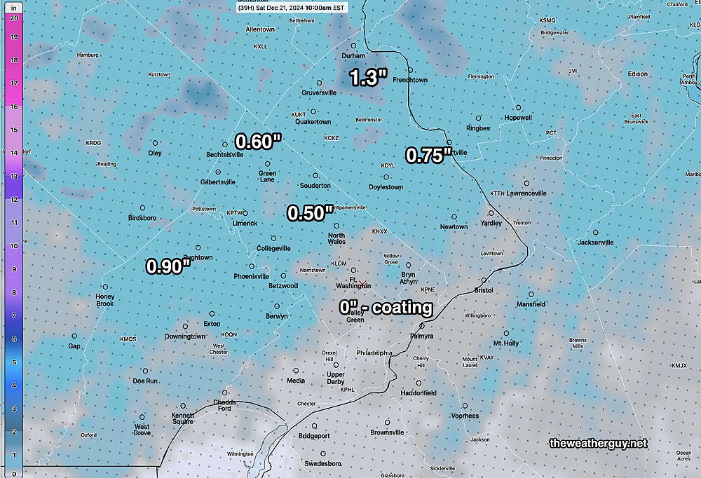
The above forecast snowfall may even be too high.
The reason for the change: less overall precipitation from the Atlantic storm being thrown our way. Add to that a slow-down in the temperatures dropping to 32º near the city, which may not occur until 6-8 PM. This forecast for accumulating snow here has been on-again, off-again since this past Sunday.
A Quick Snow Update
Posted Thursday 12/19/24 @ 5:22 PM — While I was preparing the last posting “A Coating of Snow Possible”, the ECMWF became available. It has significantly more snow than even the latest GFS. The ECMWF has as much as 2-3 inches in northwest suburbs and 1 maybe 2 inches just west of the city. I’m not going with the ECMWF forecast at this time and staying with the GFS and NBM.
A Coating of Snow Possible
Posted Thursday 12/19/24 @ 4:30 PM — Let me start by saying this is a low confidence forecast and weather scenario. Weak low pressure dropping down merges its energy with a storm in the western Atlantic. Those of you who are regular visitors here know that this was an on-again off-again forecast since Sunday
We’ll be receiving some precipitation from the initial impulse along witih some wrap-around moisture from the Atlantic storm, according to the models.
The models are “cranking out” anywhere from 0.06″ to 0.15″ of precipitation water equivalent. Much of this will be falling where near- ground temperatures are several degrees above freezing. Combine this with the actual surface ground temperature (“skin temperature”) above freezing and you have ingredients for a blown accumulation forecast.
Here’s the uncertainties— the actual precipitation (water equivalent) may be higher or lower than forecast with these merged-type systems. Temperatures at the ground and aloft may be colder…or warmer than forecast.
The error range of forecast snow accumulations with this system is magnified with snowfall amounts so low. And the degree of melting will be higher than usual.
The model blend (NBM) is the best choice here and below is is its mean (average) forecast snowfall accumulation which includes snow showers early Saturday morning—
Those who remember their basic statistics courses know that when the mean and the median forecast totals differ significantly, it suggests wide standard deviation and high uncertainty. Such is the case here.
Some light wet snow or snow with mixed with rain starts about 12-2 PM Friday, especially northwest areas. More coverage and and change to snow with melting on many surfaces through midnight Friday. Very widely scattered snow showers possible Saturday morning into the afternoon.
Not much accumulation expected on roadways for most of the event. The snow showers Saturday morning may leave a dusting.
Stay tuned for updates.
Forecast Update
Posted Wednesday 12/18/24 @ 5:32 PM — Some afternoon models are again showing precipitation moving in from a system out in the Atlantic, although the ECMWF AI model have backed away from that. This forecast has been on-again, off-again.
Here’s the tricky thing about the ‘snow’ forecast for Friday afternoon/evening— critical temperatures several thousand feet above ground are all cold enough for snow. However, temperatures of the ground and near the surface are several degrees above freezing—
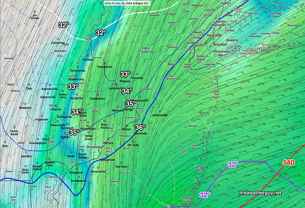
Temperatures aloft support snow, but ground temperatures are forecast to be too warm for accumulation, except in northern Bucks county where a coating is possible.
So we may see some wet snow or snow showers Friday afternoon and evening, but it likely won’t accumulate in the immediate Philadelphia area and surrounding suburbs. (Unless precipitation rates are greater than forecast and dynamic cooling occurs.)
Update Wed 12/18 11:50 AM — No sooner than when I posted the “on-again off-again” very light snow forecast for Friday night that today’s morning models became available. They’ve substantially backed off on any accumulations and snow showers for Friday night.
This may change again, but for now, we’ll have to wait later in the season for any snow here.
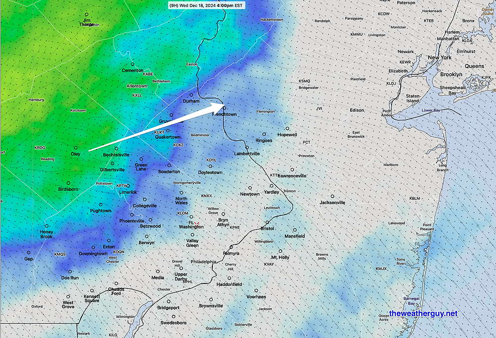
Posted Wednesday 12/18/24 @ 9:22 AM — First, light rain is expected to move into western suburbs about 4 PM today (Wednesday) and the rest of the city about an hour later according to the model blend (NBM) . The heaviest rain is forecast to move to our north, according to the latest HRRR.
For Friday, according to the NBM, most of the area will see snow or rain mixing with and changing to snow Friday night into Saturday morning. How much accumulates will be tricky, since ground temperatures have been warm. Here’s the Canadian RGEM snow accumulation forecast—
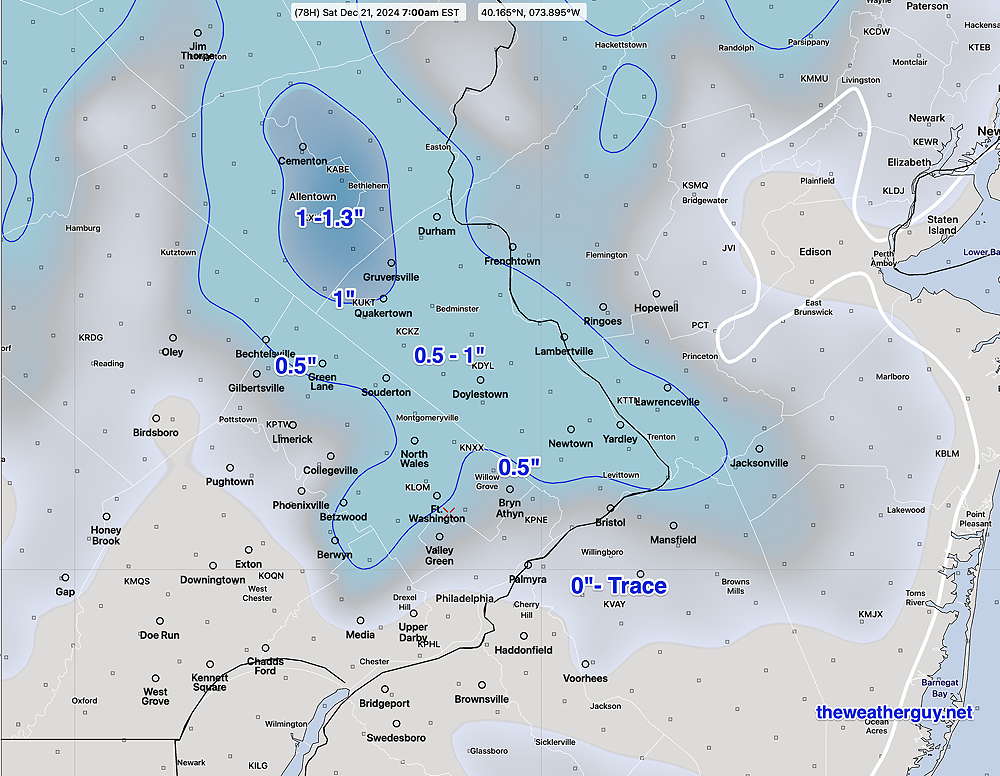
The NBM shows additional light snow flurries early Saturday morning. Very gusty winds Saturday.
Stay tuned for updates later today.
Models again showing light snow late Friday.
Posted Tuesday 12/17/24 @ 6:01 PM — The GFS and ECMWF are again showing light snow or snow showers Friday evening/night through daybreak Saturday. This snow shower forecast has been on-again off-again since Sunday.
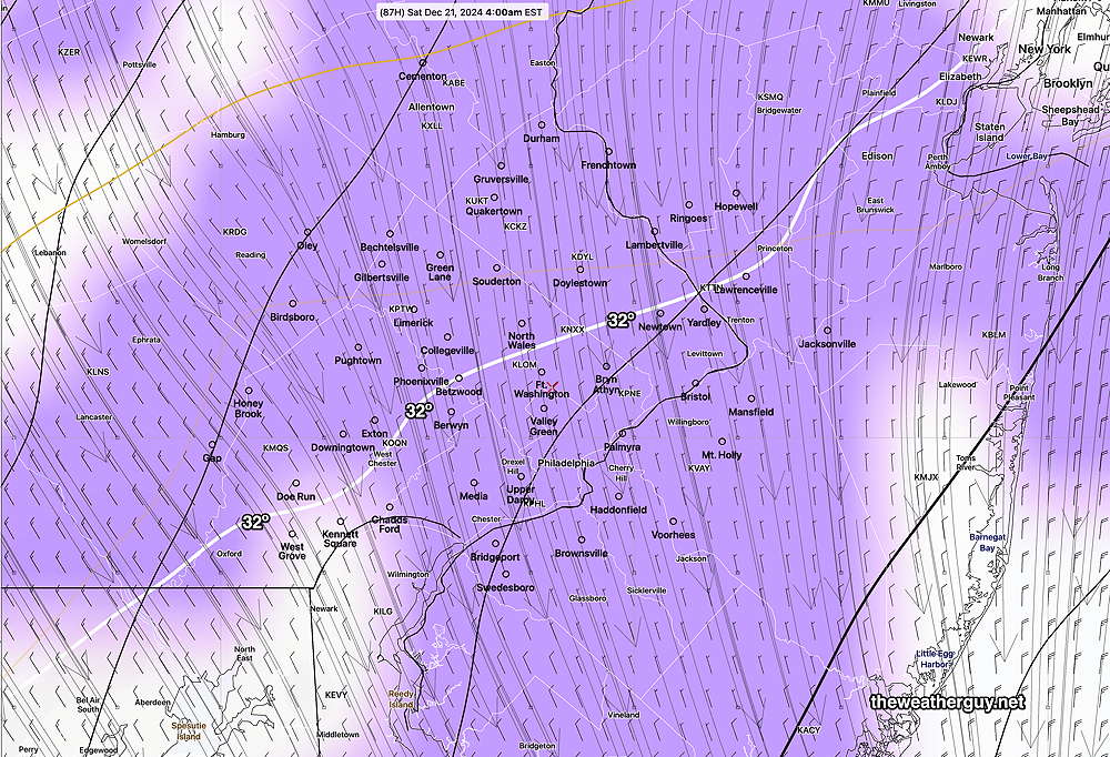
Areas in northwestern Chester/Montco/Bucks counties may see a coating up to 3/4″ fading to zero near the city, according to the latest GFS.
The ECMWF shows similar very low accumulation totals, with total water equivalent in the 0.1″ range. Very cold weather through Christmas eve with a slight warmup Christmas day. The above average temperatures I spoke of yesterday may not get here until later that week.
How Much Rain Did We Get?
We’ve had two periods of rain since Sunday early evening. The total rainfall we received is shown by the MRMS—
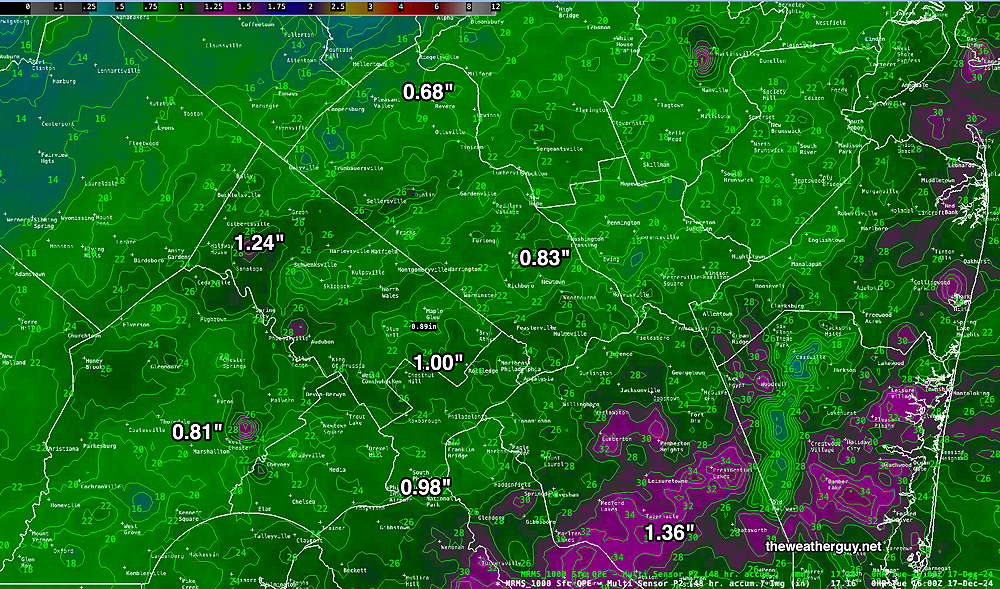
Another 0.20″-0.40″ of rain is expected starting later Wednesday afternoon into Thursday morning.
Forecast Update
Update Mon 12/16 9:44 PM — Tonight’s models have moved the start of the rain on. Wednesday earlier,, to early afternoon.
Posted Monday 12/16/24 @ 7:39 PM — Following the warm front that moves through tonight with showers, high temperatures on Tuesday will be in the upper 50s to near 60º with mostly sunny skies by late morning. It will be somewhat windy.
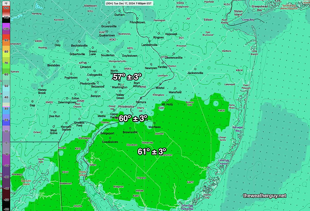
A cold front moves through Wednesday night with more rain.
Things have already changed for Friday. No snow expected, as the dip in the jet will be further east than previously forecast and will not be as amplified.
The extended forecast for Christmas and Christmas day is for temperatures to be above average. No chance of snow currently seen.
Rain
Posted Monday 12/16/24 @ 8:29 AM —As discussed yesterday, we’ll have several rounds of rain this week. The GFS and ECMWF are showing about 1″ to 1-1/2″ of rain total, including this morning, tonight and Wednesday night.
Two cold fronts move through Thursday and again later Friday. A secondary low may form off the coast, now likely Friday instead of Saturday (as discussed yesterday) and the GFS is showing light snow Friday afternoon and evening. This low will move far off the coast, so this won’t be any sort of snow storm here. Temperatures will be borderline here near Philadelphia, so there may be little or no accumulation around the city.
As far a precipitation type—
Stay tuned for updates.
Originally Posted Sun 9:28 PM —A warm front will slowly move across our area tonight through Monday with light rain in our area. Some areas of fog and drizzle appear likely to occur Monday morning.
Heavier rain is expected with the actual warm front, followed by a cold front Monday night into Tuesday morning. Clearing Tuesday afternoon.
Another disturbance ahead of stronger cold front is expected late Wednesday into Thursday with additional rain. Colder weather expected Friday through next weekend.
What about snow?
Like last year, there hasn’t been much of a signal or pattern for snow here, although there are elements in recent jet stream dips that show some potential.
The first is later on Thursday, following the cold front. Some snow showers are possible, although not currently predicted.
A few disturbances may pass through either Friday or Saturday.
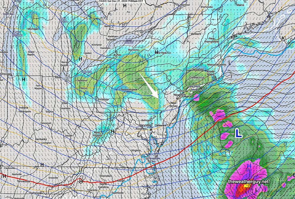
The ECMWF is showing the possibility of light snow from a clipper disturbance moving through on Saturday. A developing secondary low off the coast may rob our area of the energy and moisture and the forecast jet configuration is too flat for any substantial storm. That said, the current ECMWF is showing the possibility of a period very light snow on Saturday. I’ll keep an eye on it.

