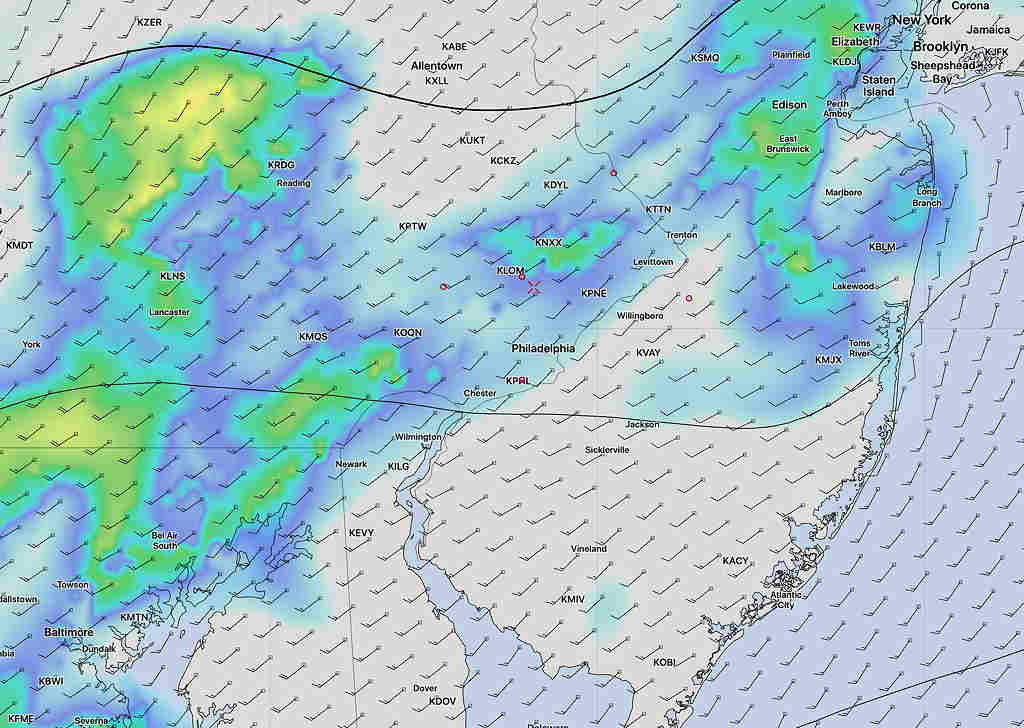
A brief update: This morning’s models just coming in ( it’s Daylight Saving Time, so they’re in an hour later) are not consistent with the shower/thunderstorm threat today.
Most of the short range models have light showers developing between now and 2 PM with the greatest threat north and west of Philadelphia.
The latest HRRR (High Resolution Rapid Refresh) model is similar, keeping the showers mostly to the west of Philadelphia, although it has some showers moving into Philadelphia before noon and 2 PM.