
#Philadelphia #weather #PAwx
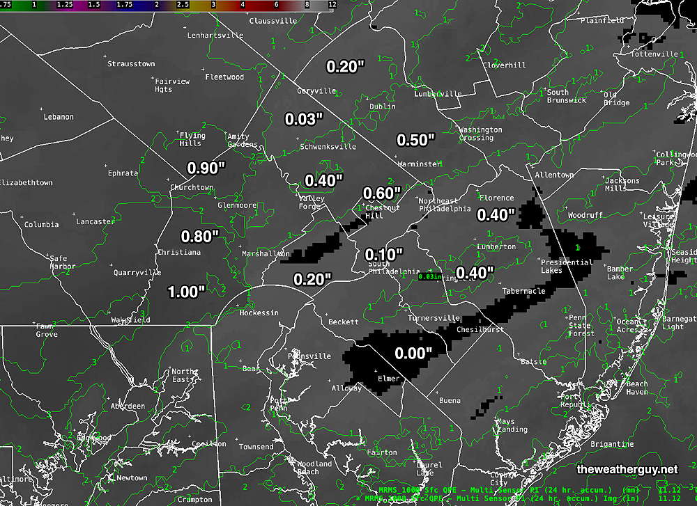
Here’s an estimate of last night’s actual snowfall based on MRMS total precipitation (water) with modest 10:1 snow water ratio—
The latest models have sunshine breaking out between 2 and 4 PM today.
Snow Update
Posted Friday 01/10/25 @ 9:45 PM — Tonight’s early models (HRRR, NAM) have trended towards higher snow accumulations than previously forecast earlier today. The HRRR is forecasting a generalized 1.2″.
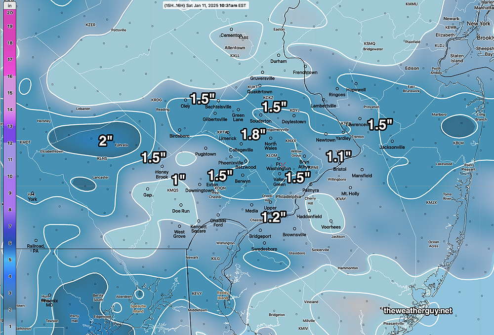
The latest NAM, below, is forecasting considerably more snow right over Philadelphia —
One always has to be cautious about posting new model forecasts a few hours before an event is expected to start. There is a phenomenon called “model spin-up time” which is a several hour period early in a new model forecast that often doesn’t accurately capture the recreation of the atmospheric conditions. I’m not sure if the increased snowfall forecast is the result of this phenomenon. I guess we’ll see tomorrow morning.
Previously Posted Fri @ 5:44 PM — —Low pressure will move through the Carolinas tonight. We’ll be on the northern periphery of the precipitation shield. Temperatures will be cold enough for snow, but this will be a minimal snow ‘event’ for our region. The snow accumulation forecast continues to decline. High pressure builds in for Sunday.
Saturday Forecast
Cloudy with light snow ending by 8 AM. Total accumulations will be minimal, mostly less than 0.5″ in most places. A mix of clouds and sun through the day. Light winds in the morning becoming gusty late afternoon and evening.
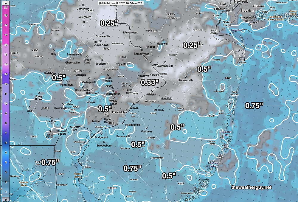
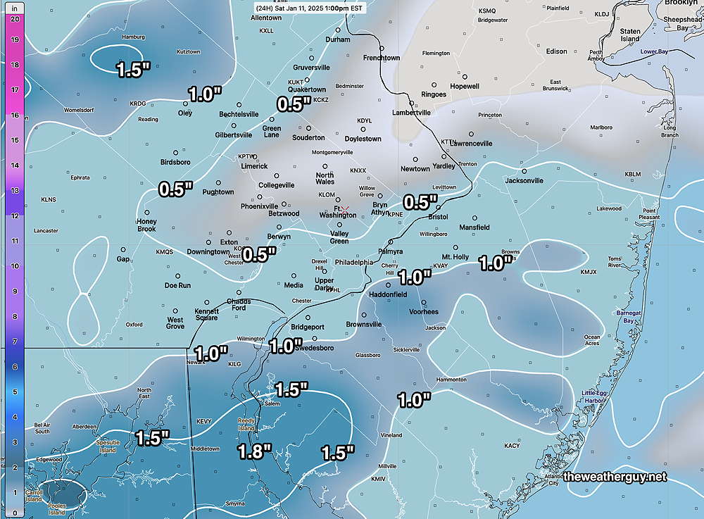
No snow forecast is complete without the NAM model—
NBM high temperatures: Blue Bell, PA 34º Philadelphia, PA 35º
Low uncertainty (based on standard deviation): ± 1.4º
Sunday Forecast
Sunny. Breezy in the morning, winds subsiding in the afternoon.
NBM high temperatures: Blue Bell, PA 39º Philadelphia, PA 40º
Low uncertainty (based on standard deviation): ± 1.4º