#Philadelphia #weather #PAwx
Forecast Review
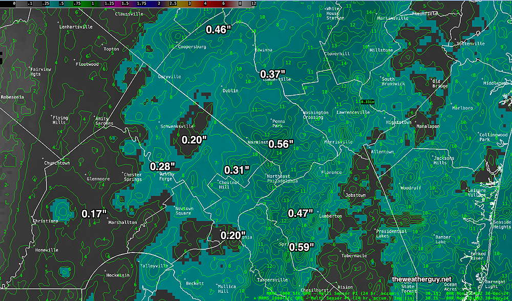
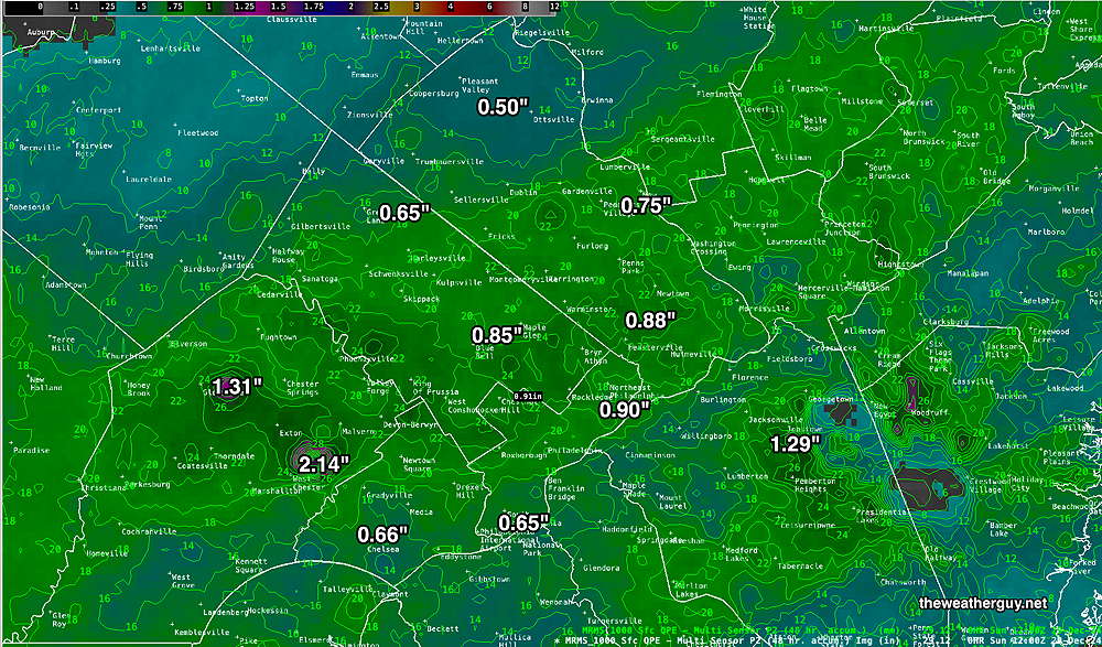
Sunday night’s actual rainfall was within the range of the model forecasts—
Forecast Update
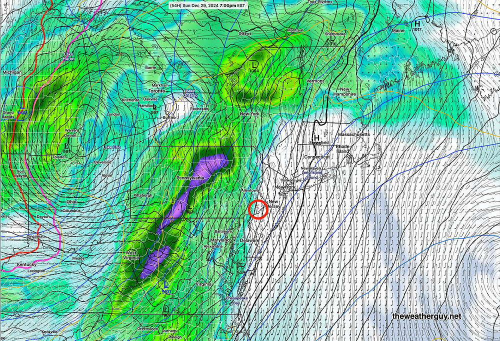
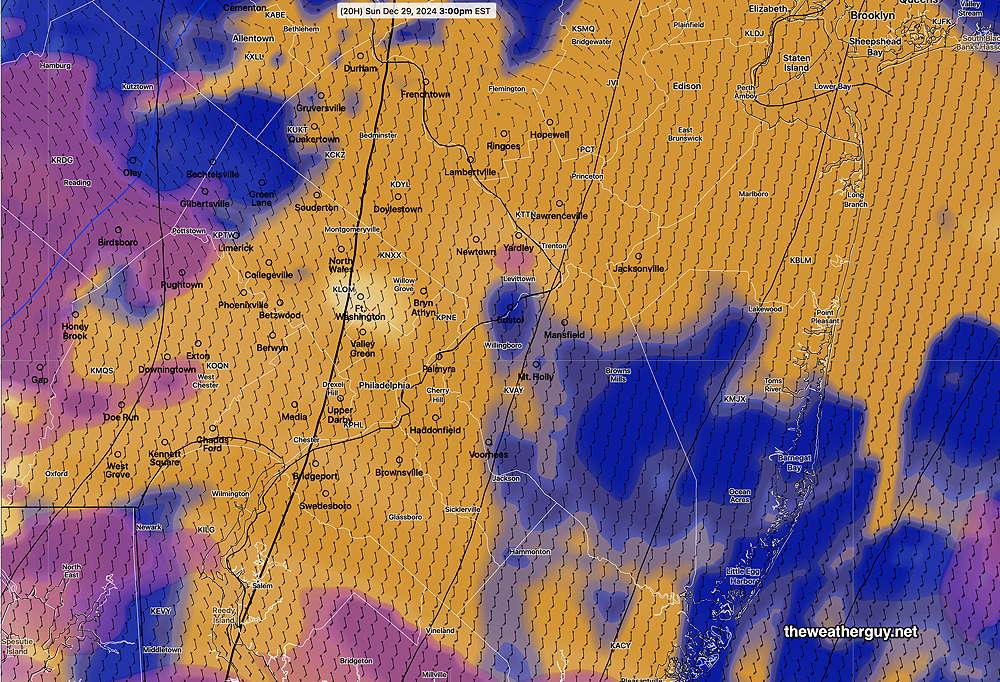
Posted Sunday 12/29/24 @ 4:45 PM — Radar is beginning to pick up some light developing echos just to our south. The main area of rain will move in between 8 PM (western areas) and 9 PM (closer to the city).
It has already gotten windy and winds will continue to increase this evening. Total rainfall will be somewhat less than predicted yesterday with totals in the 0.25-0.40″ range.
Sunday Forecast Update
Posted Sunday 12/29/24 @ 8:49 AM — Most areas have had less than an inch of rain over the past 48 hours, less than originally forecast—
The 1 AM run of the NAM-NEST (06z) has joined the other models in predicting some bright skies and sunshine developing from east to west about 11 AM. It forecasts only 2 hours of these bright conditions before lower clouds move in. The latest HRRR (12z) still maintains bright skies and even some sun for much of the afternoon.
The HRRR has showers moving in from the west about 9 PM with some widely scattered activity a few hours earlier, about 7 PM. The total additional rainfall forecast has been downgraded to ad additional 0.5″ Sunday night.
Sunday Forecast Update
Posted Saturday 12/28/24 @ 9:52 PM — Here are the salient points about the Sunday’s weather forecast—
- Low clouds and drizzle persist through much of the morning.
- Precipitation ends by noon.
- Most models have breaks of sunshine and no rain in the afternoon.
- Increasingly windy in the afternoon and evening
- High temperatures in the low 60s
- Rain moves in between 6 PM and 8:30 PM from the west
- Rainfall may not be as heavy as originally forecast; about 0.5″ Sunday night.
Of interest are today’s runs of the NAM-NEST which maintains low clouds and even some drizzle in the afternoon with scattered showers breaking out late afternoon. The latest model run, just available has the same forecast. This is an outlier forecast, but regular visitors here know my mantra, “Never ignore the NAM”. So I guess we’ll see what happens.
Go Eagles!
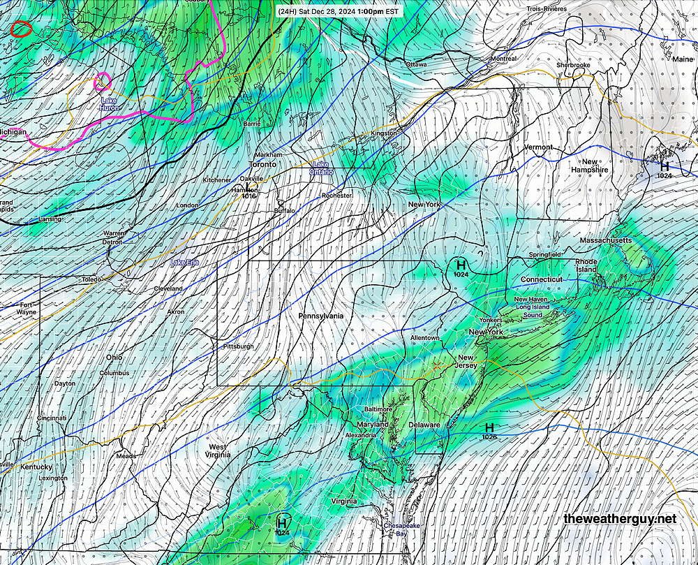
Saturday Forecast Update
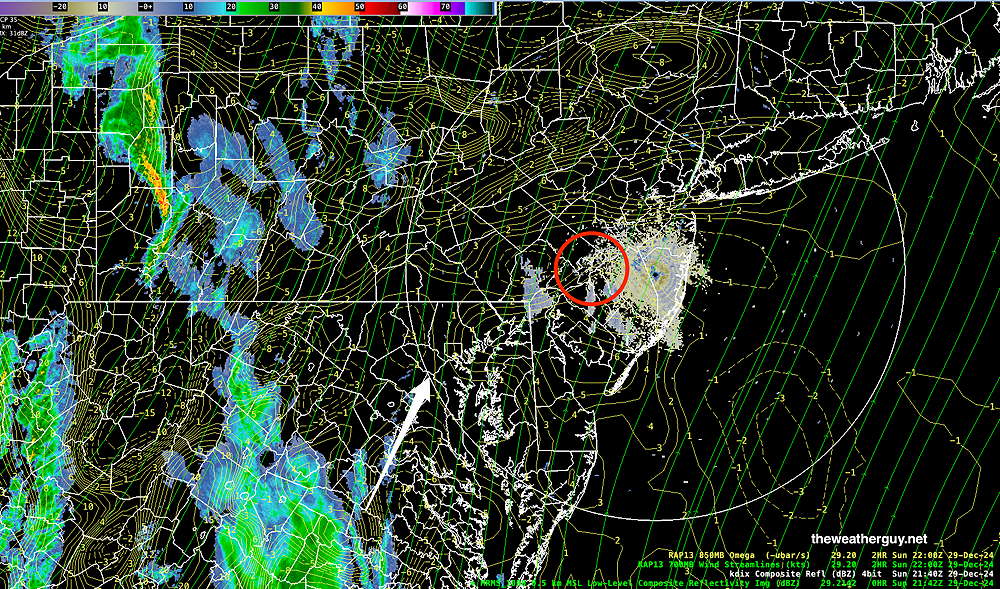
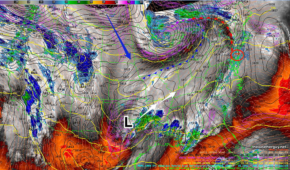
Posted Saturday 12/28/24 @ 10:02 AM — The rain moved in and will remain with us for much of the day. Current RAP model analysis shows minor areas of upward vertical motion that will move in our direction during the day and night time hours—
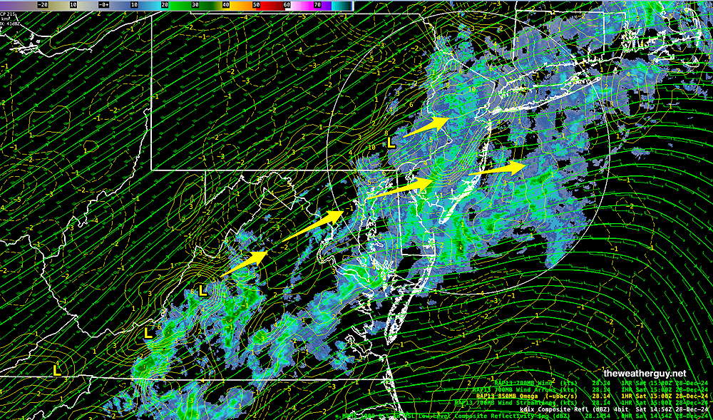
For Sunday, a system is developing along an inflection area of the jet stream along the Gulf Coast. This will move towards us bringing rain Sunday night into early Monday—
The GFS is still showing a pause in the rain for Sunday afternoon and even some sun in Philadelphia and areas eastward, but the latest NAM-NEST model shows some lingering light drizzle and sprinkles in the city during the game. I’m leaning towards the more optimistic GFS forecast at this time for the Eagles game. Heavy rain expected Sunday evening and night beginning about 7-8 PM from west to east.
Previously Posted Fri @ 11:03 PM — —Two low pressure systems will affect our weather this weekend. The first will last through much of Saturday. Luckily, the second system, as forecast with prior updates Thursday and Friday, will remain to our west for the afternoon on Sunday. The Eagles game should be mostly dry with even some breaks of sun.
Rain begins here around midnight (Friday).
Saturday Forecast
Rain for much of the day, tapering off towards evening, except continuing in South Jersey.
NBM high temperatures: Blue Bell, PA 48º Philadelphia, PA 51º
Average uncertainty (based on standard deviation): ± 1.4º
Sunday Forecast
Clouds lift for some bright spots and even some sun (especially in NJ) Rain moves in about 6 PM and continues heavy at times through the night. Increasingly windy and gusty during the afternoon and night time hours.
NBM high temperatures: Blue Bell, PA 62º Philadelphia, PA 64º
Slightly above average uncertainty (based on standard deviation): ± 2º