#Philadelphia #weather #PAwx #Drought #hurricane
Potential Hurricane Update
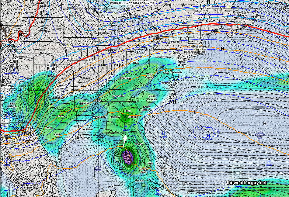
Posted Saturday 11/02/24 @ 4:53 PM — The latest artificial intelligence version of the ECMWF, the ECMWF-AIFS, has been totally consistent with its forecast development of a hurricane moving north towards the panhandle of Florida next Thursday.
The operational models and the statistical ensemble models are more divergent with the development and track of this tropical system. In fact, several of the models have any intensification of the hurricane being damped off and absorbed by generalized low pressure in the Gulf of Mexico.
Here’s the operational ECMWF forecast for Thursday—
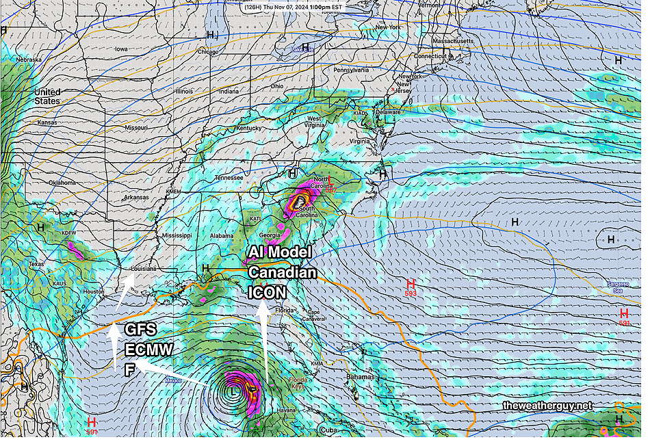
Due to the incredible forecast accuracy of the ECMWF-AIFS with Milton and Helene, I’m still leaning towards its forecast for this possible storm—
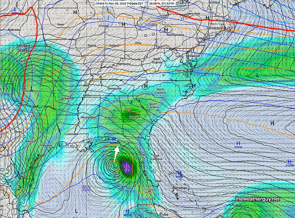
Interestingly, the moisture from this system has a good chance of giving us some rain next weekend. But let’s not celebrate yet.
Where there’s Smoke there’s Fire
Posted Saturday 11/02/24 @ 11:02 AM — The local drought has resulted in forest fires. In my neck of the woods Thursday night, there was a strong smell of smoke.
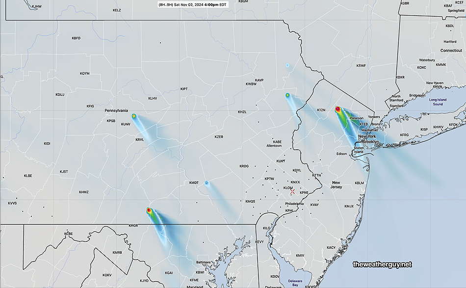
The HRRR model (along with the upcoming RRFS model under development) has a smoke plume forecast component. Here’s the latest HRRR showing forest fire sources and smoke plume trajectories—
Regarding the potential hurricane this coming week, the ECMWF-AIFS is consistent with its forecast track. The regular ECMWF and the GFS are not all that confident or consistent about the track/development.
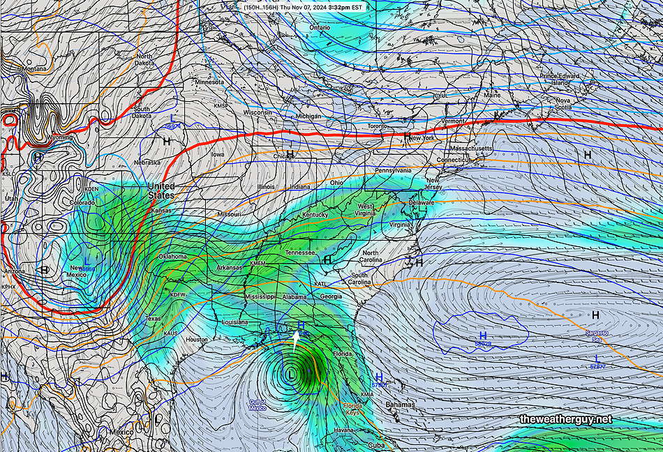
Here’s the latest ECMWF-AIFS forecast for Thursday—
Originally Posted Fri 5:01 PM —Our dry, sunny weather continues for this weekend and likely into much of next week, as high pressure builds in and a strong upper air ridge takes hold next week.
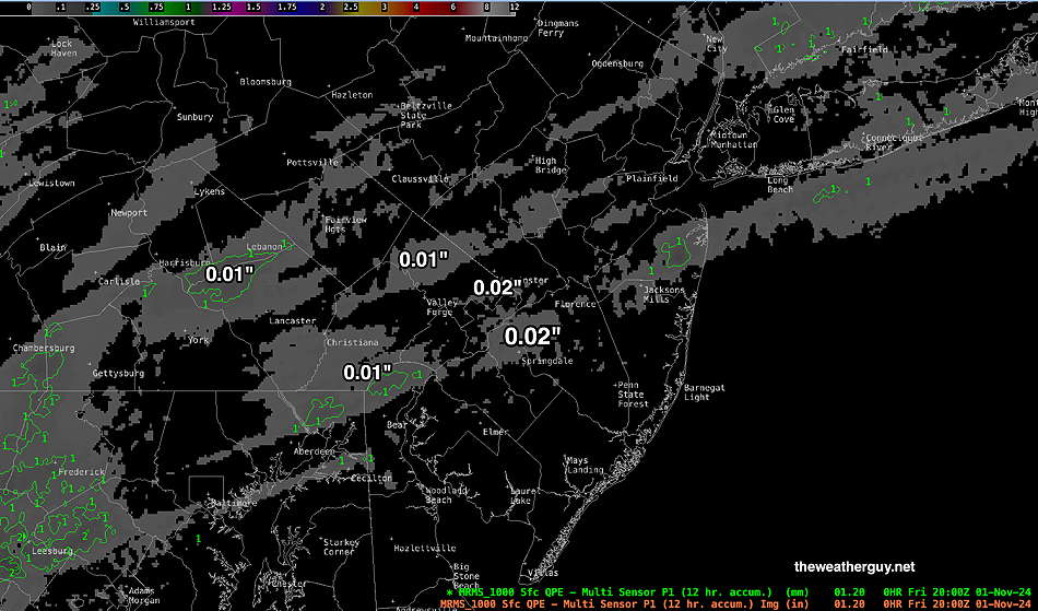
BTW, we had a few drops of rain this morning in some areas. Rainfall was in the 0.01 to 0.02″ range.
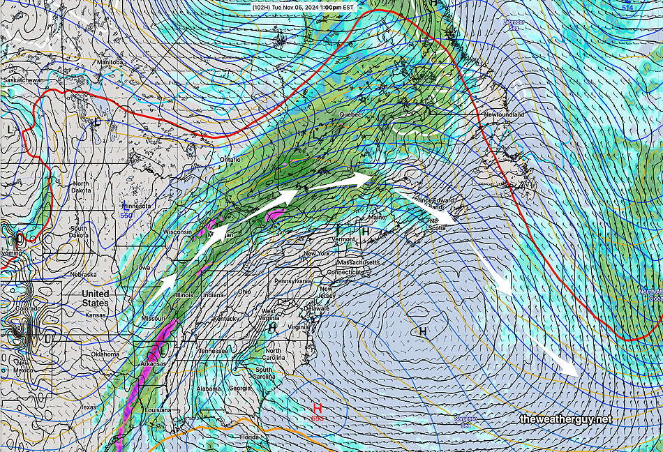
The strong upper air ridge will keep rainfall out of our area and despite a cool down this weekend, temperatures will rebound to above average next week.
Of interest is the continuing strong signal for hurricane development next week in the Gulf of Mexico. The Canadian Global has joined with the German ICON and the ECMWF-AIFS model in predicting this storm. Our GFS is somewhat on board, but it has the storm meandering in the Gulf, and is not likely an accurate forecast. The AI version of the GFS is also showing development with a northwestern track.
There is a reasonable chance that some of the moisture from this storm will affect our weather next weekend.
Here’s the latest ECMWF-AIFS—
