#Philadelphia #weather #PAwx #Drought
A Few Drops of Rain
Posted Friday 11/01/24 @ 8:17 AM — I set up today’s forecast as a “model test”, with the ECMWF consistently forecasting some light shower activity and the GFS moving through with no showers.
We have light shower activity moving through, as forecast by the ECMWF—
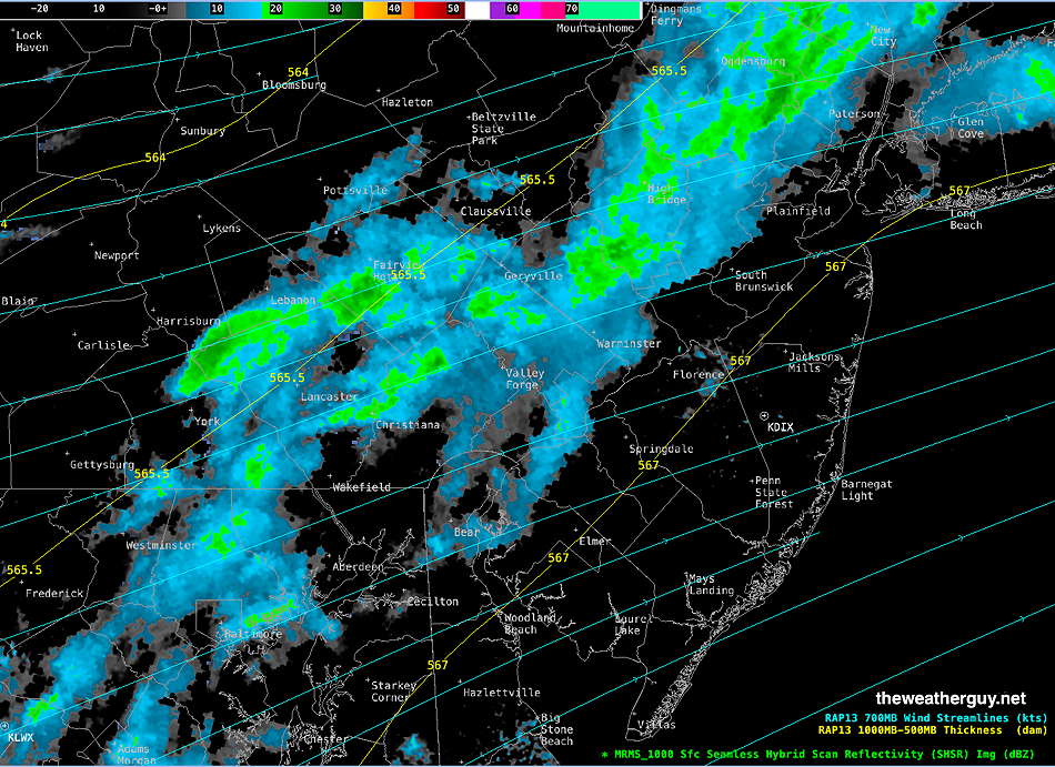
Today’s front will take time to move through and we’ll continue with mild temperatures for Friday. Cooler, more seasonable air doesn’t filter in until Saturday.
The ECMWF-AIFS model continues to show a hurricane moving towards the Gulf Coast next week. The track has trended a bit further westward. Here’s the latest forecast for next Friday—
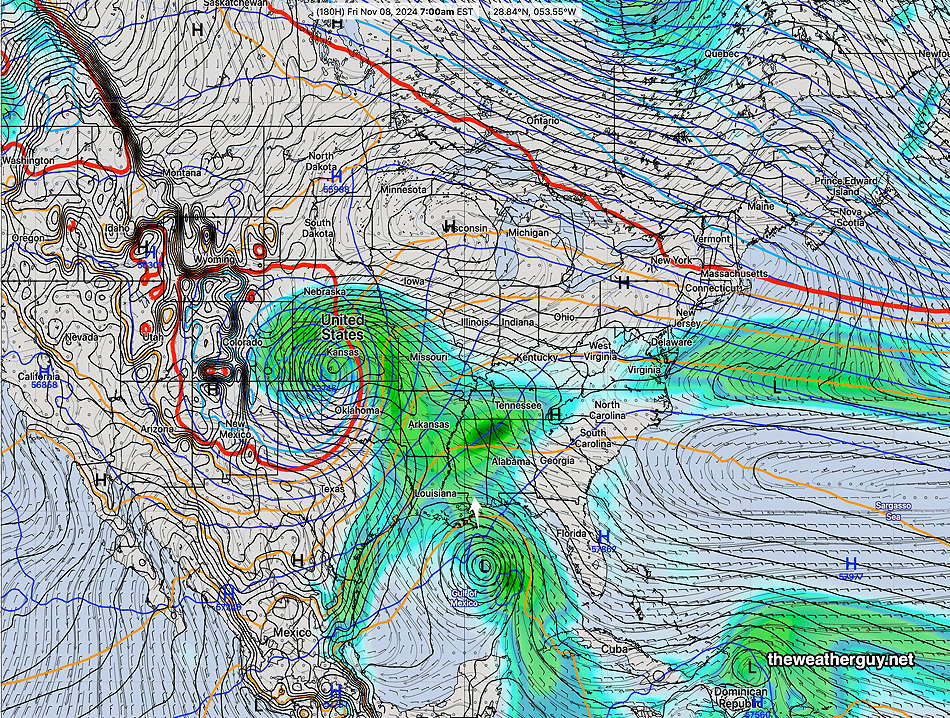
The GraphCast GFS AI forecast doesn’t show this, but the operational German ICON model consistently does.
While not a sure thing, the track of this storm may be enough to break our dry weather pattern.
Another Hurricane?
Posted Thursday 10/31/24 @ 4:45 PM — The latest ECMWF-AI has become available. Here’s its forecast for next Friday—
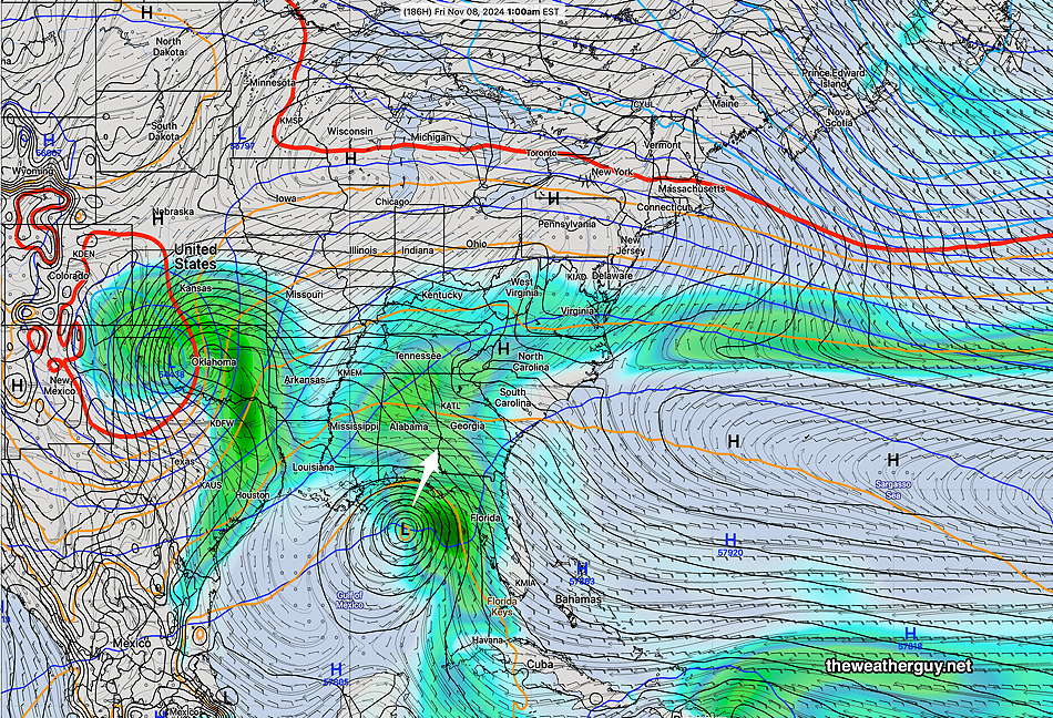
Not a good thing for the Gulf Coast, but we may eventually get some rain from this system .
Model Test for Friday
Posted Thursday 10/31/24 @ 2:56 PM — No significant change in the forecast for Friday; the ECMWF continues to spit out some light sprinkles in the mid morning hours while our GFS has us cloudy but dry.
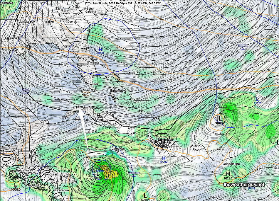
An “interesting” development: The extended range forecasts are beginning to show a strong signal for another hurricane to develop in the Gulf of Mexico and for it to move northward along the western coast of Florida next week. (Updated- possibly westward into Texas) The ECMWF-AIFS, which had been so skillful forecasting Milton, is showing this storm, as is our GEFS, Also of interest is the German ICON model, which has been showing distinct development for a couple of days, somewhat before the AI models—
One More Thing
Posted Wednesday 10/30/24 @ 9:00 AM — The near 80° temperatures for Halloween have been well-advertised. One more thing: it looks like it will be quite windy and gusty on Thursday and even more so Friday.
An Interesting Test for the Models
Posted Wednesday 10/30/24 @ 8:29 AM — I think we’d all like to see a little rain on Friday with the upcoming cold front passage. As we all know from recent months, any shower activity to our west has dissipated as it moved eastward through Philadelphia due to persistent blocking high pressure.
Current NOAA model forecasts are showing the same highly diminished rainfall. The same as true from the Canadian models.
Interestingly, the ECMWF and German ICON models have been consistently showing a line of showers moving through Philadelphia late Friday morning—
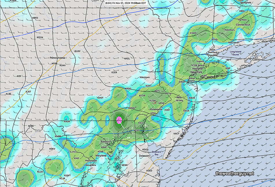
This shower forecast has been supported by the ECMWF-AIFS model but not the GFS AI model (Graphcast GFS). It will be interesting to see how everything plays out. We could use the rain.
Update
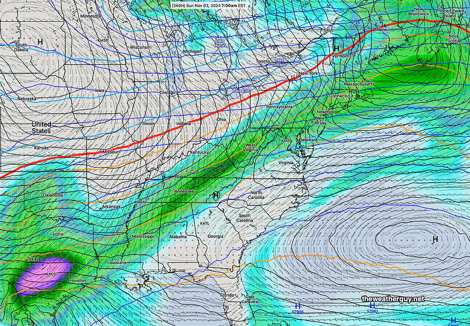
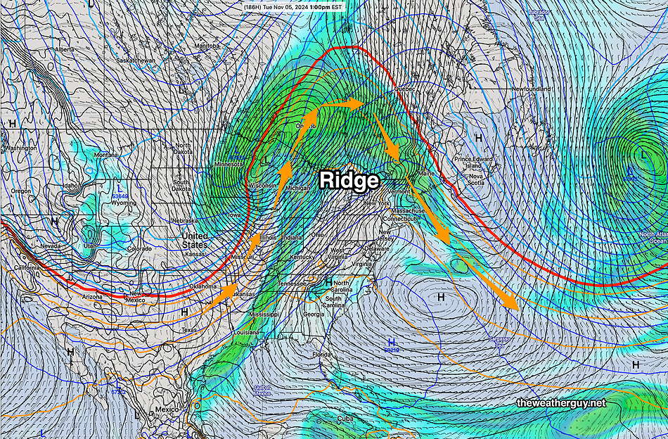
Posted Tuesday 10/29/24 @ 9:36 AM — As mentioned in my earlier post today, the conditions conducive to rain here next week have disappeared from the latest extended range and AI models. In fact. it’s hard to imagine a more accentuated upper level ridge over us that impedes development of rain—
Hoping for Rain
Posted Tuesday 10/29/24 @ 8:40 AM — Our current very dry period is not going to go away easily. A cold front moving through Friday morning into the afternoon had been promising to bring some showers. The latest GFS and GEFS have backed off considerably on that promise, although the ECMWF is still showing some light shower activity Friday morning. The AI models are showing very light shower activity, but the trend is towards little rain. The model blend (NBM) has trended towards no showers.
On top of that, the unsettled, possibly rainy period that’s been promised for the first week in November is also looking less of a sure bet.
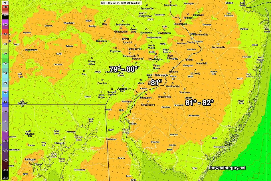
Temperatures still look incredibly warm for Halloween. The latest NBM has moved back towards the low 80s in many areas!
Increasingly Warm
Posted Monday 10/28/24 @ 9:30 AM — Increasingly warm temperatures expected through Thursday. The NBM has backed off on some of the 80º temperatures a bit with much of the region in the upper 70s.
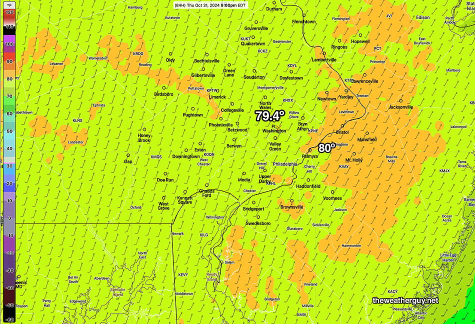
An increasing signal for some showers with a cold front early Friday (GFS) or afternoon Friday (ECMWF). Maybe 0.10 to 0.20″ rainfall, although still not a sure bet in all areas.
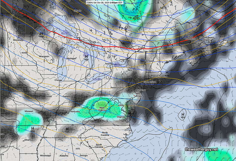
Originally Posted Sun @ 7:14 PM — —An upper air ridge will build through Thursday, bringing us sunny skies and increasingly warm temperatures. Indeed, temperatures may approach or exceed 80º on Thursday, Halloween.
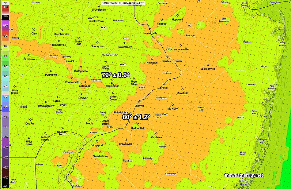
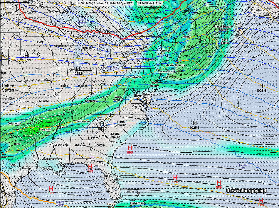
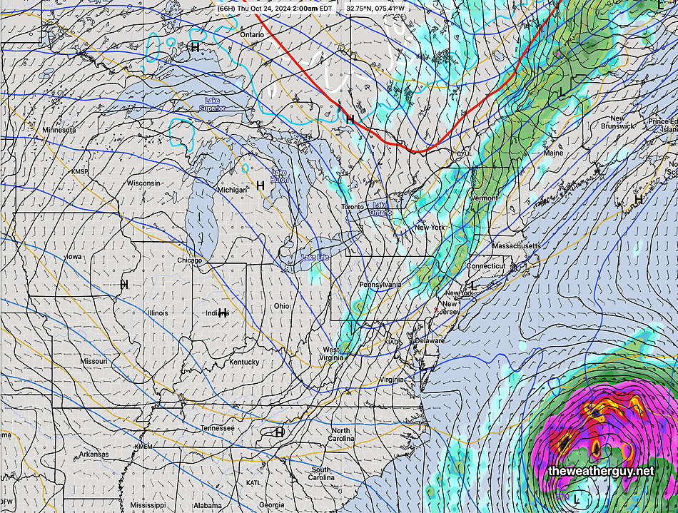
High pressure moves off late Thursday, as a cold front brings a chance of some showers here—
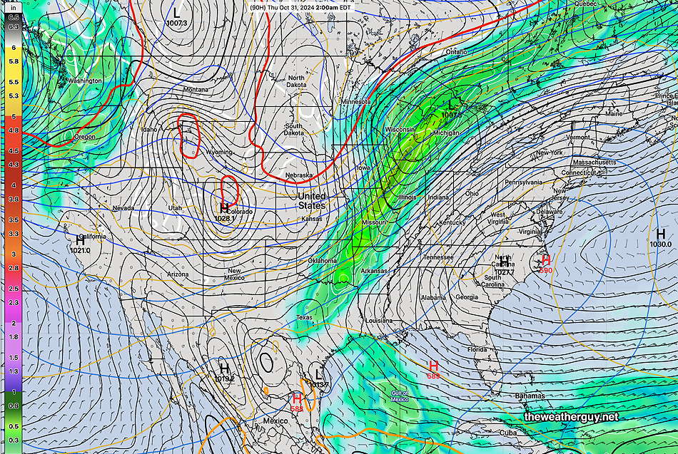
Any showers we receive after midnight Thursday into pre-dawn Friday morning will be light, less than 0.25 inches according to the latest GFS. It should be noted that the ensemble models and the AI models show even less rain here in Philadelphia, perhaps very little, during this cold front passage.
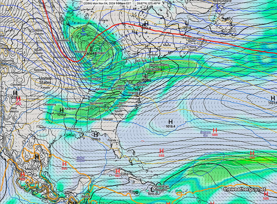
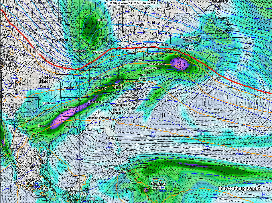
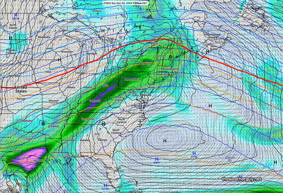
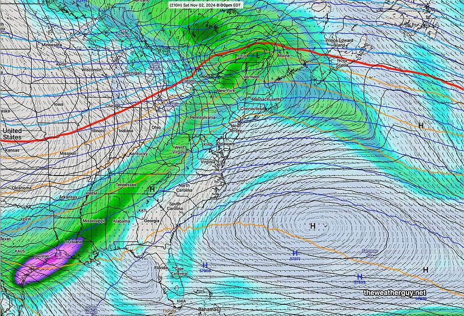
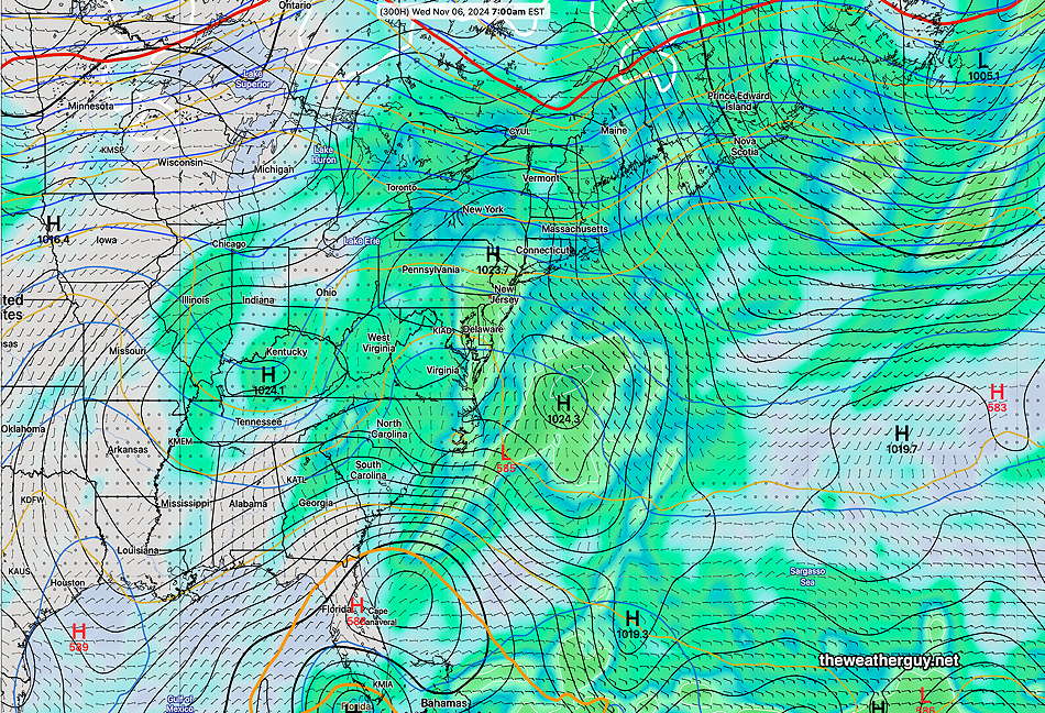
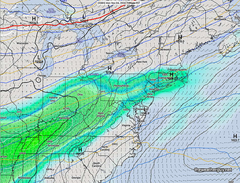
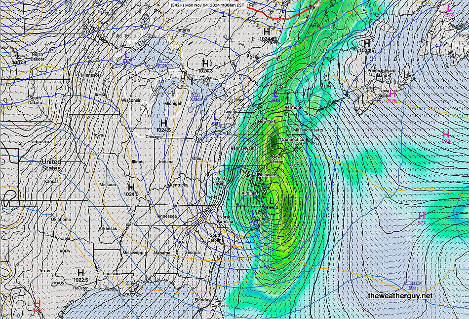
For those hoping for some rain, things still seem somewhat optimistic for some rain here during the time frame Monday Nov 3rd through Thursday Nov 7th. Stay tuned.

