Updated Thursday 12/21 @ 4:58 PM — Today’s models have backed off considerably on the chance of showers late Saturday evening and Sunday morning. In fact, at this time, most models with the exception of the ECMWF and ICON-EPS have any showers staying well west and far north of the immediate PHL areaon Sunday. Considerable cloudiness is still expected.
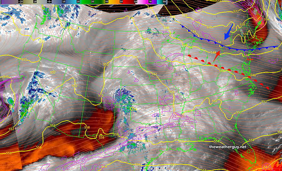
Posted Thursday 12/21 @ 9:55 AM — A back door cold front will slip through later today with colder air for Friday. The front will return as a warm front on Saturday into Sunday. I’ve summarized the situation in the graphic caption below—
Current satellite water vapor image with superimposed RAP model 500-1000 mb thickness lines (yellow), jet level wind streamlines (orange contour-arrows) potential vorticity (fine violet contours) and superimposed MRMS radar. A back door cold front will move through tonight. Colder weather for Friday. The front will return as a warm front through late Saturday into Sunday with scattered showers, mostly far north and west, but a shower here can’t be ruled out. Warmer weather for Sunday, but early morning showers are possible, along with a light shower later in the evening.
For much of Saturday and Sunday we’ll be in the transition zone between warmer and colder air masses and significant cloudiness is expected. Less certain is the amount of shower activity here.
Posted Wednesday 12/20 @ 8:25 AM — No, not what you think or want… it’s a warm front that will move through on Saturday. Past models had this frontal passage dry in our area, but the ECMWF and GFS are cranking out some light showers here Saturday night and Sunday morning into afternoon. Considerable cloudiness as well.
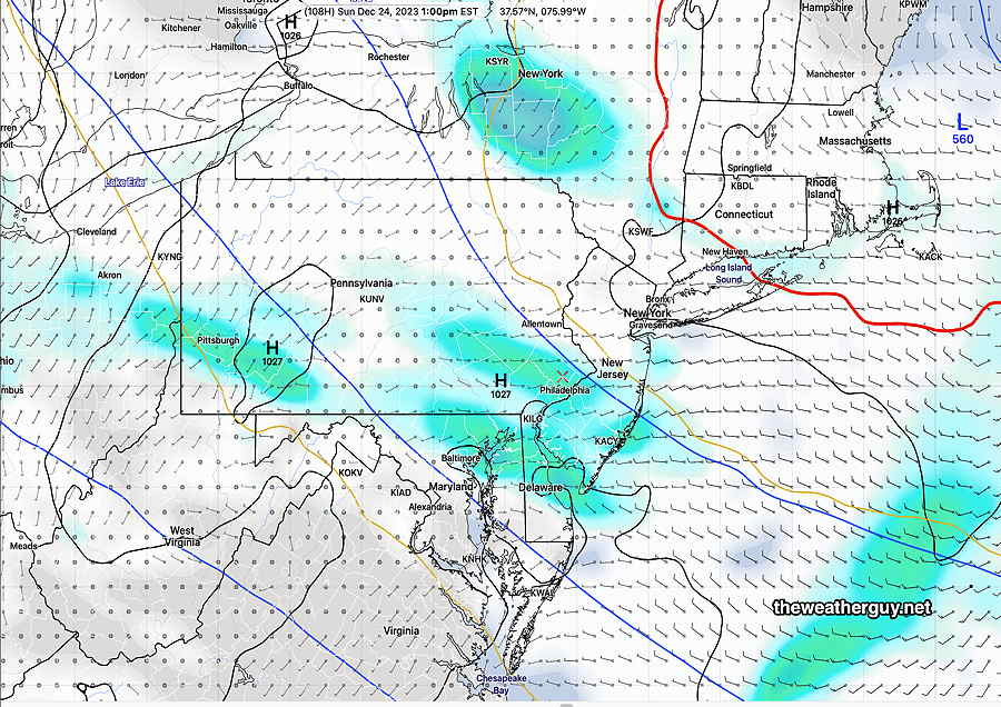
Wednesday’s 06z GFS shows light showers (3 hour precip ) at 1 PM on Sunday. Cloudy as well. Mild in the mid 40s. (Click on image for a larger view.)
Quiet and Cold
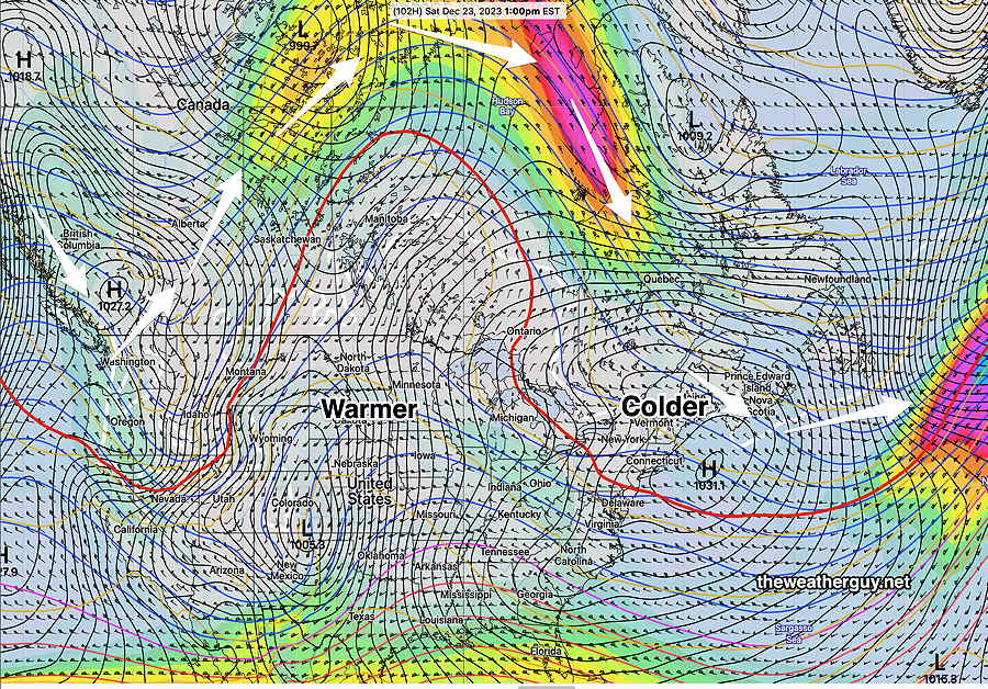
Posted Tuesday 12/19 @ 4:44 PM — A very quiet weather pattern will take over through Christmas day. We’ll be in an upper trough (cold) while much of the country will be under an upper ridge (warm). High pressure at the surface will dominate—
GEFS forecast for Saturday shows a huge upper level ridge with warmer than average air poking well into Canada. A trough over us will keep things somewhat on the cold side. While this upper ridge is expected to slide eastward towards us after this weekend, some of that strong warmer ridge will be flattened out as it makes it here. The low pressure system in southeastern Colorado is expected here next Tuesday into Wednesday. Colder and stormier the end of next week, but any snow still seems elusive. (Click on image for a larger view.)
So the this week is a good time for meteorologists in this area to take a vacation. Perhaps a few impulses will move through from the northwest, but nothing major forecast.
Light Snow Flurries Possible Tuesday Morning
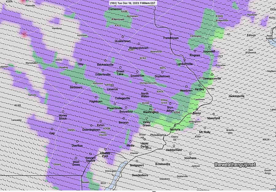
Posted Monday 12/18 @ 7:47 PM — As low pressure continues to move away, a mid level disturbance will rotate through our area around daybreak Tuesday. Several models show scattered snow flurries but temperatures are expected to marginally at or just above freezing. The NBM puts the maximum probability at only 32% and while Canadian models (onboard for the last two flurry events) show nothing.
Here’s what the experimental RRFS is showing at 7 AM—
18z RRFS (experimental) – Precipitation type: lavendar (snow) green (rain) at 7 AM Tuesday. This does not show the amount, just the type and likely over-states the coverage. (Click on image for a larger view.)
Considerable low, instability cloudiness mid day and during the early afternoon.
High pressure builds in and fair skies and cold temperatures are expected for much of the rest of the week.
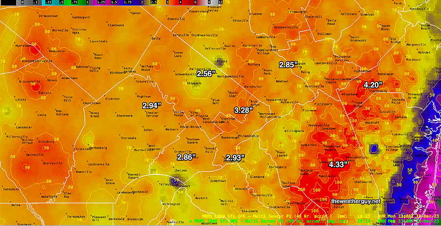
Posted Monday 12/18 @ 9:52 AM —This should be no news to anyone around here, but we had a generalized heavy 3″-4+” rainfall through this morning. It’s still raining, but I thought I’d post the current rainfall totals through 8 AM this morning—
MRMS rain gauge & radar-based estimate of rainfall received through 8AM today. Additional rainfall up to 0.10 inches possible. Color shading is in inches. Line contours are in mm (25.4 mm= 1 inch) (Click on image for a larger view.)
I don’t think we had the high wind gusts forecast, but another period of windy conditions is expected later this morning into this afternoon, as temperatures drop off.