#Philadelphia #weather #PAwx
Sunday Monday Storm Update
Posted Thursday 12/14 @ 8:08 PM — Significant changes in the model forecasts continue to occur with the speed, timing and path of the storm. Additionally, large changes in the amount of cold air moving southward have showed up in recent model runs.
Here’s the latest NAEFS forecast compared to yesterday’s NAEFS forecast for 7 AM Monday—
Meanwhile the latest GFS is more inland and much faster at 7 AM Monday with the system already in NY State—

So things are not nailed down with this system, especially since the GFS is so different than its related ensemble forecast.
One trend that is present is an earlier start of the rain on Sunday, now likely sometime in the morning. Increasing rainfall in the afternoon.
Friday and Saturday look great with temps in the low 50s. Some high clouds move in Saturday afternoon.
Interesting Weather Sunday -Tuesday
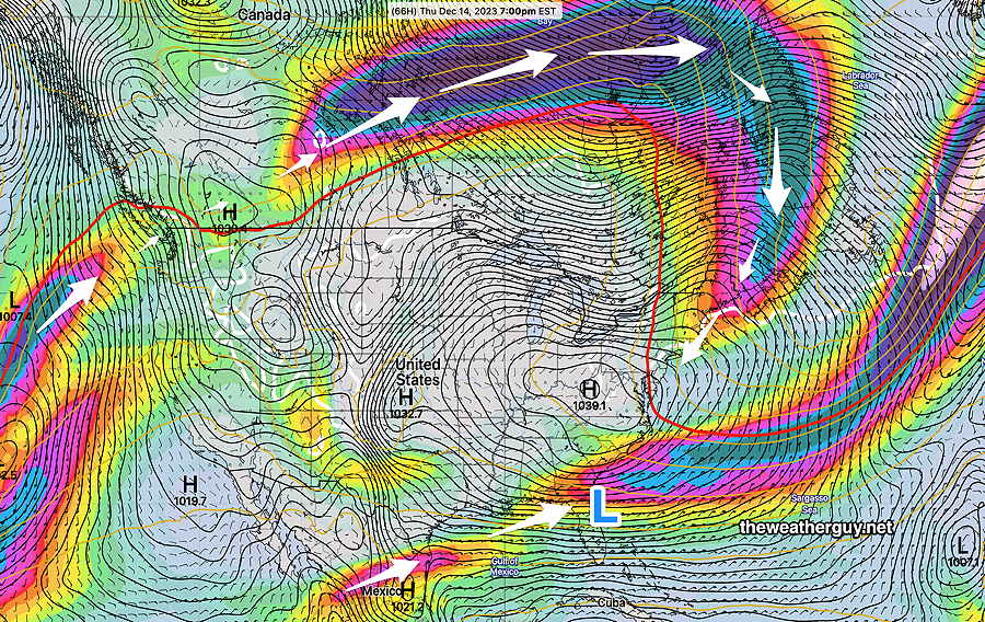
Posted Thursday 12/14 @ 9:41 AM — A very active southern jet stream will spawn low pressure over Florida.
Here’s the current setup as seen via satellite with superimposed RAP model —
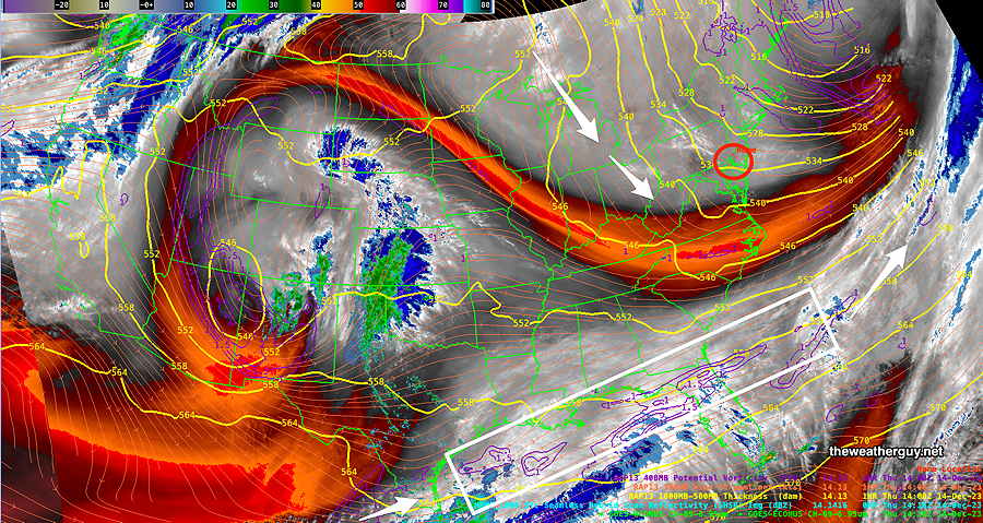
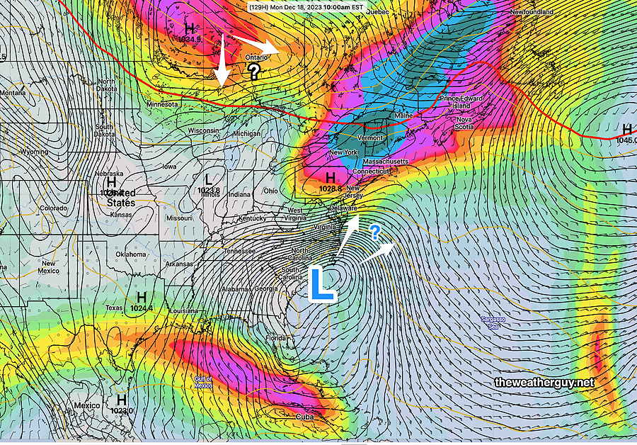
There’s been uncertainty with the development and track of the low. What had been expected to be a coastal low now appears to be more of an inland storm, with plenty of rain and wind, beginning here Sunday.
For several days, the low was expected to be coastal and linger. Now, it’s expected to be inland, move north faster, and then a second low will develop along the coast. —
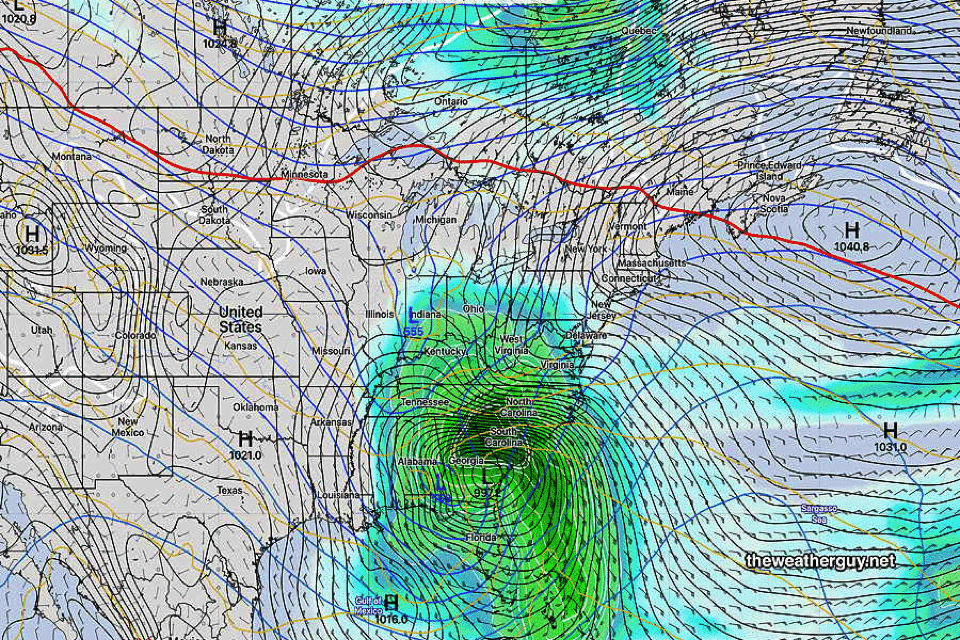
With a faster moving system, rain will begin around noontime on Sunday and continue through much of Monday. More showers (or even snow showers) possible Tuesday.
The trends shows the influx of cold air behind the first system, a new trend with this storm. There won’t be enough cold air with the main system for snow here, but snow showers possible with the second system on Tuesday.
This is a complex system and the final forecast is not complete. (is it ever?) Stay tuned.
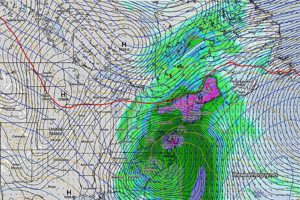
Coastal Storm Early Next Week
Posted Wednesday 12/13 @ 10:21 AM — As discussed yesterday, we’ll be under the influence of a cold upper trough Thursday that transitions to a warm upper ridge as early as Friday into Saturday.
An interesting setup for late Sunday through at least Tuesday as a southern jet stream spawns a low over Florida that ends up somewhere in the western Atlantic and possibly moves up the coast (GFS). Other models have different tracks and speeds with this system. The NAEFS has the storm lingering through much of early next week, which, while possible, is unlikely.
The current setup for next week depicts a pattern that does NOT favor snow. In colder winters this would be different.
With the (red) 540 thickness line so far to our north, snow isn’t possible in our area from this storm. Should high pressure push further southward from Canada, things might change. No model is showing that now.
An interesting situation. Stay tuned.
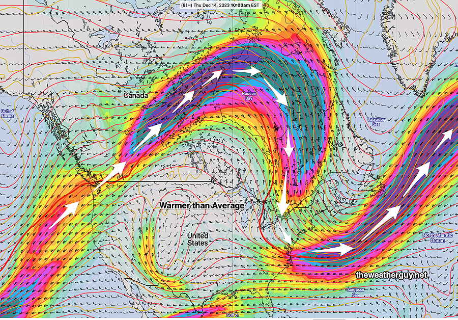
Philly Weather Outlook
Posted Tuesday 12/12 @ 5:51 PM — High pressure will continue to provide fair skies and cold temperatures through Saturday. A weak front will replenish the cold air Thursday.
The jet stream configuration continues to be strange for December, with the northern jet well into Canada. My discussion of what’s happening is in the caption of the graphic below—
“There’s not enough cold air here for snow.”
-Likely to become the defining phrase of this winter.
Previously Posted Mon 11:17 AM —
We’ll start with a forecast review:
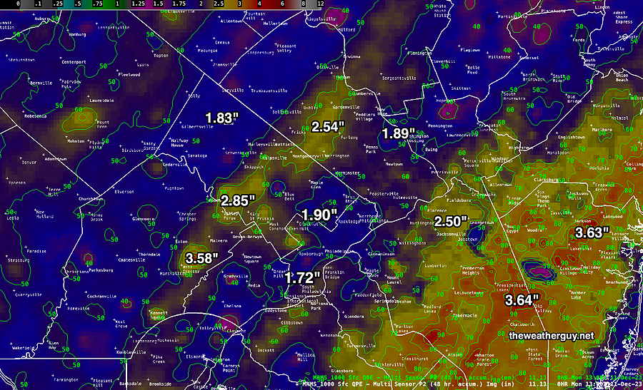
If we go back to my previous postings for the weekend, the general range of rainfall, 2-3+ inches is correct, but no model consistently nailed the exact placement of the heaviest rain; most had the heaviest rain in NJ, but those that did missed the other band of heavy rain just west of the city.
This is entirely analogous to why it’s impossible to nail down the heaviest banding of snow storms; it’s similar model precipitation physics but snow leaves its forensic remains in plain sight; with rain, few people know if they received 1.8 inches or 3. Not so with snow. Not to mention the multiplier factor of typically 1:11 for snow.
The Coming Week
As for the week’s weather, look for dry conditions through the week (and likely through the weekend and much of next week)! Not much happening. As mentioned in my updated Winter Outlook, I don’t see any snow here for Christmas at this time.
I can’t think of the last time I saw the jet stream so far north into Canada in December—