
#Philadelphia #weather #PAwx
Sunday Forecast Update
Posted Saturday 12/02 @ 5:50 PM — Rain moves in after midnight tonight and tapers off during the early afternoon. It will remain cloudy with light winds. It should no longer be raining in Philadelphia at the start of the Eagles game. Light winds and temperatures about 52º at 4:30 PM.
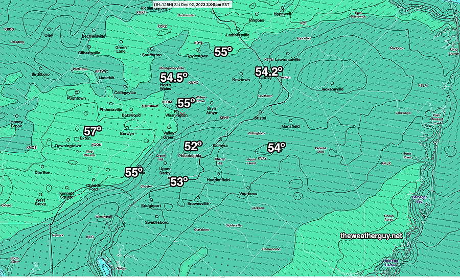
RTMA measured and interpolated actual temperatures at 3 PM today—
Saturday Update
Posted Sat 12/02 @ 10:47 AM — Right after posting my update this morning, the 12z HRDPS became available. It’s showing 60º and mostly sunny in the afternoon. We’ll see.
Posted Saturday 12/02 @ 9:58 AM — This morning’s models still show low fog breaking for some sunshine through mid and high clouds between 11 AM and 1PM. (The latest HRDPS has clouds lingering until about 1:30-2 PM)
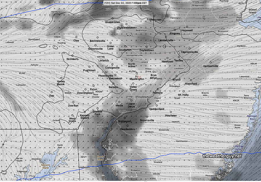
Here’s the HRDPS at 1:00 PM showing low clouds hanging tight in the low valleys near the rivers—
I don’t think many areas are going to see the 60º forecast by last night’s TV weather entertainers. This morning’s 12z NBM still shows a high of 57º with a very high standard deviation (high uncertainty) of ± 4º
So, there still remain a wide range of forecasts in temperature and cloud cover. The warm front is getting hung up near our area, causing the uncertainty.
Updates
Update Fri 12/01 11:22 PM — Tonight’s models suggest that high temperatures on Saturday are likely to be anywhere from 54° to 59°. Still high uncertainty. Clouds and fog may linger until 11 AM before skies brighten.
Posted Friday 12/01 @ 5:56 PM — The latest HREF and Canadian RGEM have become available and they capture the extreme uncertainty in tomorrow’s high temperature forecast—
18z HREF—
18z Canadian RGEM—
Previously Posted Fri 6:19 PM —
Two disturbances ahead of a cold front will affect our weather this weekend. One is bringing the rain we’re getting this afternoon (Friday). The next one will bring rain primarily Saturday night into Sunday.
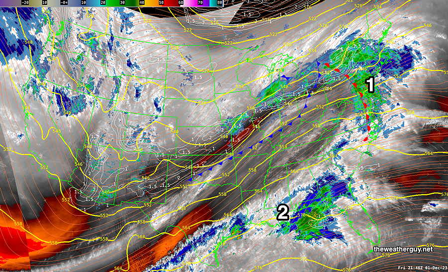
As posted last night, there’s an usually large range of model forecasts for the next few days; the most significant differences (and uncertainties) are around the the cloud cover/high temperatures on Saturday and the location of the secondary coastal low formation on Sunday.
Let’s tackle each one individually.
Saturday
A disturbance and associated warm front is moving through Friday evening and it is expected to exit by Saturday morning. There’s a wide range in the cloud cover forecast. The ECMWF forecasting sunshine breaking through has our high temperatures in the low 60s! Most of our models show areas and periods of considerable cloudiness and are in the 56º to 59º range. The NBM shows an incredibly high standard deviation of ± 5.0º, which captures the very high uncertainty of the forecast.
Here’s the summary—
Clouds break for periods of sunshine through high clouds with periods that are considerably cloudy. I’m leaning towards a compromise on temperatures. A below average confidence forecast. Saturday will be dry. Rain begins again about 11 PM Saturday night
High temperature 57º ( — location Blue Bell, PA)
High temperature 59º ( — location Philadelphia , PA)
Sunday
As the low pressure in the Great Lakes and its associated cold front spawns a secondary coastal low, we’ll have periods of rain much of Sunday with a taper off during the afternoon. There are huge model differences in the placement of the low, the amount of rain, and when the rain ends. It appears that the cold front will move through Sunday evening. I’m going with a compromise.
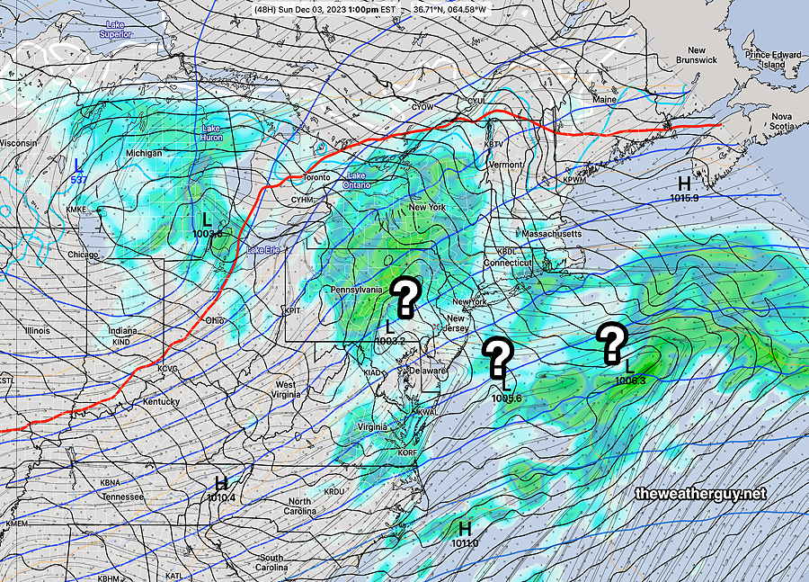
Rain ends about 4-7 PM.
High temperature 54º ( NBM model— location Blue Bell, PA)
High temperature 56º ( NBM model— location Philadelphia, PA)
uncertainty ± 3.5º (still high uncertainty)